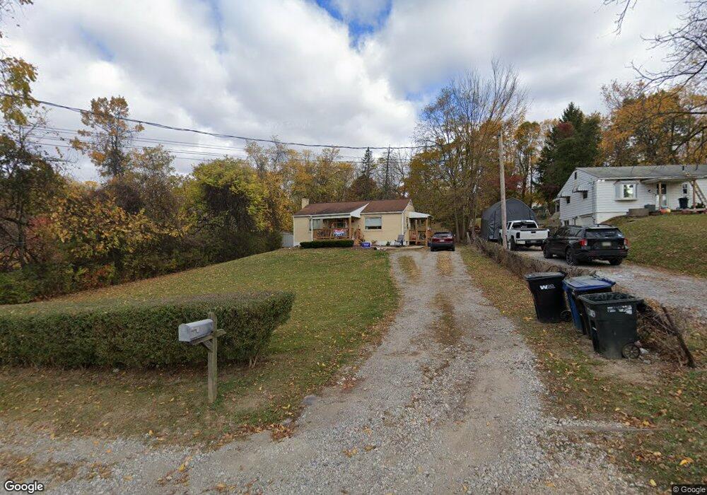
117 Port Vue Dr Coraopolis, PA 15108
Estimated Value: $197,000 - $235,000
2
Beds
1
Bath
925
Sq Ft
$228/Sq Ft
Est. Value
About This Home
This home is located at 117 Port Vue Dr, Coraopolis, PA 15108 and is currently estimated at $211,114, approximately $228 per square foot. 117 Port Vue Dr is a home located in Allegheny County with nearby schools including Moon Area High School, Rhema Christian School, and Montessori Children's Community.
Ownership History
Date
Name
Owned For
Owner Type
Purchase Details
Closed on
Nov 9, 2009
Sold by
Sheerin Brian J and Sheerin Rebecca R
Bought by
Houck Amanda and Houck Mark A
Current Estimated Value
Home Financials for this Owner
Home Financials are based on the most recent Mortgage that was taken out on this home.
Original Mortgage
$98,188
Outstanding Balance
$64,178
Interest Rate
5.02%
Mortgage Type
FHA
Estimated Equity
$146,936
Purchase Details
Closed on
Jun 14, 2002
Sold by
Peterson Mary Carr
Bought by
Sheerin William B and Sheerin Brian J
Create a Home Valuation Report for This Property
The Home Valuation Report is an in-depth analysis detailing your home's value as well as a comparison with similar homes in the area
Home Values in the Area
Average Home Value in this Area
Purchase History
| Date | Buyer | Sale Price | Title Company |
|---|---|---|---|
| Houck Amanda | $100,000 | -- | |
| Sheerin William B | $52,000 | -- |
Source: Public Records
Mortgage History
| Date | Status | Borrower | Loan Amount |
|---|---|---|---|
| Open | Houck Amanda | $98,188 |
Source: Public Records
Tax History Compared to Growth
Tax History
| Year | Tax Paid | Tax Assessment Tax Assessment Total Assessment is a certain percentage of the fair market value that is determined by local assessors to be the total taxable value of land and additions on the property. | Land | Improvement |
|---|---|---|---|---|
| 2025 | $2,954 | $94,500 | $36,200 | $58,300 |
| 2024 | $2,954 | $94,500 | $36,200 | $58,300 |
| 2023 | $2,849 | $94,500 | $36,200 | $58,300 |
| 2022 | $2,849 | $94,500 | $36,200 | $58,300 |
| 2021 | $2,848 | $94,500 | $36,200 | $58,300 |
| 2020 | $2,777 | $94,500 | $36,200 | $58,300 |
| 2019 | $2,701 | $94,500 | $36,200 | $58,300 |
| 2018 | $447 | $94,500 | $36,200 | $58,300 |
| 2017 | $2,554 | $94,500 | $36,200 | $58,300 |
| 2016 | $447 | $94,500 | $36,200 | $58,300 |
| 2015 | $447 | $94,500 | $36,200 | $58,300 |
| 2014 | $2,487 | $94,500 | $36,200 | $58,300 |
Source: Public Records
Map
Nearby Homes
- 140 S Patton Dr
- 1333 Forest Green Dr Unit 1333
- 302 Mckinney Dr
- 611 Forest Green Dr
- 631 Forest Green Dr
- 511 Forest Green Dr
- 335 Forest Green Dr
- 333 Forest Green Unit 333
- 300 Commerce Dr
- 113 Forest Green Dr Unit 113
- 124 Forest Green Dr
- 5085 Sanlin Dr
- 182 Lockheed Dr
- 108 Shippen Dr
- 176 Lockheed Dr
- 7116 Sanlin Dr
- 506 Isabella Ct
- 713 Ravenshire Ct
- 209 Lockheed Dr
- 430 Amherst Ave
- 119 Port Vue Dr
- 123 Port Vue Dr
- 134 Port Vue Dr
- 116 S Patton Dr
- 118 S Patton Dr
- 120 S Patton Dr
- 114 S Patton Dr
- 122 S Patton Dr
- 112 S Patton Dr
- 124 S Patton Dr
- 110 S Patton Dr
- 128 S Patton Dr
- 117 S Patton Dr
- 130 S Patton Dr
- 121 S Patton Dr
- 132 S Patton Dr
- 115 S Patton Dr
- 113 S Patton Dr
- 111 S Patton Dr
- 115 Maple Ln