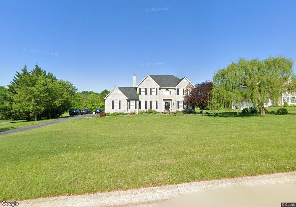
117 Preston Rd Lincoln University, PA 19352
Estimated Value: $535,328 - $577,000
4
Beds
3
Baths
2,686
Sq Ft
$205/Sq Ft
Est. Value
About This Home
This home is located at 117 Preston Rd, Lincoln University, PA 19352 and is currently estimated at $550,332, approximately $204 per square foot. 117 Preston Rd is a home located in Chester County with nearby schools including Elk Ridge School, Nottingham School, and Jordan Bank Elementary School.
Ownership History
Date
Name
Owned For
Owner Type
Purchase Details
Closed on
May 16, 2016
Sold by
Baker Dennis R and Hayes Christina M
Bought by
Peterson Chad and Peterson Wendy
Current Estimated Value
Home Financials for this Owner
Home Financials are based on the most recent Mortgage that was taken out on this home.
Original Mortgage
$314,204
Outstanding Balance
$249,556
Interest Rate
3.59%
Mortgage Type
FHA
Estimated Equity
$300,776
Purchase Details
Closed on
Sep 24, 2013
Sold by
Francke Hendrik Jan and Francke Laura Lynne
Bought by
Baker Dennis R and Hayes Christina M
Home Financials for this Owner
Home Financials are based on the most recent Mortgage that was taken out on this home.
Original Mortgage
$291,620
Interest Rate
4.25%
Mortgage Type
FHA
Create a Home Valuation Report for This Property
The Home Valuation Report is an in-depth analysis detailing your home's value as well as a comparison with similar homes in the area
Home Values in the Area
Average Home Value in this Area
Purchase History
| Date | Buyer | Sale Price | Title Company |
|---|---|---|---|
| Peterson Chad | $320,000 | None Available | |
| Baker Dennis R | $297,000 | None Available |
Source: Public Records
Mortgage History
| Date | Status | Borrower | Loan Amount |
|---|---|---|---|
| Open | Peterson Chad | $314,204 | |
| Previous Owner | Baker Dennis R | $291,620 |
Source: Public Records
Tax History Compared to Growth
Tax History
| Year | Tax Paid | Tax Assessment Tax Assessment Total Assessment is a certain percentage of the fair market value that is determined by local assessors to be the total taxable value of land and additions on the property. | Land | Improvement |
|---|---|---|---|---|
| 2025 | $7,017 | $171,740 | $27,880 | $143,860 |
| 2024 | $7,017 | $171,740 | $27,880 | $143,860 |
| 2023 | $6,773 | $171,740 | $27,880 | $143,860 |
| 2022 | $6,553 | $171,740 | $27,880 | $143,860 |
| 2021 | $6,322 | $171,740 | $27,880 | $143,860 |
| 2020 | $6,196 | $171,740 | $27,880 | $143,860 |
| 2019 | $6,143 | $171,740 | $27,880 | $143,860 |
| 2018 | $6,143 | $171,740 | $27,880 | $143,860 |
| 2017 | $6,090 | $171,740 | $27,880 | $143,860 |
| 2016 | $5,483 | $171,740 | $27,880 | $143,860 |
| 2015 | $5,483 | $171,740 | $27,880 | $143,860 |
| 2014 | $5,483 | $171,740 | $27,880 | $143,860 |
Source: Public Records
Map
Nearby Homes
- 580 Elkdale Rd
- 180 College Cir
- 106 1st Ave
- 1748 Baltimore Pike
- 570 Greenwood Dr (Hemlock)
- Greenwood Drive #B (Hemlock)
- 0 Greenwood Drive #A (Juniper)
- Greenwood Drive #F (Norway)
- 102 Greenwood Dr
- 205 Hinson Drive Lot 86 (Juniper) Qd
- 209 Hinson Drive Lot #87 Qd (Douglas)
- 104 Flintwood Dr
- 219 Greenwood Dr
- 263 Greenwood Dr
- 000 Greenwood Drive D (Balsam)
- 324 Greenwood Dr
- 000 Greenwood Dr Unit D (FLETCHER)
- 148 Evergreen Dr
- 246 Joseph Rd
- 520 Mystic Ln
- 117 Preston Dr
- 105 Preston Rd
- 129 Preston Rd
- 114 Preston Rd
- 133 Preston Rd
- 106 Preston Rd
- 305 W Branch Rd
- 140 Preston Rd
- 149 Preston Rd
- 315 W Branch Rd
- 347 W Branch Rd
- 148 Preston Rd
- 351 W Branch Rd
- 150 Bedford Way
- 117 Crowl Toot Rd
- 105 McDonald Way
- 111 Crowl Toot Rd
- 142 Bedford Way
- 123 Crowl Toot Rd
- 215 Warwick Ct