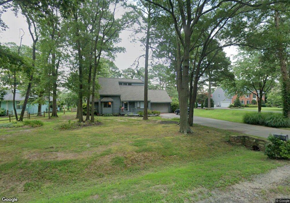
117 Queens Colony High Rd Stevensville, MD 21666
Estimated Value: $429,000 - $646,000
--
Bed
2
Baths
1,713
Sq Ft
$328/Sq Ft
Est. Value
About This Home
This home is located at 117 Queens Colony High Rd, Stevensville, MD 21666 and is currently estimated at $561,892, approximately $328 per square foot. 117 Queens Colony High Rd is a home located in Queen Anne's County with nearby schools including Matapeake Elementary School, Matapeake Middle School, and Kent Island High School.
Ownership History
Date
Name
Owned For
Owner Type
Purchase Details
Closed on
Feb 11, 2003
Sold by
Jacobson Joyce E
Bought by
Goldberg Jacqueline
Current Estimated Value
Purchase Details
Closed on
May 10, 2001
Sold by
Dands Melanie S
Bought by
Jacobson Joyce E
Purchase Details
Closed on
Jun 24, 1999
Sold by
Scalia Joseph Mark and Scalia Marilyn E
Bought by
Dands Melanie S
Purchase Details
Closed on
Sep 2, 1997
Sold by
Edwards Vernon G and Edwards Veola Lucilla
Bought by
Scalia Joseph Mark and Scalia Marilyn E
Create a Home Valuation Report for This Property
The Home Valuation Report is an in-depth analysis detailing your home's value as well as a comparison with similar homes in the area
Home Values in the Area
Average Home Value in this Area
Purchase History
| Date | Buyer | Sale Price | Title Company |
|---|---|---|---|
| Goldberg Jacqueline | -- | -- | |
| Jacobson Joyce E | $252,000 | -- | |
| Dands Melanie S | $215,000 | -- | |
| Scalia Joseph Mark | $200,000 | -- |
Source: Public Records
Mortgage History
| Date | Status | Borrower | Loan Amount |
|---|---|---|---|
| Closed | Scalia Joseph Mark | -- |
Source: Public Records
Tax History Compared to Growth
Tax History
| Year | Tax Paid | Tax Assessment Tax Assessment Total Assessment is a certain percentage of the fair market value that is determined by local assessors to be the total taxable value of land and additions on the property. | Land | Improvement |
|---|---|---|---|---|
| 2025 | $4,004 | $440,867 | $0 | $0 |
| 2024 | $3,865 | $412,233 | $0 | $0 |
| 2023 | $3,674 | $383,600 | $191,900 | $191,700 |
| 2022 | $3,674 | $383,600 | $191,900 | $191,700 |
| 2021 | $3,894 | $383,600 | $191,900 | $191,700 |
| 2020 | $3,894 | $399,700 | $191,900 | $207,800 |
| 2019 | $3,820 | $392,067 | $0 | $0 |
| 2018 | $3,747 | $384,433 | $0 | $0 |
| 2017 | $3,674 | $376,800 | $0 | $0 |
| 2016 | -- | $376,800 | $0 | $0 |
| 2015 | $1,677 | $376,800 | $0 | $0 |
| 2014 | $1,677 | $379,400 | $0 | $0 |
Source: Public Records
Map
Nearby Homes
- 114 Queens Colony High Rd
- 303 Queens Colony High Rd
- 312 Queens Colony High Rd
- 511 Chesapeake Ave
- 0 Allen Ave
- 0 Reynolds Ave
- 206 Columbia Ln
- 410 5 Farms Dr
- 227 Queen Anne Club Dr
- 412 Five Farms Dr
- 303 Queen Anne Club Dr
- 312 Columbia Ln
- 116 Mallard Dr
- 122 Mallard Dr
- Lot 7 Maple Rd
- 103 Chesapeake Estates Dr
- 0 Chesapeake Estates Dr
- 101 Oak St
- 321 Oregon Rd
- 122 S Carolina Rd
- 119 Queens Colony High Rd
- 113 Queens Colony High Rd
- 116 Queens Colony High Rd
- 121 Queens Colony High Rd
- 110 Queens Colony High Rd
- 112 Queens Colony High Rd
- 108 Queens Colony High Rd
- 123 Queens Colony High Rd
- 106 Queens Colony High Rd
- 120 Queens Colony High Rd
- 125 Holly Thicket
- 105 Queens Colony High Rd
- 104 Queens Colony High Rd
- 300 Chesapeake Ave
- 200 Queens Colony High Rd
- 103 Holly Ct
- 105 Holly Ct
- 101 Holly Ct
- 302 Chesapeake Ave
- 102 Queens Colony High Rd