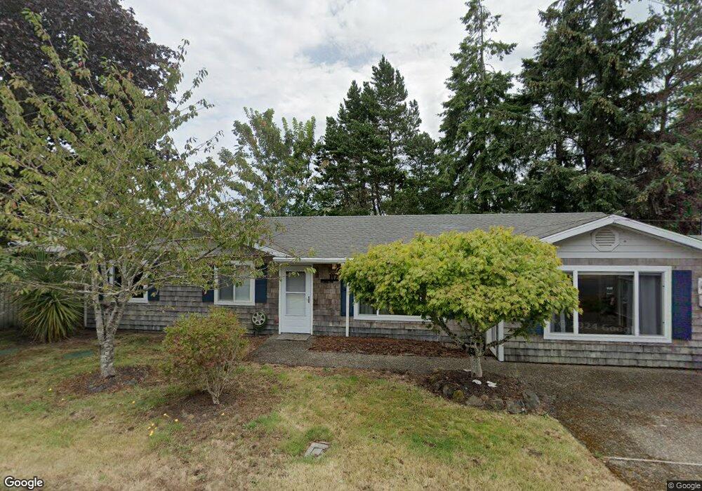
117 Ridge Dr Seaside, OR 97138
Estimated Value: $467,000 - $517,000
3
Beds
1
Bath
1,475
Sq Ft
$335/Sq Ft
Est. Value
About This Home
This home is located at 117 Ridge Dr, Seaside, OR 97138 and is currently estimated at $494,697, approximately $335 per square foot. 117 Ridge Dr is a home located in Clatsop County with nearby schools including Seaside High School.
Ownership History
Date
Name
Owned For
Owner Type
Purchase Details
Closed on
Feb 12, 2025
Sold by
Siegel Cogen Arlene May and Siegel Jay Cogen
Bought by
Cogen Mitchell Jay
Current Estimated Value
Purchase Details
Closed on
Sep 2, 2009
Sold by
Cogen Mitchell
Bought by
Cogen Mitchell and Cogen Arlene Siegel
Purchase Details
Closed on
Aug 13, 2008
Sold by
Abrams Russell S
Bought by
Cogen Mitchell
Purchase Details
Closed on
Jun 26, 2007
Sold by
Anderson Michele M
Bought by
Cogen Mitchell and Abrams Russell S
Purchase Details
Closed on
May 24, 2006
Sold by
Salisbury Charlotte
Bought by
Anderson Michele M
Home Financials for this Owner
Home Financials are based on the most recent Mortgage that was taken out on this home.
Original Mortgage
$168,000
Interest Rate
6.46%
Mortgage Type
Fannie Mae Freddie Mac
Create a Home Valuation Report for This Property
The Home Valuation Report is an in-depth analysis detailing your home's value as well as a comparison with similar homes in the area
Home Values in the Area
Average Home Value in this Area
Purchase History
| Date | Buyer | Sale Price | Title Company |
|---|---|---|---|
| Cogen Mitchell Jay | -- | None Listed On Document | |
| Cogen Mitchell | -- | None Available | |
| Cogen Mitchell | $118,500 | None Available | |
| Cogen Mitchell | $245,000 | Pacific Title Company | |
| Anderson Michele M | $210,000 | Pacific Title Company |
Source: Public Records
Mortgage History
| Date | Status | Borrower | Loan Amount |
|---|---|---|---|
| Previous Owner | Anderson Michele M | $168,000 |
Source: Public Records
Tax History Compared to Growth
Tax History
| Year | Tax Paid | Tax Assessment Tax Assessment Total Assessment is a certain percentage of the fair market value that is determined by local assessors to be the total taxable value of land and additions on the property. | Land | Improvement |
|---|---|---|---|---|
| 2024 | $2,545 | $222,565 | -- | -- |
| 2023 | $2,474 | $216,084 | $0 | $0 |
| 2022 | $2,400 | $209,791 | $0 | $0 |
| 2021 | $2,450 | $203,681 | $0 | $0 |
| 2020 | $2,363 | $197,749 | $0 | $0 |
| 2019 | $2,302 | $191,991 | $0 | $0 |
| 2018 | $2,219 | $186,400 | $0 | $0 |
| 2017 | $2,160 | $180,972 | $0 | $0 |
| 2016 | $1,866 | $175,702 | $68,843 | $106,859 |
| 2015 | $1,805 | $170,585 | $66,838 | $103,747 |
| 2014 | $1,716 | $165,618 | $0 | $0 |
| 2013 | -- | $160,795 | $0 | $0 |
Source: Public Records
Map
Nearby Homes
- 0 5th St
- 196 Dylan Ct
- 1065 Picture Place
- 1054 Picture Place
- Lots 25-26 5th St
- 3387-3389 U S 101
- 3389 U S 101
- 1324 Sea Ridge Ln
- 1265 D St
- 1360 Sea Ridge Ln
- 714 7th St
- 415 Spruce Ave
- 1309 Park Ln
- 261 Railroad Ave
- 782 Woodland Ct
- 1396 N Ocean Ave
- 0 Wellington Ave Unit 25-48
- 0 Wellington Ave Unit 1202
- 924 Little Beach Dr
- 149 Ridge Dr
- 157 Summit Ave
- 146 Ridge Dr
- 878 Pacific Way
- 898 Pacific Way
- 169 Ridge Dr Dr
- 166 Ridge Dr
- 106 Summit Ave
- 176 Summit Ave
- 226 Ridge Dr
- 1002 Pacific Way
- 268 Ridge Dr
- 230 Summit Ave
- 16 Dylan Ct
- 95 Summit Ct
- 0 Pacific Way
- 276 Summit Ave
- 0 Dylan Ct
- 965 Pacific Way
- 0 V L 2nd St Lot 3703 Tract C Unit 23-678