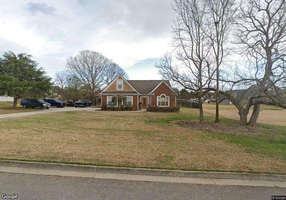
117 River Park Cir McDonough, GA 30252
Estimated Value: $315,842 - $327,000
3
Beds
2
Baths
1,906
Sq Ft
$167/Sq Ft
Est. Value
About This Home
This home is located at 117 River Park Cir, McDonough, GA 30252 and is currently estimated at $318,961, approximately $167 per square foot. 117 River Park Cir is a home located in Henry County with nearby schools including New Hope Elementary School, Ola Middle School, and New Creation Christian Academy.
Ownership History
Date
Name
Owned For
Owner Type
Purchase Details
Closed on
Jul 23, 2012
Sold by
Cash Geraldlyn Seaborn
Bought by
Cash Andrew S
Current Estimated Value
Home Financials for this Owner
Home Financials are based on the most recent Mortgage that was taken out on this home.
Original Mortgage
$141,000
Outstanding Balance
$97,376
Interest Rate
3.68%
Mortgage Type
New Conventional
Estimated Equity
$221,585
Purchase Details
Closed on
Aug 23, 2007
Sold by
Cash Andrew S
Bought by
Cash Andres S and Cash Geraldlyn S
Home Financials for this Owner
Home Financials are based on the most recent Mortgage that was taken out on this home.
Original Mortgage
$150,000
Interest Rate
6.65%
Mortgage Type
Stand Alone Second
Purchase Details
Closed on
May 10, 2002
Sold by
Regions Bk
Bought by
Oxford Hms Inc
Home Financials for this Owner
Home Financials are based on the most recent Mortgage that was taken out on this home.
Original Mortgage
$105,000
Interest Rate
7.12%
Create a Home Valuation Report for This Property
The Home Valuation Report is an in-depth analysis detailing your home's value as well as a comparison with similar homes in the area
Home Values in the Area
Average Home Value in this Area
Purchase History
| Date | Buyer | Sale Price | Title Company |
|---|---|---|---|
| Cash Andrew S | -- | -- | |
| Cash Andres S | -- | -- | |
| Oxford Hms Inc | $27,000 | -- |
Source: Public Records
Mortgage History
| Date | Status | Borrower | Loan Amount |
|---|---|---|---|
| Open | Cash Andrew S | $141,000 | |
| Previous Owner | Cash Andres S | $150,000 | |
| Previous Owner | Oxford Hms Inc | $105,000 |
Source: Public Records
Tax History Compared to Growth
Tax History
| Year | Tax Paid | Tax Assessment Tax Assessment Total Assessment is a certain percentage of the fair market value that is determined by local assessors to be the total taxable value of land and additions on the property. | Land | Improvement |
|---|---|---|---|---|
| 2025 | $3,685 | $135,800 | $18,000 | $117,800 |
| 2024 | $3,685 | $126,200 | $18,000 | $108,200 |
| 2023 | $3,222 | $128,080 | $14,000 | $114,080 |
| 2022 | $3,090 | $101,040 | $14,000 | $87,040 |
| 2021 | $2,475 | $82,000 | $14,000 | $68,000 |
| 2020 | $2,475 | $76,120 | $12,000 | $64,120 |
| 2019 | $2,394 | $72,920 | $12,000 | $60,920 |
| 2018 | $2,191 | $64,720 | $12,000 | $52,720 |
| 2016 | $1,962 | $57,160 | $10,000 | $47,160 |
| 2015 | $1,780 | $51,280 | $8,000 | $43,280 |
| 2014 | $1,573 | $45,680 | $8,000 | $37,680 |
Source: Public Records
Map
Nearby Homes
- 151 River Park Cir
- 845 Graeme Dr
- 812 Graeme Dr
- 153 Hilda Way
- 136 Hilda Way
- 225 Laney Ct
- 461 Old Jackson Rd
- 767 Old Jackson Rd
- 2563 Highway 81 E
- 275 S Bethany Rd
- 315 S Bethany Rd
- 469 Kimberly Ct
- 175 Laney Ct Unit 1
- 136 Crown Forest Dr
- 405 Cynthia Ln
- 215 Laney Rd
- 242 Old Jackson Rd
- 125 Laney Ct
- 1891 Highway 81 E
- 120 N Bethany Rd
- 205 Chestatee Trace
- 115 River Park Cir
- 201 Chestatee Trace
- 209 Chestatee Trace
- 113 River Park Cir
- 114 River Park Cir
- 116 River Park Cir
- 175 River Park Cir
- 173 River Park Cir
- 173 River Park Cir Unit 74
- 118 River Park Cir
- 111 River Park Cir
- 208 Chestatee Trace Unit 51
- 208 Chestatee Trace
- 171 River Park Cir Unit 171
- 171 River Park Cir
- 200 Chestatee Trace
- 204 Chestatee Trace
- 112 River Park Cir
- 120 River Park Cir