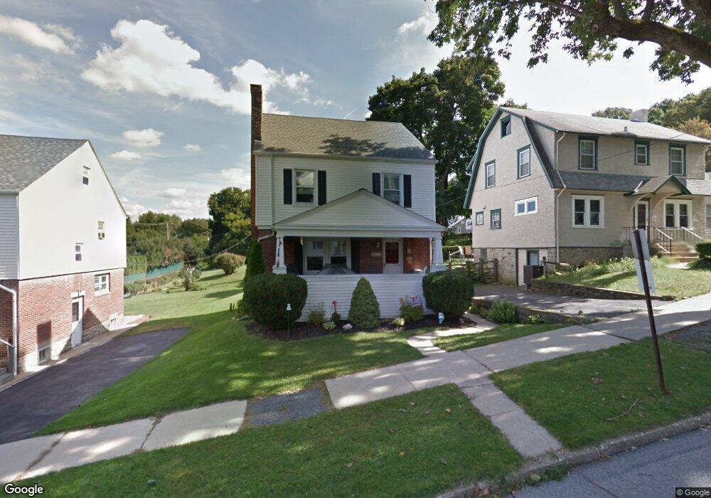
117 S 12th Ave Coatesville, PA 19320
Estimated Value: $267,000 - $304,000
3
Beds
1
Bath
1,508
Sq Ft
$195/Sq Ft
Est. Value
About This Home
This home is located at 117 S 12th Ave, Coatesville, PA 19320 and is currently estimated at $293,902, approximately $194 per square foot. 117 S 12th Ave is a home located in Chester County with nearby schools including Caln Elementary School, Coatesville Intermediate High School, and Coatesville Area Senior High School.
Ownership History
Date
Name
Owned For
Owner Type
Purchase Details
Closed on
Dec 16, 1999
Sold by
Shaw Stephen Mark and Shaw Lynnette Mary
Bought by
Martin Samuel B and Shortlidge Karen
Current Estimated Value
Home Financials for this Owner
Home Financials are based on the most recent Mortgage that was taken out on this home.
Original Mortgage
$115,491
Outstanding Balance
$35,472
Interest Rate
7.61%
Mortgage Type
FHA
Estimated Equity
$258,430
Create a Home Valuation Report for This Property
The Home Valuation Report is an in-depth analysis detailing your home's value as well as a comparison with similar homes in the area
Home Values in the Area
Average Home Value in this Area
Purchase History
| Date | Buyer | Sale Price | Title Company |
|---|---|---|---|
| Martin Samuel B | $115,600 | Stewart Title Guaranty Compa |
Source: Public Records
Mortgage History
| Date | Status | Borrower | Loan Amount |
|---|---|---|---|
| Open | Martin Samuel B | $115,491 |
Source: Public Records
Tax History Compared to Growth
Tax History
| Year | Tax Paid | Tax Assessment Tax Assessment Total Assessment is a certain percentage of the fair market value that is determined by local assessors to be the total taxable value of land and additions on the property. | Land | Improvement |
|---|---|---|---|---|
| 2025 | $5,314 | $88,380 | $22,190 | $66,190 |
| 2024 | $5,314 | $88,380 | $22,190 | $66,190 |
| 2023 | $5,261 | $88,380 | $22,190 | $66,190 |
| 2022 | $5,126 | $88,380 | $22,190 | $66,190 |
| 2021 | $4,995 | $88,380 | $22,190 | $66,190 |
| 2020 | $4,978 | $88,380 | $22,190 | $66,190 |
| 2019 | $4,750 | $86,550 | $22,190 | $64,360 |
| 2018 | $4,591 | $86,550 | $22,190 | $64,360 |
| 2017 | $4,465 | $86,550 | $22,190 | $64,360 |
| 2016 | $3,419 | $86,550 | $22,190 | $64,360 |
| 2015 | $3,419 | $86,550 | $22,190 | $64,360 |
| 2014 | $3,419 | $86,550 | $22,190 | $64,360 |
Source: Public Records
Map
Nearby Homes
- 1050 Wayne Ave
- 826 Stirling St
- 824 Stirling St
- 1263 E Diamond St
- 69 Palmer Ave
- 901 Merchant St Unit 60
- 124 Chester Ave
- 440 Oak St
- 131 Pennsylvania Ave
- 622 Walnut St
- 420 Glendale Ave
- 215 Kennedy Dr
- 213 Kennedy Dr
- 298 N Chester Ave
- 65 Lukens Mill Dr Unit 154
- 499 Prospect Ave
- 111 Lukens Mill Dr Unit 50
- 214 Andrew Rd
- 209 Kendig Ln
- 43 S 5th Ave