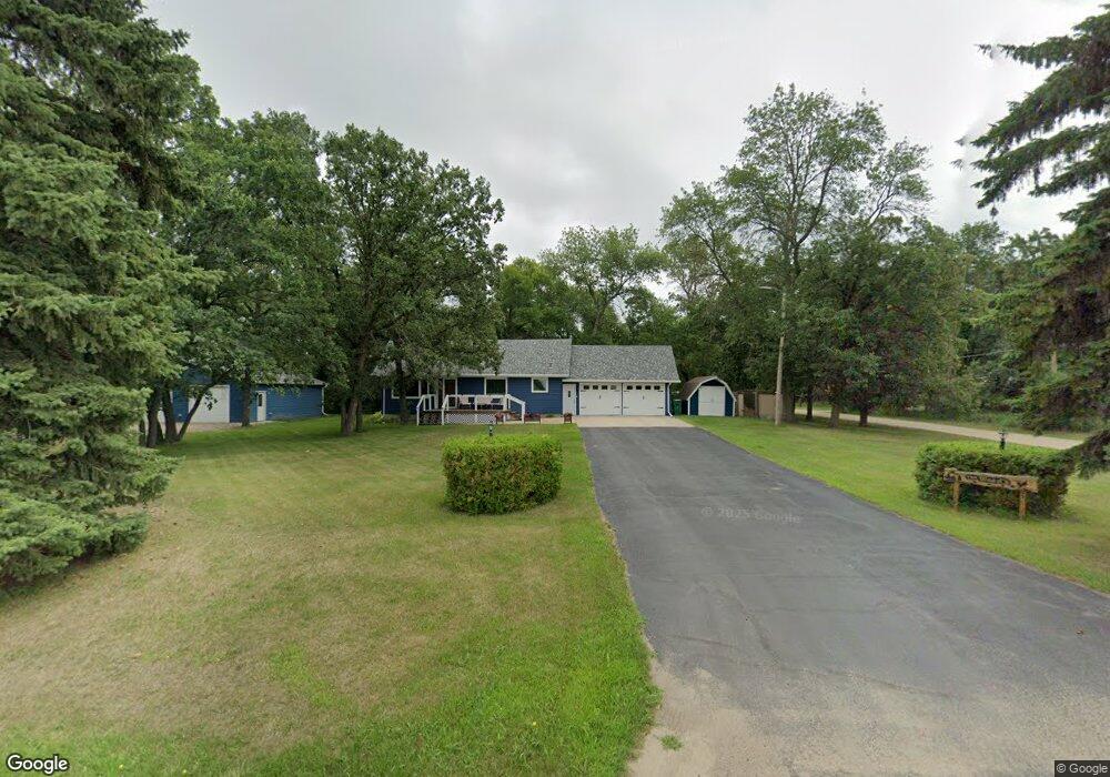
117 Samuelson St Devils Lake, ND 58301
Estimated Value: $214,802 - $505,000
3
Beds
1
Bath
1,248
Sq Ft
$280/Sq Ft
Est. Value
About This Home
This home is located at 117 Samuelson St, Devils Lake, ND 58301 and is currently estimated at $349,951, approximately $280 per square foot. 117 Samuelson St is a home located in Ramsey County with nearby schools including Minnie H. Kindergarten Center, Central Middle School, and Devils Lake High School.
Ownership History
Date
Name
Owned For
Owner Type
Purchase Details
Closed on
Oct 3, 2012
Sold by
Fischer Elizabeth V
Bought by
County Of Ramsey County
Current Estimated Value
Purchase Details
Closed on
May 12, 2009
Sold by
Tanner Craig E and Randall Tanner Tanya K
Bought by
Heiser Joseph M
Home Financials for this Owner
Home Financials are based on the most recent Mortgage that was taken out on this home.
Original Mortgage
$97,600
Interest Rate
4.83%
Mortgage Type
New Conventional
Purchase Details
Closed on
Apr 15, 2005
Sold by
Hawkins Lance and Hawkins Rebecfa
Bought by
Zainhofsky Scott D and Zainhofsky Christy A
Home Financials for this Owner
Home Financials are based on the most recent Mortgage that was taken out on this home.
Original Mortgage
$83,200
Interest Rate
5.88%
Mortgage Type
New Conventional
Create a Home Valuation Report for This Property
The Home Valuation Report is an in-depth analysis detailing your home's value as well as a comparison with similar homes in the area
Purchase History
| Date | Buyer | Sale Price | Title Company |
|---|---|---|---|
| County Of Ramsey County | $1,177 | None Available | |
| Heiser Joseph M | $122,000 | None Available | |
| Zainhofsky Scott D | $104,000 | None Available |
Source: Public Records
Mortgage History
| Date | Status | Borrower | Loan Amount |
|---|---|---|---|
| Previous Owner | Heiser Joseph M | $97,600 | |
| Previous Owner | Zainhofsky Scott D | $83,200 |
Source: Public Records
Tax History
| Year | Tax Paid | Tax Assessment Tax Assessment Total Assessment is a certain percentage of the fair market value that is determined by local assessors to be the total taxable value of land and additions on the property. | Land | Improvement |
|---|---|---|---|---|
| 2025 | $2,053 | $82,150 | $11,900 | $70,250 |
| 2024 | $2,053 | $81,700 | $11,900 | $69,800 |
| 2023 | $2,102 | $98,850 | $10,900 | $87,950 |
| 2022 | $1,912 | $92,750 | $10,900 | $81,850 |
| 2021 | $1,747 | $86,700 | $10,900 | $75,800 |
| 2020 | $1,611 | $83,350 | $10,900 | $72,450 |
| 2019 | $1,623 | $83,350 | $10,900 | $72,450 |
| 2018 | $1,625 | $0 | $0 | $0 |
| 2017 | $1,404 | $0 | $0 | $0 |
| 2016 | $1,262 | $69,250 | $0 | $0 |
| 2015 | $1,299 | $0 | $0 | $0 |
| 2014 | $1,350 | $0 | $0 | $0 |
| 2013 | -- | $0 | $0 | $0 |
Source: Public Records
Map
Nearby Homes
- 518 Fair Ave
- 802 Washington Ave
- 113 Country Club Rd
- 215 Nadess Ave
- LOT 13 Augusta Ave
- LOT 3 Augusta Ave
- LOT 2 Augusta Ave
- LOT 12 Pinehurst Ct
- 2613 29th Ave SW
- LOT 10 Pinehurst Ct
- LOT 11 Pinehurst Ct
- LOT 4 Augusta Ave
- LOT 8 Augusta Ave
- LOT 5 Augusta Ave
- LOT 9 Pinehurst Ct
- XX Country Club Estates
- LOT 7 Augusta Ave
- LOT 6 Augusta Ave
- 611 Oakwood Dr
- TBD Eagle Bend Estates
- 205 Samuelson St
- 616 Fair Ave
- 118 Samuelson St
- 210 Samuelson St
- 210 Samuelson St
- 217 Samuelson St
- 217 Samuelson St
- 217 Samuelson St
- 217 Samuelson St
- 418 Fair Ave
- 418 Fair Ave
- N/A Fair Ave
- 220 Samuelson St
- 508 Fair Ave
- 804 Fair Ave
- 515 Fair Ave
- 515 Fair Ave
- 307 Samuelson St
- 421 Fair Ave
- 312 Samuelson St
Your Personal Tour Guide
Ask me questions while you tour the home.