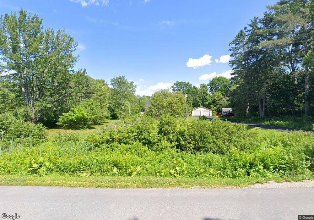
117 Sandy Point Rd Stockton Springs, ME 04981
Estimated Value: $299,000 - $362,237
3
Beds
1
Bath
1,530
Sq Ft
$213/Sq Ft
Est. Value
About This Home
This home is located at 117 Sandy Point Rd, Stockton Springs, ME 04981 and is currently estimated at $325,559, approximately $212 per square foot. 117 Sandy Point Rd is a home located in Waldo County with nearby schools including Bucksport Christian School.
Ownership History
Date
Name
Owned For
Owner Type
Purchase Details
Closed on
Feb 25, 2014
Sold by
Thompson Loran C Est
Bought by
Salley Linda H
Current Estimated Value
Purchase Details
Closed on
Feb 11, 2011
Sold by
Miscall Mildred L Est
Bought by
Siemer Jeffrey R and Dunn Gerald M
Home Financials for this Owner
Home Financials are based on the most recent Mortgage that was taken out on this home.
Original Mortgage
$75,200
Interest Rate
4.88%
Mortgage Type
Commercial
Create a Home Valuation Report for This Property
The Home Valuation Report is an in-depth analysis detailing your home's value as well as a comparison with similar homes in the area
Home Values in the Area
Average Home Value in this Area
Purchase History
| Date | Buyer | Sale Price | Title Company |
|---|---|---|---|
| Salley Linda H | -- | -- | |
| Siemer Jeffrey R | -- | -- |
Source: Public Records
Mortgage History
| Date | Status | Borrower | Loan Amount |
|---|---|---|---|
| Previous Owner | Siemer Jeffrey R | $75,200 |
Source: Public Records
Tax History Compared to Growth
Tax History
| Year | Tax Paid | Tax Assessment Tax Assessment Total Assessment is a certain percentage of the fair market value that is determined by local assessors to be the total taxable value of land and additions on the property. | Land | Improvement |
|---|---|---|---|---|
| 2024 | $2,890 | $174,080 | $44,660 | $129,420 |
| 2023 | $2,519 | $113,490 | $44,660 | $68,830 |
| 2022 | $2,315 | $113,500 | $44,660 | $68,840 |
| 2021 | $2,304 | $113,500 | $44,660 | $68,840 |
| 2020 | $2,339 | $113,520 | $44,660 | $68,860 |
| 2019 | $2,304 | $113,520 | $44,660 | $68,860 |
| 2018 | $2,293 | $113,530 | $44,660 | $68,870 |
| 2017 | $2,327 | $113,530 | $44,660 | $68,870 |
| 2016 | $1,813 | $114,080 | $44,660 | $69,420 |
| 2015 | $2,162 | $114,080 | $44,660 | $69,420 |
| 2014 | $2,129 | $110,600 | $48,900 | $61,700 |
| 2013 | $1,983 | $110,140 | $48,900 | $61,240 |
Source: Public Records
Map
Nearby Homes
- 1357 U S Route 1
- 45 Sandy Point Rd
- 22 Bayview Dr
- 671 U S Route 1
- 15 Windjammer Ln
- 19 Bracken Ln
- 196 Hersey Retreat Rd
- #17 W Side Dr
- 00 Stagecoach Rd
- 115 Pirates Cove Rd
- 115A&B Pirates Cove Rd
- 115 Rd
- 95 Osprey Reach Rd
- 38 Osprey Reach Rd
- R1-137A Morningside Place
- 43 Verona Park
- 4 Switzer Spring Rd
- 153 E Side Dr
- 271 U S Route 1
- Lot 157 Denslow Rd
- 118 Sandy Point Rd
- 107 Sandy Point Rd
- 124 Sandy Point Rd
- 132 Sandy Point Rd
- 0 Stowers Rd Unit 985415
- 0 Stowers Rd Unit 1206055
- 0 Stowers Rd Unit 1282589
- 106 Sandy Point Rd
- 93 Sandy Point Rd
- 84 Sandy Point Rd
- 90 Sandy Point Rd
- 143 Sandy Point Rd
- 148 Sandy Point Rd
- 23 Oceanview Dr
- 773 Us Route 1
- 83 Sandy Point Rd
- 5 West Dr
- 16 Muskrat Farm Rd
- 845 Us Rt 1
- 0 Muskrat Farm Rd Unit 858677
