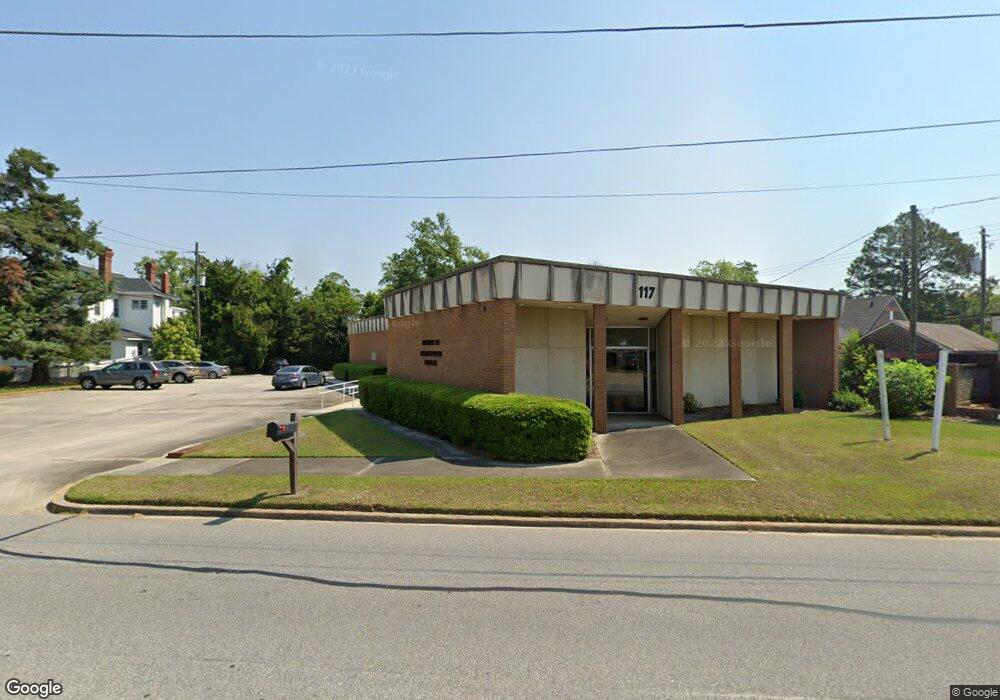
117 Savannah Ave Statesboro, GA 30458
Estimated Value: $527,872
--
Bed
--
Bath
3,422
Sq Ft
$154/Sq Ft
Est. Value
About This Home
This home is located at 117 Savannah Ave, Statesboro, GA 30458 and is currently estimated at $527,872, approximately $154 per square foot. 117 Savannah Ave is a home located in Bulloch County with nearby schools including Statesboro High School, Sallie Zetterower Elementary School, and Langston Chapel Middle School.
Ownership History
Date
Name
Owned For
Owner Type
Purchase Details
Closed on
Dec 15, 2016
Sold by
Dark Horse Properties Llc
Bought by
Panther Properties Llc
Current Estimated Value
Home Financials for this Owner
Home Financials are based on the most recent Mortgage that was taken out on this home.
Original Mortgage
$200,000
Interest Rate
3.94%
Mortgage Type
Commercial
Purchase Details
Closed on
Mar 10, 2008
Sold by
Not Provided
Bought by
Dark Horse Properties Llc
Purchase Details
Closed on
Apr 1, 1993
Bought by
Johnston Joe P
Create a Home Valuation Report for This Property
The Home Valuation Report is an in-depth analysis detailing your home's value as well as a comparison with similar homes in the area
Home Values in the Area
Average Home Value in this Area
Purchase History
| Date | Buyer | Sale Price | Title Company |
|---|---|---|---|
| Panther Properties Llc | $250,000 | -- | |
| Dark Horse Properties Llc | -- | -- | |
| Johnston Joe P | -- | -- |
Source: Public Records
Mortgage History
| Date | Status | Borrower | Loan Amount |
|---|---|---|---|
| Closed | Panther Properties Llc | $200,000 |
Source: Public Records
Tax History Compared to Growth
Tax History
| Year | Tax Paid | Tax Assessment Tax Assessment Total Assessment is a certain percentage of the fair market value that is determined by local assessors to be the total taxable value of land and additions on the property. | Land | Improvement |
|---|---|---|---|---|
| 2024 | $3,326 | $158,960 | $25,800 | $133,160 |
| 2023 | $2,876 | $106,990 | $25,800 | $81,190 |
| 2022 | $1,970 | $106,747 | $25,800 | $80,947 |
| 2021 | $2,026 | $108,387 | $27,440 | $80,947 |
| 2020 | $2,085 | $108,568 | $27,440 | $81,128 |
| 2019 | $2,097 | $117,462 | $27,440 | $90,022 |
| 2018 | $2,187 | $117,643 | $27,440 | $90,203 |
| 2017 | $2,203 | $118,006 | $27,440 | $90,566 |
| 2016 | $1,886 | $107,117 | $27,440 | $79,677 |
| 2015 | $1,894 | $114,194 | $27,440 | $86,754 |
| 2014 | $1,740 | $114,194 | $27,440 | $86,754 |
Source: Public Records
Map
Nearby Homes
- 111 S Mulberry St
- 227 E Main St
- 15 N Gordon St
- LOT 21 Oak Hill Dr
- 0 U S 301 Unit 24576764
- 0 Highway 67 Unit 10541885
- 316 E Main St
- 342 Savannah Ave
- 27 W Grady St
- 313 Donaldson St
- 0 Oak St Unit OAK ST/ LOT 2
- 118 Lee St
- 0 Highway 80 W Unit 10534803
- 360 Savannah Ave
- 141 Griffith Ln
- 362 Savannah Ave
- 113 Church St
- 115 Inman Ln Unit A/B
- 8 Roundtree St
- 117 W Jones Ave
- 0 Broad St Unit 3248853
- 0 Broad St Unit 3158345
- 0 Broad St Unit 7610321
- 0 Broad St Unit 7453835
- 0 Broad St Unit 7001948
- 0 Broad St Unit 7048775
- 0 Broad St Unit 3062279
- 0 Broad St Unit 7103695
- 0 Broad St Unit 7480373
- 0 Broad St Unit 3232271
- 0 Broad St Unit 8379990
- 0 Broad St Unit 7553023
- 0 Broad St Unit 7371297
- 0 Broad St Unit 7393394
- 0 Broad St Unit 7202332
- 0 Broad St Unit 7089136
- 0 Broad St Unit 9077542
- 0 Broad St Unit 8734708
- 0 Broad St Unit 8734949
- 0 Broad St Unit 8942108