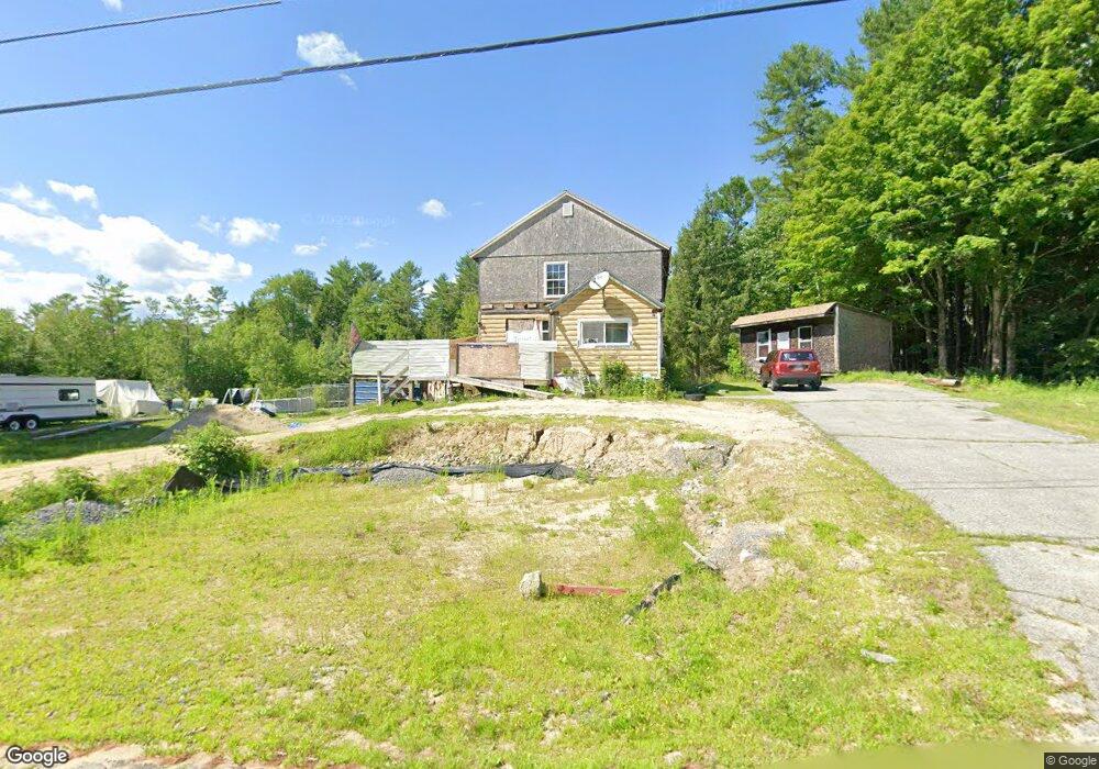
117 Strickland Loop Rd Livermore Falls, ME 04254
Estimated Value: $178,145 - $228,000
4
Beds
1
Bath
1,560
Sq Ft
$134/Sq Ft
Est. Value
About This Home
This home is located at 117 Strickland Loop Rd, Livermore Falls, ME 04254 and is currently estimated at $208,382, approximately $133 per square foot. 117 Strickland Loop Rd is a home located in Androscoggin County with nearby schools including Spruce Mountain Primary School, Spruce Mountain Middle School, and Spruce Mountain High School.
Ownership History
Date
Name
Owned For
Owner Type
Purchase Details
Closed on
Dec 15, 2010
Sold by
Hall Michael L and Hall-Lamarca Cynthia P
Bought by
Corliss Kevin W
Current Estimated Value
Home Financials for this Owner
Home Financials are based on the most recent Mortgage that was taken out on this home.
Original Mortgage
$110,720
Outstanding Balance
$71,751
Interest Rate
4.23%
Mortgage Type
FHA
Estimated Equity
$136,631
Purchase Details
Closed on
Mar 15, 2005
Sold by
Hall Arthur J and Hall Mary E
Bought by
Hall Michael L and Hall Cynthia P
Home Financials for this Owner
Home Financials are based on the most recent Mortgage that was taken out on this home.
Original Mortgage
$35,100
Interest Rate
5.64%
Mortgage Type
Purchase Money Mortgage
Create a Home Valuation Report for This Property
The Home Valuation Report is an in-depth analysis detailing your home's value as well as a comparison with similar homes in the area
Home Values in the Area
Average Home Value in this Area
Purchase History
| Date | Buyer | Sale Price | Title Company |
|---|---|---|---|
| Corliss Kevin W | -- | -- | |
| Hall Michael L | -- | -- | |
| Hall Michael L | -- | -- |
Source: Public Records
Mortgage History
| Date | Status | Borrower | Loan Amount |
|---|---|---|---|
| Open | Hall Michael L | $110,720 | |
| Closed | Hall Michael L | $110,720 | |
| Previous Owner | Hall Michael L | $62,300 | |
| Previous Owner | Hall Michael L | $35,100 |
Source: Public Records
Tax History
| Year | Tax Paid | Tax Assessment Tax Assessment Total Assessment is a certain percentage of the fair market value that is determined by local assessors to be the total taxable value of land and additions on the property. | Land | Improvement |
|---|---|---|---|---|
| 2025 | $2,521 | $198,490 | $43,400 | $155,090 |
| 2024 | $2,297 | $88,500 | $13,600 | $74,900 |
| 2023 | $2,146 | $88,500 | $13,600 | $74,900 |
| 2022 | $2,036 | $88,500 | $13,600 | $74,900 |
| 2021 | $2,053 | $88,500 | $13,600 | $74,900 |
| 2020 | $1,704 | $88,500 | $13,600 | $74,900 |
| 2019 | $1,954 | $88,500 | $13,600 | $74,900 |
| 2018 | $1,912 | $88,500 | $13,600 | $74,900 |
| 2017 | $1,483 | $88,500 | $13,600 | $74,900 |
| 2016 | $5,450 | $88,500 | $13,600 | $74,900 |
| 2015 | $1,867 | $88,500 | $13,600 | $74,900 |
| 2014 | $1,867 | $88,500 | $13,600 | $74,900 |
| 2013 | $1,841 | $88,500 | $13,600 | $74,900 |
Source: Public Records
Map
Nearby Homes
- 132 Hunton Loop
- 309 Strickland Ferry Rd
- Lot 0 Strickland Ferry Rd
- 232 Campground Rd
- 881 River Rd
- 156 Lakeshore Dr
- 27 Mountain View Rd
- 735 River Rd
- 286 Pond Rd
- 5 Corbyn Way
- 506 Main St
- 574 Howes Corner Rd
- 21 Stonewall Dr
- 8 Sunrise Trail
- 1081 Federal Rd
- Lot 39 Main St
- 62 Norton Rd
- 506 Park St
- 591 North Rd
- 363 Butter Hill Rd
- 0 Strickland Loop Rd
- 99 Strickland Loop Rd
- 111 Strickland Loop Rd
- 106 Strickland Loop Rd
- 112 Strickland Loop Rd
- 120 Strickland Loop Rd
- 86 Strickland Loop Rd
- 7 Norris Farm Ln
- 153 Strickland Loop Rd
- 256 Strickland Loop Rd
- 298 Strickland Loop Rd
- 179 Strickland Loop Rd
- 192 Strickland Loop Rd
- 282 Strickland Loop Rd
- 330 Strickland Loop Rd
- 189 Strickland Loop Rd
- 304 Strickland Loop Rd
- 265 Strickland Loop Rd
- 318 Strickland Loop Rd
- 50 Strickland Loop Rd
Your Personal Tour Guide
Ask me questions while you tour the home.