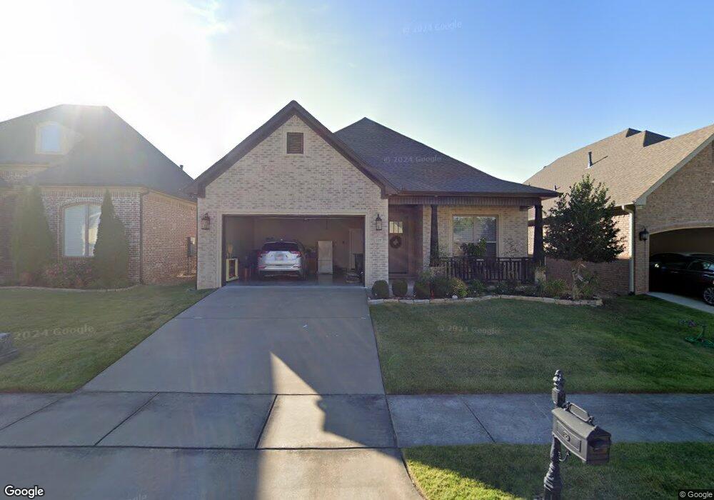
117 Summershade Loop Little Rock, AR 72223
Chenal Valley NeighborhoodEstimated Value: $399,767 - $447,000
3
Beds
2
Baths
1,919
Sq Ft
$223/Sq Ft
Est. Value
About This Home
This home is located at 117 Summershade Loop, Little Rock, AR 72223 and is currently estimated at $428,192, approximately $223 per square foot. 117 Summershade Loop is a home located in Pulaski County with nearby schools including Chenal Elementary School, Joe T. Robinson Middle School, and Joe T. Robinson High School.
Ownership History
Date
Name
Owned For
Owner Type
Purchase Details
Closed on
Jun 16, 2017
Sold by
Graham Smith Construction Llc
Bought by
Lou Paul C and Lou Judy M
Current Estimated Value
Home Financials for this Owner
Home Financials are based on the most recent Mortgage that was taken out on this home.
Original Mortgage
$200,000
Outstanding Balance
$105,048
Interest Rate
4.05%
Mortgage Type
New Conventional
Estimated Equity
$323,144
Purchase Details
Closed on
Oct 25, 2016
Sold by
Wildwood Partners Llc
Bought by
Graham Smith Construction Llc
Home Financials for this Owner
Home Financials are based on the most recent Mortgage that was taken out on this home.
Original Mortgage
$245,000
Interest Rate
3.48%
Mortgage Type
Construction
Create a Home Valuation Report for This Property
The Home Valuation Report is an in-depth analysis detailing your home's value as well as a comparison with similar homes in the area
Home Values in the Area
Average Home Value in this Area
Purchase History
| Date | Buyer | Sale Price | Title Company |
|---|---|---|---|
| Lou Paul C | $309,000 | American Abstract & Title Co | |
| Graham Smith Construction Llc | $70,000 | American Abstract & Title Co |
Source: Public Records
Mortgage History
| Date | Status | Borrower | Loan Amount |
|---|---|---|---|
| Open | Lou Paul C | $200,000 | |
| Previous Owner | Graham Smith Construction Llc | $245,000 |
Source: Public Records
Tax History
| Year | Tax Paid | Tax Assessment Tax Assessment Total Assessment is a certain percentage of the fair market value that is determined by local assessors to be the total taxable value of land and additions on the property. | Land | Improvement |
|---|---|---|---|---|
| 2025 | $3,522 | $66,755 | $14,400 | $52,355 |
| 2024 | $3,522 | $66,755 | $14,400 | $52,355 |
| 2023 | $3,522 | $66,755 | $14,400 | $52,355 |
| 2022 | $5,352 | $66,755 | $14,400 | $52,355 |
| 2021 | $5,380 | $54,780 | $13,300 | $41,480 |
| 2020 | $4,977 | $54,780 | $13,300 | $41,480 |
| 2019 | $4,977 | $54,780 | $13,300 | $41,480 |
| 2018 | $4,894 | $54,780 | $13,300 | $41,480 |
| 2017 | $2,577 | $13,300 | $13,300 | $0 |
Source: Public Records
Map
Nearby Homes
- 4104 Gordon Rd
- 6 Hallen Ct
- 125 Hallen Ln
- 19208 Summershade Dr
- 120 Sezanne Ct
- 120 Ensbury Dr
- 11 Accadia Ct
- 37 Chenal Cir
- 20 Accadia Ct
- 7 Lacelle Ct
- 35 Sologne Cir
- 303 Wildcreek Blvd
- 80 Saffron Cir
- 7 Crosswood Ct
- 67 Chenal Cir
- 109 Rosemary Way
- 68 Chenal Cir
- 60 Sologne Cir
- 12 Sologne Cir
- 14 Sologne Cir
- 119 Summershade Loop
- 107 Summershade Loop
- 201 Summershade Loop
- 215 Summershade Loop
- 116 Summershade Loop
- 118 Summershade Dr
- 2323 Gordon Rd
- 2320 Gordon Rd
- 0 Summershade Loop Unit 16035987
- 0 Summershade Loop Unit 17007516
- 0 Summershade Loop Unit 17012647
- 0 Summershade Loop Unit 17037159
- 0 Summershade Loop Unit 17034116
- 0 Summershade Loop Unit 18003852
- 0 Summershade Loop Unit 17023688
- 0 Summershade Loop Unit 17029239
- 0 Summershade Loop Unit 17033029
- 0 Summershade Loop Unit 17033024
- 114 Summershade Loop
- 2308 Gordon Rd
Your Personal Tour Guide
Ask me questions while you tour the home.