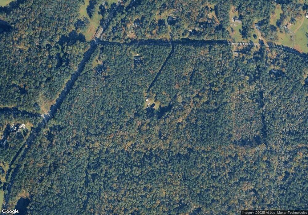
117 Sutton Rd Forsyth, GA 31029
Estimated Value: $242,314 - $321,000
--
Bed
2
Baths
1,998
Sq Ft
$143/Sq Ft
Est. Value
About This Home
This home is located at 117 Sutton Rd, Forsyth, GA 31029 and is currently estimated at $286,105, approximately $143 per square foot. 117 Sutton Rd is a home located in Monroe County with nearby schools including Katherine B. Sutton Elementary School and Mary Persons High School.
Ownership History
Date
Name
Owned For
Owner Type
Purchase Details
Closed on
Jun 22, 2022
Sold by
Grovenstein William F Executor
Bought by
Grovenstein William F
Current Estimated Value
Purchase Details
Closed on
May 25, 2022
Sold by
Stanford Matthew H
Bought by
Grovenstein William F
Purchase Details
Closed on
May 11, 2022
Sold by
Kenley Kenneth
Bought by
Grovenstein William F
Purchase Details
Closed on
May 4, 2022
Sold by
Stanford C William
Bought by
Grovenstein William F
Purchase Details
Closed on
May 3, 2022
Sold by
Sharpe Kaeli M
Bought by
Grovenstein William F
Purchase Details
Closed on
Apr 29, 2022
Sold by
Grovenstein Zachary R
Bought by
Grovenstein William F
Create a Home Valuation Report for This Property
The Home Valuation Report is an in-depth analysis detailing your home's value as well as a comparison with similar homes in the area
Home Values in the Area
Average Home Value in this Area
Purchase History
| Date | Buyer | Sale Price | Title Company |
|---|---|---|---|
| Grovenstein William F | -- | -- | |
| Grovenstein William F | -- | -- | |
| Grovenstein William F | -- | -- | |
| Grovenstein William F | -- | -- | |
| Grovenstein William F | -- | -- | |
| Grovenstein William F | -- | -- | |
| Grovenstein William F | -- | -- | |
| Grovenstein William F | -- | -- |
Source: Public Records
Tax History Compared to Growth
Tax History
| Year | Tax Paid | Tax Assessment Tax Assessment Total Assessment is a certain percentage of the fair market value that is determined by local assessors to be the total taxable value of land and additions on the property. | Land | Improvement |
|---|---|---|---|---|
| 2024 | $42 | $78,728 | $54,200 | $24,528 |
| 2023 | $37 | $75,168 | $54,200 | $20,968 |
| 2022 | $2,107 | $75,168 | $54,200 | $20,968 |
| 2021 | $500 | $75,168 | $54,200 | $20,968 |
| 2020 | $500 | $75,168 | $54,200 | $20,968 |
| 2019 | $501 | $75,168 | $54,200 | $20,968 |
| 2018 | $500 | $75,168 | $54,200 | $20,968 |
| 2017 | $2,185 | $75,168 | $54,200 | $20,968 |
| 2016 | $402 | $75,168 | $54,200 | $20,968 |
| 2015 | $378 | $75,168 | $54,200 | $20,968 |
| 2014 | $361 | $75,168 | $54,200 | $20,968 |
Source: Public Records
Map
Nearby Homes
- 83 Sydney Woods Dr
- 4320 Cornwall Dr
- 5343 Felles Way
- 5357 Felles Way Unit 378
- 110 Tomkins Creek Trail
- 2023 Camberle Ct
- 2023 Camberle Ct Unit 144
- 1082 Victorian Blvd
- 67 Strickland Loop
- 410 Strickland Loop
- 4631 Capulet Ct Unit 331
- 4631 Capulet Ct
- 4686 Johnstonville Rd
- 68 Creekview Dr
- 29 Deer Run
- 80 S Cedar Creek Dr
- 62 S Cedar Creek Dr
- 90 +/- ACRES English Rd
- 3355 Sr 42 N
- 3355 Georgia 42
- 35 Sutton Rd
- 2307 Georgia 42
- 2307 Ga Highway 42 N
- 2343 Ga Highway 42 N
- 76 Sutton Rd
- 145 Sutton Rd
- 2387 Ga Highway 42 N
- 0 Sutton Rd Unit 7142353
- 0 Sutton Rd Unit 7525038
- 0 Sutton Rd Unit 7338039
- 0 Sutton Rd Unit 13 7599211
- 0 Sutton Rd Unit 8085372
- 0 Sutton Rd Unit M122918
- 42 Sydney Ct
- 42 Sydney Woods Dr
- 13 Sutton Rd
- 185 Sutton Rd
- 38 Sydney Ct
- 41 Sydney Ct
- 2204 Georgia 42
