Estimated Value: $292,077 - $342,000
3
Beds
2
Baths
1,436
Sq Ft
$221/Sq Ft
Est. Value
About This Home
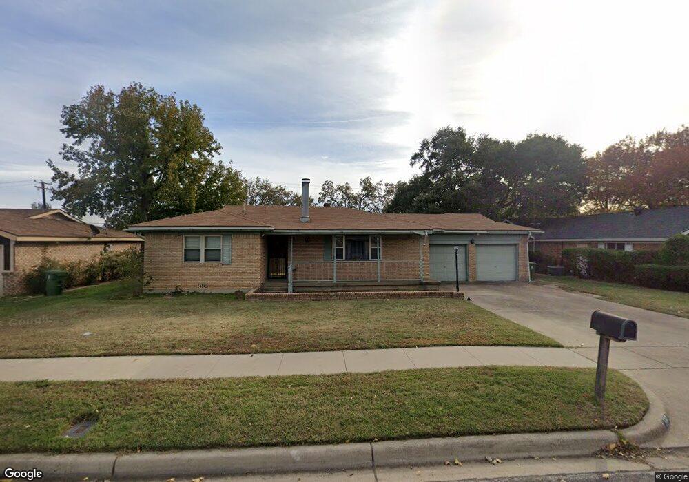
This home is located at 117 W Cheryl Ave, Hurst, TX 76053 and is currently estimated at $317,039, approximately $220 per square foot. 117 W Cheryl Ave is a home located in Tarrant County with nearby schools including Harrison Lane Elementary School, Hurst J High School, and L.D. Bell High School.
Ownership History
Date
Name
Owned For
Owner Type
Purchase Details
Closed on
Oct 1, 2018
Sold by
Reyenga Kara J and Reyenga Shaughn W
Bought by
Mettler Christine M and Mettler Jeremy N
Current Estimated Value
Home Financials for this Owner
Home Financials are based on the most recent Mortgage that was taken out on this home.
Original Mortgage
$200,000
Outstanding Balance
$174,412
Interest Rate
4.5%
Mortgage Type
Purchase Money Mortgage
Estimated Equity
$142,627
Purchase Details
Closed on
Aug 29, 2016
Sold by
Lahaie Arley R and Lahaie Joyce
Bought by
Reyenga Kara J and Reyenga Shaughn W
Home Financials for this Owner
Home Financials are based on the most recent Mortgage that was taken out on this home.
Original Mortgage
$142,500
Interest Rate
3.45%
Mortgage Type
New Conventional
Create a Home Valuation Report for This Property
The Home Valuation Report is an in-depth analysis detailing your home's value as well as a comparison with similar homes in the area
Home Values in the Area
Average Home Value in this Area
Purchase History
| Date | Buyer | Sale Price | Title Company |
|---|---|---|---|
| Mettler Christine M | -- | Old Republic Title Co | |
| Reyenga Kara J | -- | Rt |
Source: Public Records
Mortgage History
| Date | Status | Borrower | Loan Amount |
|---|---|---|---|
| Open | Mettler Christine M | $200,000 | |
| Previous Owner | Reyenga Kara J | $142,500 |
Source: Public Records
Tax History Compared to Growth
Tax History
| Year | Tax Paid | Tax Assessment Tax Assessment Total Assessment is a certain percentage of the fair market value that is determined by local assessors to be the total taxable value of land and additions on the property. | Land | Improvement |
|---|---|---|---|---|
| 2025 | $3,288 | $213,018 | $55,000 | $158,018 |
| 2024 | $3,288 | $260,933 | $55,000 | $205,933 |
| 2023 | $4,485 | $304,205 | $40,000 | $264,205 |
| 2022 | $4,685 | $266,670 | $40,000 | $226,670 |
| 2021 | $4,462 | $185,000 | $40,000 | $145,000 |
| 2020 | $4,704 | $195,508 | $40,000 | $155,508 |
| 2019 | $4,785 | $195,508 | $40,000 | $155,508 |
| 2018 | $3,251 | $155,835 | $19,000 | $136,835 |
| 2017 | $3,722 | $147,094 | $19,000 | $128,094 |
| 2016 | $2,402 | $137,524 | $19,000 | $118,524 |
| 2015 | $797 | $86,300 | $15,000 | $71,300 |
| 2014 | $797 | $86,300 | $15,000 | $71,300 |
Source: Public Records
Map
Nearby Homes
- 1016 Keith Dr
- 1136 Simpson Dr
- 905 Brown Trail
- 127 W Cedar St
- 420 Bedford Ct W
- 400 Joanna Dr
- 409 Vicki Place
- 802 Brown Trail
- 1220 Norwood Dr
- 803 Glenda Dr
- 624 Harrison Ln
- 341 Hurst Dr
- 344 Bedford Ct E
- 644 Caduceus Ln
- 1208 Karla Dr
- 231 Elm St
- 552 Norwood Dr
- 116 Oakhurst Dr
- 1337 Harrison Ln
- 849 Russell Ln
- 121 W Cheryl Ave
- 113 W Cheryl Ave
- 125 W Cheryl Ave
- 1101 Simpson Dr
- 1100 Harrison Ln
- 1100 Simpson Dr
- 105 W Cheryl Ave
- 1105 Simpson Dr
- 1104 Harrison Ln
- 201 W Cheryl Ave
- 1104 Simpson Dr
- 101 W Cheryl Ave
- 1109 Simpson Dr
- 1053 Keith Dr
- 1101 Norwood Dr
- 1108 Harrison Ln
- 1101 Harrison Ln
- 1108 Simpson Dr
- 205 W Cheryl Ave
- 1105 Norwood Dr