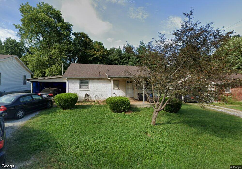
117 W Halstead Ave Bardstown, KY 40004
Estimated Value: $164,000 - $224,417
4
Beds
2
Baths
1,550
Sq Ft
$122/Sq Ft
Est. Value
About This Home
This home is located at 117 W Halstead Ave, Bardstown, KY 40004 and is currently estimated at $189,854, approximately $122 per square foot. 117 W Halstead Ave is a home located in Nelson County with nearby schools including Bardstown Elementary School, Bardstown Primary School, and Bardstown Middle School.
Ownership History
Date
Name
Owned For
Owner Type
Purchase Details
Closed on
Aug 21, 2014
Sold by
Ballard Mike and Ballard Kathy
Bought by
Tonge Tammy M and Brammer May L
Current Estimated Value
Home Financials for this Owner
Home Financials are based on the most recent Mortgage that was taken out on this home.
Original Mortgage
$77,120
Outstanding Balance
$58,692
Interest Rate
4.37%
Mortgage Type
FHA
Estimated Equity
$131,162
Purchase Details
Closed on
Apr 4, 2014
Sold by
Nationstar Mortgage Llc
Bought by
Ballard Mike A
Create a Home Valuation Report for This Property
The Home Valuation Report is an in-depth analysis detailing your home's value as well as a comparison with similar homes in the area
Home Values in the Area
Average Home Value in this Area
Purchase History
| Date | Buyer | Sale Price | Title Company |
|---|---|---|---|
| Tonge Tammy M | $81,500 | None Available | |
| Ballard Mike A | $50,701 | None Available |
Source: Public Records
Mortgage History
| Date | Status | Borrower | Loan Amount |
|---|---|---|---|
| Open | Tonge Tammy M | $77,120 |
Source: Public Records
Tax History
| Year | Tax Paid | Tax Assessment Tax Assessment Total Assessment is a certain percentage of the fair market value that is determined by local assessors to be the total taxable value of land and additions on the property. | Land | Improvement |
|---|---|---|---|---|
| 2025 | $172 | $89,500 | $0 | $0 |
| 2024 | $172 | $89,500 | $0 | $0 |
| 2023 | $172 | $89,500 | $0 | $0 |
| 2022 | $187 | $89,500 | $89,500 | $0 |
| 2021 | $164 | $81,500 | $81,500 | $0 |
| 2020 | $167 | $81,500 | $81,500 | $0 |
| 2019 | $173 | $81,500 | $81,500 | $0 |
| 2018 | $181 | $81,500 | $81,500 | $0 |
| 2017 | $80 | $81,500 | $81,500 | $0 |
| 2016 | $1,318 | $81,500 | $81,500 | $0 |
| 2015 | $1,318 | $81,500 | $81,500 | $0 |
| 2014 | $1,318 | $127,500 | $127,500 | $0 |
| 2012 | $1,318 | $127,500 | $127,500 | $0 |
Source: Public Records
Map
Nearby Homes
- 728 Beechwood Ave
- 117 E Halstead Ave
- 40 Bluegrass Ct
- 111 E Obryan Ave
- 310 E Daugherty Ave
- 111 Hurstland Dr
- 111 N Salem Dr
- 110 E Brashear Ave
- 916 Woods Run Rd
- 926 Woods Run Rd
- 308 N 3rd St
- 319 N 1st St
- 1107 N 3rd St
- 104 Mckenna Way
- 116 Windsor Ave
- 120 Purcell Ave
- 105 Riggs Blvd
- 191 Mcgowan Ave
- 201 E John Fitch Ave
- 166 Castleton Dr
- 118 W Halstead Ave
- 118 W Halstead Ave
- 115 W Halstead Ave
- 713 Oaklawn Ct
- 712 Oaklawn Ct
- 111 W Halstead Ave
- 714 N 3rd St
- 117 W Forrest Ave
- 119 W Forrest Ave
- 718 N 3rd St
- 121 W Forrest Ave
- 113 W Forrest Ave
- 123 W Forrest Ave
- 715 Beechwood Ave
- 713 Beechwood Ave
- 717 Beechwood Ave
- 125 W Forrest Ave
- 711 Beechwood Ave
- 725 Beechwood Ave
- 719 Beechwood Ave
Your Personal Tour Guide
Ask me questions while you tour the home.