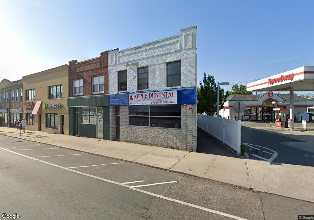
117 W Sunrise Hwy Unit 1 Freeport, NY 11520
Estimated Value: $635,000 - $1,213,308
--
Bed
--
Bath
8,548
Sq Ft
$108/Sq Ft
Est. Value
About This Home
This home is located at 117 W Sunrise Hwy Unit 1, Freeport, NY 11520 and is currently estimated at $924,154, approximately $108 per square foot. 117 W Sunrise Hwy Unit 1 is a home located in Nassau County with nearby schools including Columbus Avenue School, Caroline G. Atkinson Intermediate School, and John W Dodd Middle School.
Ownership History
Date
Name
Owned For
Owner Type
Purchase Details
Closed on
Jan 19, 2016
Sold by
Referee Of Nassau County
Bought by
Peykarian Sinai
Current Estimated Value
Purchase Details
Closed on
Jan 25, 2007
Sold by
Surf Properties Inc
Bought by
Jk Deleon Llc L
Purchase Details
Closed on
Jan 29, 2004
Sold by
Glacken Jeffrey
Bought by
Surf Properties Inc
Create a Home Valuation Report for This Property
The Home Valuation Report is an in-depth analysis detailing your home's value as well as a comparison with similar homes in the area
Home Values in the Area
Average Home Value in this Area
Purchase History
| Date | Buyer | Sale Price | Title Company |
|---|---|---|---|
| Peykarian Sinai | $324,000 | None Available | |
| Jk Deleon Llc L | $725,000 | -- | |
| Surf Properties Inc | $335,000 | -- |
Source: Public Records
Mortgage History
| Date | Status | Borrower | Loan Amount |
|---|---|---|---|
| Closed | Peykarian Sinai | $0 |
Source: Public Records
Tax History Compared to Growth
Tax History
| Year | Tax Paid | Tax Assessment Tax Assessment Total Assessment is a certain percentage of the fair market value that is determined by local assessors to be the total taxable value of land and additions on the property. | Land | Improvement |
|---|---|---|---|---|
| 2025 | $16,190 | $4,428 | $454 | $3,974 |
| 2024 | $2,178 | $4,854 | $497 | $4,357 |
| 2023 | $20,515 | $5,166 | $529 | $4,637 |
| 2022 | $20,515 | $7,058 | $723 | $6,335 |
| 2021 | $29,070 | $4,760 | $515 | $4,245 |
| 2020 | $19,346 | $3,591 | $961 | $2,630 |
| 2019 | $20,197 | $3,591 | $804 | $2,787 |
| 2018 | $20,388 | $3,591 | $0 | $0 |
| 2017 | $21,226 | $4,291 | $961 | $3,330 |
| 2016 | $24,621 | $4,291 | $961 | $3,330 |
| 2015 | $2,983 | $4,291 | $961 | $3,330 |
| 2014 | $2,983 | $4,291 | $961 | $3,330 |
| 2013 | $2,821 | $4,291 | $961 | $3,330 |
Source: Public Records
Map
Nearby Homes
- 55 S Bergen Place Unit 3F
- 100 S Ocean Ave Unit 4A
- 100 S Ocean Ave Unit 3m
- 110 Brooklyn Ave Unit 1D
- 70 N Grove St Unit 1R
- 70 S Main St Unit 307-PH
- 99 Randall Ave Unit 1Q
- 190 W Merrick Rd Unit 4E
- 47 Harding Place
- 100 Randall Ave Unit 1E
- 28 Lexington Ave
- 124 Smith St Unit 1B
- 124 Smith St Unit 3B
- 150 S Ocean Ave Unit 4-H
- 194 Smith St Unit 3P
- 194 Smith St Unit 1
- 250 W Merrick Rd Unit 2 L
- 250 W Merrick Rd Unit 2F
- 250 W Merrick Rd Unit 2R
- 250 W Merrick Rd Unit 2M
- 117 W Sunrise Hwy
- 117 W Sunrise Hwy Unit 2
- 117 W Sunrise Hwy
- 113 W Sunrise Hwy
- 20 Yachtsman's Cove
- 111 W Sunrise Hwy
- 109 W Sunrise Hwy
- 75A W Sunrise Hwy
- 1 Guy Lombardo Ave
- 28 Guy Lombardo Ave
- 30 N Guy Lombardo Ave
- 30 S Ocean Ave
- 30 S Ocean Ave Unit 201
- 30 S Ocean Ave Unit 203
- 30 S Ocean Ave Unit 301
- 30 S Ocean Ave Unit 101
- 30 S Ocean Ave Unit 102
- 30 S Ocean Ave Unit 305
- 31 Guy Lombardo Ave
- 70 W Sunrise Hwy