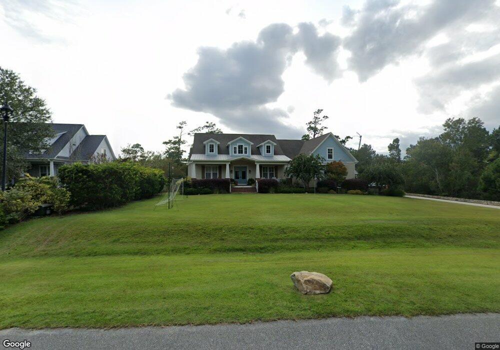
117 Waters Edge Hampstead, NC 28443
Estimated Value: $677,000 - $1,731,000
4
Beds
4
Baths
4,196
Sq Ft
$251/Sq Ft
Est. Value
About This Home
This home is located at 117 Waters Edge, Hampstead, NC 28443 and is currently estimated at $1,052,410, approximately $250 per square foot. 117 Waters Edge is a home located in Pender County with nearby schools including South Topsail Elementary School, Topsail Middle School, and Topsail High School.
Ownership History
Date
Name
Owned For
Owner Type
Purchase Details
Closed on
Aug 12, 2011
Bought by
Teta Jeffrey
Current Estimated Value
Purchase Details
Closed on
Feb 15, 2011
Sold by
Gilley Jeffery L and Gilley Shannon B
Bought by
Branch Banking And Trust Co
Purchase Details
Closed on
Aug 30, 2007
Sold by
Elraie Khaled F
Bought by
Gilley Jeffery L and Gilley Shannon B
Home Financials for this Owner
Home Financials are based on the most recent Mortgage that was taken out on this home.
Original Mortgage
$1,000,000
Interest Rate
6.7%
Mortgage Type
Construction
Create a Home Valuation Report for This Property
The Home Valuation Report is an in-depth analysis detailing your home's value as well as a comparison with similar homes in the area
Home Values in the Area
Average Home Value in this Area
Purchase History
| Date | Buyer | Sale Price | Title Company |
|---|---|---|---|
| Teta Jeffrey | $615,000 | -- | |
| Branch Banking And Trust Co | $595,000 | -- | |
| Gilley Jeffery L | $540,000 | -- |
Source: Public Records
Mortgage History
| Date | Status | Borrower | Loan Amount |
|---|---|---|---|
| Previous Owner | Gilley Jeffery L | $1,000,000 |
Source: Public Records
Tax History
| Year | Tax Paid | Tax Assessment Tax Assessment Total Assessment is a certain percentage of the fair market value that is determined by local assessors to be the total taxable value of land and additions on the property. | Land | Improvement |
|---|---|---|---|---|
| 2025 | $5,633 | $1,196,202 | $225,250 | $970,952 |
| 2024 | $5,633 | $587,306 | $247,775 | $339,531 |
| 2023 | $5,633 | $587,306 | $247,775 | $339,531 |
| 2022 | $5,109 | $587,306 | $247,775 | $339,531 |
| 2021 | $5,109 | $587,306 | $247,775 | $339,531 |
| 2020 | $5,109 | $587,306 | $247,775 | $339,531 |
| 2019 | $5,109 | $587,306 | $247,775 | $339,531 |
| 2018 | $5,854 | $645,786 | $255,714 | $390,072 |
| 2017 | $5,854 | $645,786 | $255,714 | $390,072 |
| 2016 | $5,680 | $645,786 | $255,714 | $390,072 |
| 2015 | $5,662 | $645,786 | $255,714 | $390,072 |
| 2014 | $4,410 | $645,786 | $255,714 | $390,072 |
| 2013 | -- | $645,786 | $255,714 | $390,072 |
| 2012 | -- | $645,786 | $255,714 | $390,072 |
Source: Public Records
Map
Nearby Homes
- 119 Waters Edge
- 802 Sound View Dr
- 601 Wildwood Rd
- 718 Hughes Rd
- 613 Hughes Rd
- 1031 Washington Acres Rd
- 1438 Washington Acres Rd
- 173 Mae Dr
- 107 Weir Dr
- 1091 Dan Owen Dr
- 38 Pin Oak Ct
- 1189 Dan Owen Dr
- 33 Medina Ct
- 39 Excalibur Point
- 140 E Keel Dr
- 37 Twisted Oak Ct
- 21 Grant Dr
- 11 Amidships Ln
- Gramercy Plan at Salters Haven
- Bryant Plan at Salters Haven
- 115 Waters Edge
- 17 Waters Edge
- 16 Waters Edge
- Lot 4 Waters Edge
- 0 Waters Edge
- 106 Waters Edge
- 3 Waters Edge
- 113 Waters Edge
- 121 Waters Edge
- 444 E Creekview Dr
- 446 E Creekview Dr
- 111 Waters Edge
- 448 E Creekview Dr
- 442 E Creekview Dr
- 450 E Creekview Dr
- 109 Waters Edge
- 125 Waters Edge
- 452 E Creekview Dr
- 441 E Creekview Dr
- 107 Waters Edge
Your Personal Tour Guide
Ask me questions while you tour the home.