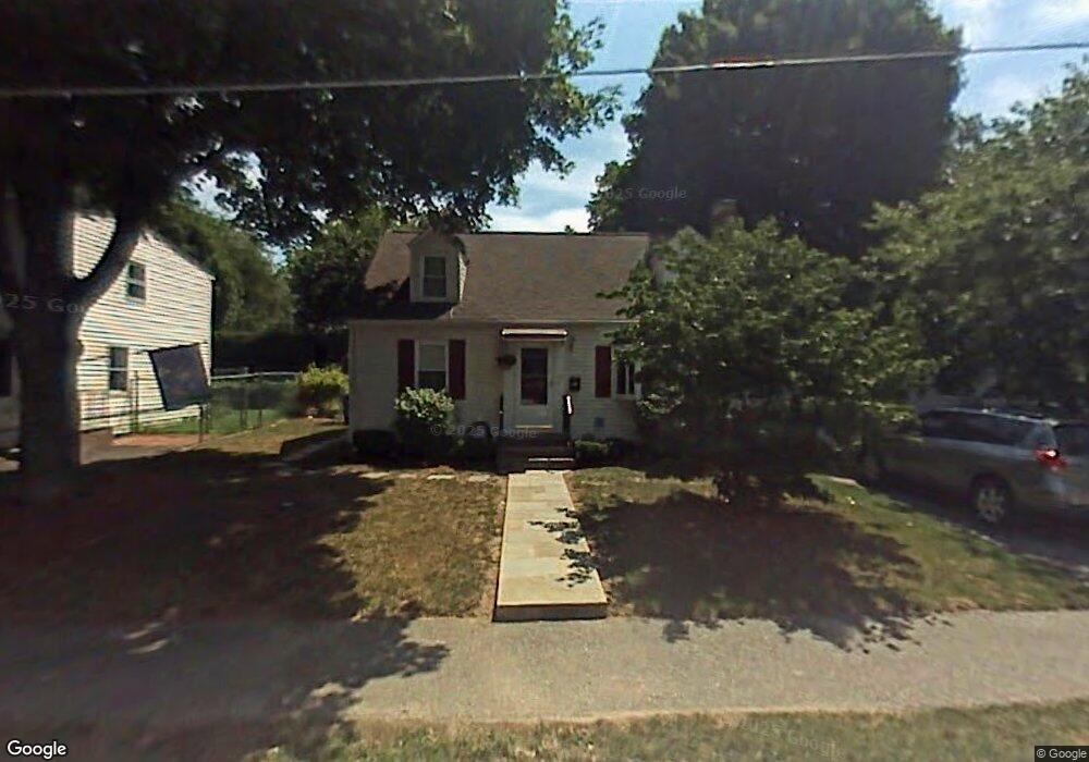
117 Whitman Rd Waltham, MA 02453
Warrendale NeighborhoodEstimated Value: $795,000 - $878,000
3
Beds
2
Baths
1,080
Sq Ft
$773/Sq Ft
Est. Value
About This Home
This home is located at 117 Whitman Rd, Waltham, MA 02453 and is currently estimated at $835,257, approximately $773 per square foot. 117 Whitman Rd is a home located in Middlesex County with nearby schools including James Fitzgerald Elementary School, John W. Mcdevitt Middle School, and Waltham Sr High School.
Ownership History
Date
Name
Owned For
Owner Type
Purchase Details
Closed on
Apr 29, 1991
Sold by
Campbell Thomas J
Bought by
Kusmirek Leo
Current Estimated Value
Home Financials for this Owner
Home Financials are based on the most recent Mortgage that was taken out on this home.
Original Mortgage
$129,600
Interest Rate
9.41%
Mortgage Type
Purchase Money Mortgage
Create a Home Valuation Report for This Property
The Home Valuation Report is an in-depth analysis detailing your home's value as well as a comparison with similar homes in the area
Home Values in the Area
Average Home Value in this Area
Purchase History
| Date | Buyer | Sale Price | Title Company |
|---|---|---|---|
| Kusmirek Leo | $162,000 | -- |
Source: Public Records
Mortgage History
| Date | Status | Borrower | Loan Amount |
|---|---|---|---|
| Closed | Kusmirek Leo | $129,600 |
Source: Public Records
Tax History
| Year | Tax Paid | Tax Assessment Tax Assessment Total Assessment is a certain percentage of the fair market value that is determined by local assessors to be the total taxable value of land and additions on the property. | Land | Improvement |
|---|---|---|---|---|
| 2025 | $6,683 | $680,600 | $458,800 | $221,800 |
| 2024 | $6,320 | $655,600 | $436,600 | $219,000 |
| 2023 | $6,429 | $623,000 | $414,400 | $208,600 |
| 2022 | $6,460 | $579,900 | $384,800 | $195,100 |
| 2021 | $6,415 | $566,700 | $384,800 | $181,900 |
| 2020 | $6,331 | $529,800 | $355,200 | $174,600 |
| 2019 | $6,362 | $502,500 | $347,700 | $154,800 |
| 2018 | $5,866 | $465,200 | $321,900 | $143,300 |
| 2017 | $5,471 | $435,600 | $292,300 | $143,300 |
| 2016 | $4,834 | $394,900 | $251,600 | $143,300 |
| 2015 | $4,523 | $344,500 | $222,000 | $122,500 |
Source: Public Records
Map
Nearby Homes
- 67 Longfellow Rd
- 17 Tennyson Rd
- 40 Whitman Rd Unit 2-1
- 51 Warren St Unit 1-3
- 31 Warren St Unit B-1
- 78 Barbara Rd Unit 1
- 21 Warren St Unit 2-4
- 54 Clements Rd
- 29 Puritan Rd
- 22 Grove St Unit 2
- 40 Grove St Unit 1
- 504 Main St Unit 1
- 133 Warren St Unit 3
- 38 Carey Ave Unit 3
- 38 Carey Ave Unit 6
- 56 Ralph St Unit 3
- 36 Brandley Rd Unit 38
- 38 Brandley Rd
- 256 Sycamore St Unit 256
- 186 Lexington St Unit 8
- 123 Whitman Rd
- 111 Whitman Rd
- 106 Longfellow Rd
- 112 Longfellow Rd
- 127 Whitman Rd
- 103 Whitman Rd
- 100 Longfellow Rd
- 114 Whitman Rd
- 118 Longfellow Rd
- 104 Whitman Rd
- 133 Whitman Rd
- 99 Whitman Rd
- 124 Longfellow Rd
- 92 Longfellow Rd
- 36 Fairfax Rd
- 14 Byron Rd
- 107 Longfellow Rd
- 101 Longfellow Rd
- 15 Byron Rd
- 113 Longfellow Rd
Your Personal Tour Guide
Ask me questions while you tour the home.