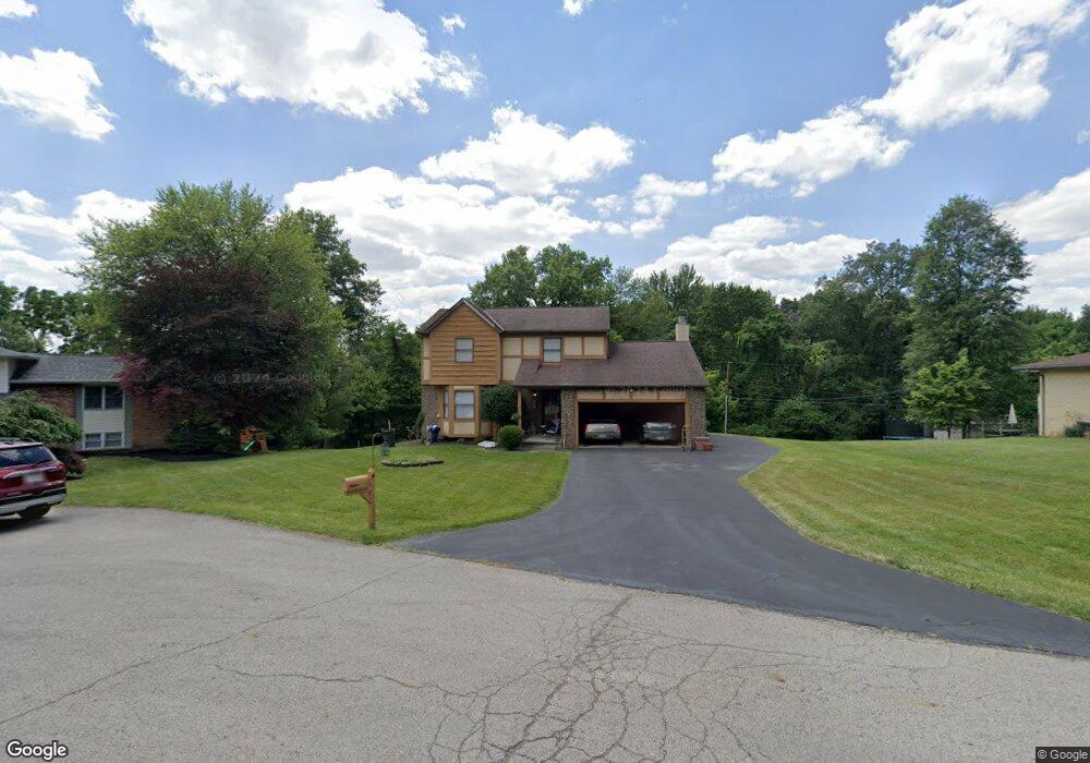
117 Wickfield Rd Blacklick, OH 43004
Estimated Value: $337,000 - $358,319
3
Beds
3
Baths
1,798
Sq Ft
$192/Sq Ft
Est. Value
About This Home
This home is located at 117 Wickfield Rd, Blacklick, OH 43004 and is currently estimated at $346,080, approximately $192 per square foot. 117 Wickfield Rd is a home located in Franklin County with nearby schools including Waggoner Road Elementary School, Waggoner Road Junior High School, and St Pius X School.
Ownership History
Date
Name
Owned For
Owner Type
Purchase Details
Closed on
Oct 5, 2001
Sold by
Perdue Ralph R and Adkins Gaye M
Bought by
Perdue Ralph R and Adkins Gaye M
Current Estimated Value
Purchase Details
Closed on
Jul 26, 2001
Sold by
Bushman Debra V and Watters Debra V
Bought by
Perdue Ralph R and Adkins Gaye M
Home Financials for this Owner
Home Financials are based on the most recent Mortgage that was taken out on this home.
Original Mortgage
$100,000
Outstanding Balance
$39,008
Interest Rate
7.15%
Mortgage Type
Purchase Money Mortgage
Estimated Equity
$307,072
Purchase Details
Closed on
Aug 13, 1997
Sold by
Rinehart Darci A
Bought by
Watters Mark A and Watters Debra V
Home Financials for this Owner
Home Financials are based on the most recent Mortgage that was taken out on this home.
Original Mortgage
$141,000
Interest Rate
7.71%
Mortgage Type
VA
Purchase Details
Closed on
May 1, 1985
Create a Home Valuation Report for This Property
The Home Valuation Report is an in-depth analysis detailing your home's value as well as a comparison with similar homes in the area
Home Values in the Area
Average Home Value in this Area
Purchase History
| Date | Buyer | Sale Price | Title Company |
|---|---|---|---|
| Perdue Ralph R | -- | -- | |
| Perdue Ralph R | $153,500 | George Pritsolas Title | |
| Bushman Debra V | -- | George Pritsolas Title | |
| Watters Mark A | $141,000 | Chicago Title | |
| -- | $16,000 | -- |
Source: Public Records
Mortgage History
| Date | Status | Borrower | Loan Amount |
|---|---|---|---|
| Open | Perdue Ralph R | $100,000 | |
| Previous Owner | Watters Mark A | $141,000 |
Source: Public Records
Tax History Compared to Growth
Tax History
| Year | Tax Paid | Tax Assessment Tax Assessment Total Assessment is a certain percentage of the fair market value that is determined by local assessors to be the total taxable value of land and additions on the property. | Land | Improvement |
|---|---|---|---|---|
| 2024 | $4,312 | $101,080 | $30,800 | $70,280 |
| 2023 | $4,281 | $101,080 | $30,800 | $70,280 |
| 2022 | $3,943 | $75,110 | $14,210 | $60,900 |
| 2021 | $3,809 | $75,110 | $14,210 | $60,900 |
| 2020 | $3,762 | $73,500 | $14,210 | $59,290 |
| 2019 | $3,672 | $63,530 | $12,360 | $51,170 |
| 2018 | $3,588 | $65,180 | $12,360 | $52,820 |
| 2017 | $3,587 | $65,180 | $12,360 | $52,820 |
| 2016 | $3,386 | $53,900 | $11,410 | $42,490 |
| 2015 | $3,389 | $53,900 | $11,410 | $42,490 |
| 2014 | $3,436 | $53,900 | $11,410 | $42,490 |
| 2013 | $1,552 | $51,310 | $10,850 | $40,460 |
Source: Public Records
Map
Nearby Homes
- 7344 Serenoa Dr
- 7288 Serenoa Dr
- 108 Kingsmeadow Ln
- 399 Fallriver Dr
- 160 Strathsprey Dr
- 192 Strathsprey Dr
- 170 Malloy Ln Unit 24C
- 208 Glenkirk Dr Unit 104B
- 440 Doverwood Dr
- 307 Deer Trail Rd
- 184 Malloy Ln Unit 25D
- 186 Malloy Ln Unit 25c
- 167 MacEnroe Dr Unit 32B
- 7204 Kirkdale Dr Unit 36C
- 462 Doverwood Dr
- 184 MacAndrews Way Unit 44E
- 201 MacEnroe Dr Unit 66C
- 7589 Swindon St
- 7452 Call Rd Unit 99F
- 7511 Daugherty Dr
- 89 Wickfield Rd
- 139 Wickfield Rd
- 71 Wickfield Rd
- 7388 Rum Cay Ln
- 7382 Rum Cay Ln
- 120 Wickfield Rd
- 100 Wickfield Rd
- 140 Wickfield Rd
- 7376 Rum Cay Ln
- Lot 229 Rum Cay Ln
- 7394 Rum Cay Ln
- 7406 Rum Cay Ln
- 7400 Rum Cay Ln
- 7370 Rum Cay Ln
- 7412 Rum Cay Ln
- 74 Wickfield Rd
- 47 Wickfield Rd
- 7364 Rum Cay Ln
- 7387 Rum Cay Ln
- 7418 Rum Cay Ln