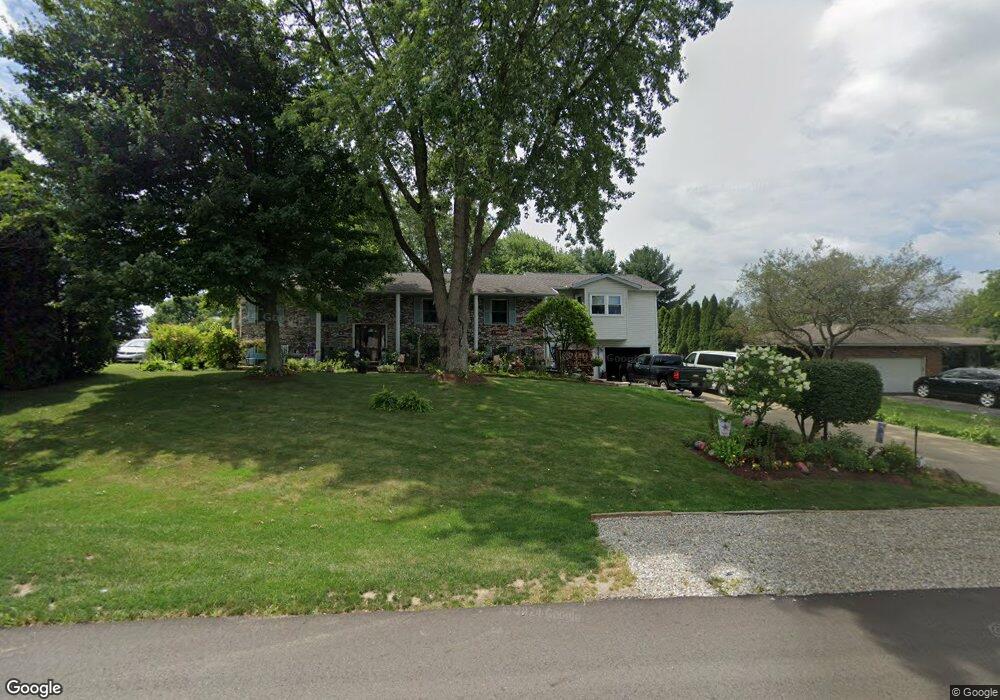
1170 Canyon St NE Uniontown, OH 44685
Estimated Value: $307,341 - $381,000
5
Beds
3
Baths
1,894
Sq Ft
$183/Sq Ft
Est. Value
About This Home
This home is located at 1170 Canyon St NE, Uniontown, OH 44685 and is currently estimated at $345,835, approximately $182 per square foot. 1170 Canyon St NE is a home located in Stark County with nearby schools including Lake Middle/High School and Lake Center Christian School.
Ownership History
Date
Name
Owned For
Owner Type
Purchase Details
Closed on
May 31, 2003
Sold by
Lord Christine and Nidy Christine
Bought by
Nidy Keith and Nidy Christine
Current Estimated Value
Home Financials for this Owner
Home Financials are based on the most recent Mortgage that was taken out on this home.
Original Mortgage
$161,000
Interest Rate
5.88%
Mortgage Type
Purchase Money Mortgage
Create a Home Valuation Report for This Property
The Home Valuation Report is an in-depth analysis detailing your home's value as well as a comparison with similar homes in the area
Home Values in the Area
Average Home Value in this Area
Purchase History
| Date | Buyer | Sale Price | Title Company |
|---|---|---|---|
| Nidy Keith | -- | Quality Title Agency Inc |
Source: Public Records
Mortgage History
| Date | Status | Borrower | Loan Amount |
|---|---|---|---|
| Closed | Nidy Keith | $161,000 |
Source: Public Records
Tax History Compared to Growth
Tax History
| Year | Tax Paid | Tax Assessment Tax Assessment Total Assessment is a certain percentage of the fair market value that is determined by local assessors to be the total taxable value of land and additions on the property. | Land | Improvement |
|---|---|---|---|---|
| 2025 | -- | $106,260 | $21,840 | $84,420 |
| 2024 | -- | $106,260 | $21,840 | $84,420 |
| 2023 | $4,059 | $86,950 | $13,620 | $73,330 |
| 2022 | $4,073 | $86,950 | $13,620 | $73,330 |
| 2021 | $4,126 | $87,090 | $13,620 | $73,470 |
| 2020 | $3,982 | $75,360 | $11,730 | $63,630 |
| 2019 | $3,946 | $75,360 | $11,730 | $63,630 |
| 2018 | $3,947 | $75,360 | $11,730 | $63,630 |
| 2017 | $3,534 | $62,720 | $11,760 | $50,960 |
| 2016 | $3,540 | $62,720 | $11,760 | $50,960 |
| 2015 | $3,537 | $62,720 | $11,760 | $50,960 |
| 2014 | $1,047 | $56,220 | $10,540 | $45,680 |
| 2013 | $1,524 | $56,220 | $10,540 | $45,680 |
Source: Public Records
Map
Nearby Homes
- 1037 Canyon St NE
- 11121 Geib Ave NE
- 747 Grandview Cir
- 786 Fair Vista Cir SW
- 778 Fair Vista Cir SW
- 2084 Hazel St NE
- 531 Gentlebrook Blvd SW
- 550 Woodlands Glen Ave
- 525 Gentlebrook Blvd SW
- 425 Tonawanda Trail SW
- 11900 Geib Ave NE
- 510 Meadow Cir SW Unit 11
- 12055 King Church Ave NW
- 1180 Tessa Trail Unit 1180
- 1975 Eloise Cir NE
- 225 Seneca Trail SW
- Unit 9 Meadow Trail SW Unit 9
- 1771 Midway St NW
- 12201 King Church Ave NW
- 9790 Smithdale Ave NE
- 1190 Canyon St NE
- 1152 Canyon St NE
- 1210 Canyon St NE
- 1134 Canyon St NE
- 1173 Desert St NE
- 1193 Desert St NE
- 1155 Desert St NE
- 1171 Canyon St NE
- 1191 Canyon St NE
- 1153 Canyon St NE
- 1133 Desert St NE
- 1209 Desert St NE
- 1232 Canyon St NE
- 1135 Canyon St NE
- 1211 Canyon St NE
- 1094 Canyon St NE
- 1231 Desert St NE
- 1115 Canyon St NE
- 1233 Canyon St NE
- 1266 Canyon St NE