1170 Hodson Way Anderson, MO 64831
Estimated payment $1,554/month
Highlights
- No HOA
- Living Room
- 1-Story Property
- Home Office
- Tile Flooring
- Central Heating and Cooling System
About This Home
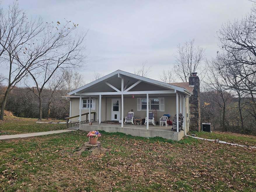
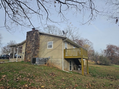
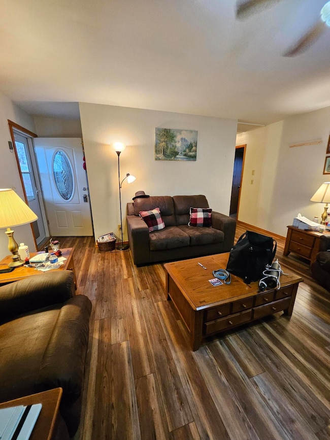
Discover your own peaceful retreat on this 6-acre private parcel nestled in nature. The spacious 4-bedroom, 2-bath home features a walk-out basement, offering flexible space for a recreation room, home office, or guest suite.
Step outside and relax on the inviting front porch, where you can sip your morning coffee or unwind in the evening as wildlife roams across your own acreage. With beautiful, sweeping views and a rustic barn for storage, projects, or hobby farming, this property offers both charm and practical utility.
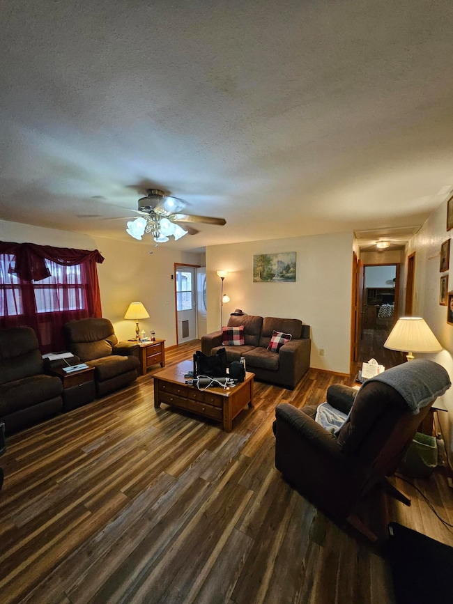
Inside, you'll enjoy a warm and open layout that's perfect for living and entertaining. The large windows frame the natural surroundings, bringing the outdoors in. The home's design creates a sense of calm and connection with the land — truly a place to recharge.
Listing Agent
Century 21 Properties Unlimited License #2010043050 Listed on: 11/21/2025

Home Details
Home Type
- Single Family
Est. Annual Taxes
- $594
Year Built
- Built in 1979
Lot Details
- 5.97 Acre Lot
- Property fronts a county road
- Barbed Wire
Parking
- 2 Car Garage
Home Design
- Lap Siding
Interior Spaces
- 2,364 Sq Ft Home
- 1-Story Property
- Ceiling Fan
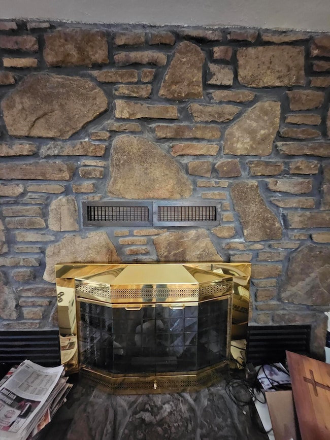
- Wood Burning Fireplace
- Drapes & Rods
- Living Room
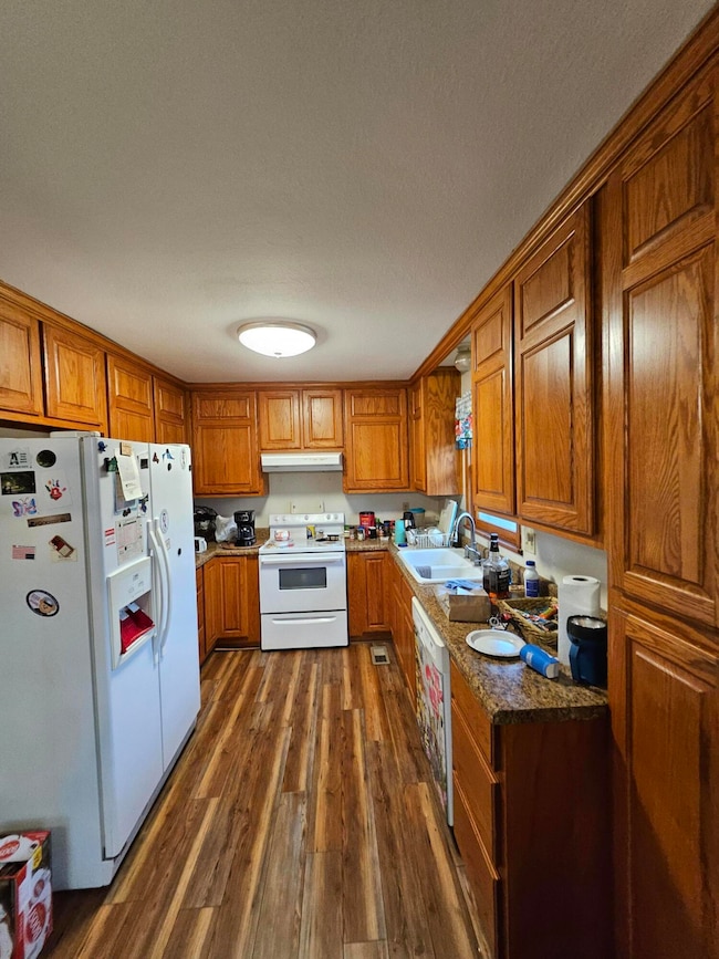
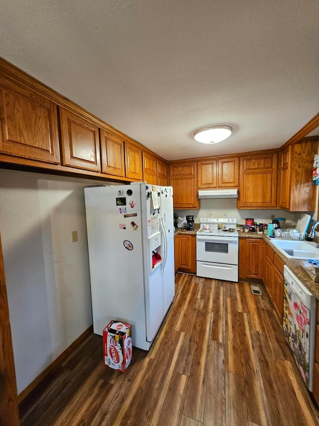
- Combination Kitchen and Dining Room
- Home Office
Kitchen
- Dishwasher
- Disposal
Flooring
- Laminate
- Tile
- Vinyl
Bedrooms and Bathrooms
- 4 Bedrooms
- 2 Full Bathrooms
Finished Basement
- Walk-Out Basement
- Basement Fills Entire Space Under The House
Outdoor Features
- Outbuilding
- Rain Gutters
Schools
- Anderson Elementary School
- Mcdonald County High School
Utilities
- Central Heating and Cooling System
- Private Company Owned Well
- Septic Tank
Community Details
- No Home Owners Association
Listing and Financial Details
- Tax Lot 1
- Assessor Parcel Number 07-1.0-01-000-000-001.001
Map
Home Values in the Area
Average Home Value in this Area
Tax History
| Year | Tax Paid | Tax Assessment Tax Assessment Total Assessment is a certain percentage of the fair market value that is determined by local assessors to be the total taxable value of land and additions on the property. | Land | Improvement |
|---|---|---|---|---|
| 2025 | $548 | $14,930 | $0 | $0 |
| 2024 | $548 | $13,820 | $0 | $0 |
| 2023 | $548 | $13,820 | $0 | $0 |
| 2022 | $548 | $13,820 | $0 | $0 |
| 2021 | $548 | $13,820 | $0 | $0 |
| 2020 | $492 | $12,370 | $0 | $0 |
| 2019 | $492 | $12,370 | $0 | $0 |
| 2018 | $492 | $12,370 | $0 | $0 |
| 2017 | $492 | $12,370 | $0 | $0 |
| 2016 | $470 | $11,810 | $0 | $0 |
| 2015 | -- | $11,810 | $0 | $0 |
| 2014 | -- | $11,810 | $0 | $0 |
Property History
| Date | Event | Price | List to Sale | Price per Sq Ft |
|---|---|---|---|---|
| 11/21/2025 11/21/25 | For Sale | $285,000 | -- | $121 / Sq Ft |
Purchase History
| Date | Type | Sale Price | Title Company |
|---|---|---|---|
| Warranty Deed | -- | None Available | |
| Special Warranty Deed | -- | None Available |
Mortgage History
| Date | Status | Loan Amount | Loan Type |
|---|---|---|---|
| Open | $35,000 | Seller Take Back |
Source: Southern Missouri Regional MLS
MLS Number: 60310432
APN: 07-1.0-01-000-000-001.001
Disclaimer: Certain information contained herein is derived from information provided by parties other than Homes.com. All information provided is deemed reliable, but is not guaranteed to be accurate and should be independently verified.
![]() The data relating to real estate for sale on this web page comes in part from the Internet Data Exchange (IDX) of the Southern Missouri Regional MLS, LLC, Inc. Real estate listings held by Brokerage firms other than [Displaying Broker’s Name] are marked with the IDX logo and detailed information about them includes the name of the listing Brokers. The information being provided is for consumers’ personal, noncommercial use and may not be used for any purpose other than to identify prospective properties consumers may be interested in purchasing. The information being provided is not guaranteed, and all information should be verified by the consumer. Any representation that a web site contains all listings shall only mean that the website contains all listing available to the public through the IDX data feed. There may be other properties offered through a REALTOR® that have not been displayed on this site. © 2025 Southern Missouri Regional MLS, LLC. All rights reserved.
The data relating to real estate for sale on this web page comes in part from the Internet Data Exchange (IDX) of the Southern Missouri Regional MLS, LLC, Inc. Real estate listings held by Brokerage firms other than [Displaying Broker’s Name] are marked with the IDX logo and detailed information about them includes the name of the listing Brokers. The information being provided is for consumers’ personal, noncommercial use and may not be used for any purpose other than to identify prospective properties consumers may be interested in purchasing. The information being provided is not guaranteed, and all information should be verified by the consumer. Any representation that a web site contains all listings shall only mean that the website contains all listing available to the public through the IDX data feed. There may be other properties offered through a REALTOR® that have not been displayed on this site. © 2025 Southern Missouri Regional MLS, LLC. All rights reserved.
SOMO MLS respects the intellectual property rights of others and expects you to do the same. Per the DMCA, SOMO MLS will respond expeditiously to claims of copyright infringement on the Site if submitted to SOMO MLS' s Copyright Agent as described below. Upon receipt of a notice alleging copyright infringement, SOMO MLS will take whatever action it deems appropriate within its sole discretion, including removal of the allegedly infringing materials. If you believe that your intellectual property rights have been violated by SOMO MLS or by a third party who has uploaded materials to the Site, please provide the following information to SOMO MLS' s designated Copyright Agent listed below:
a. A description of the copyrighted work or other intellectual property that you claim has been infringed;
b. A description of where the material that you claim is infringing is located on the Site;
c. An address, telephone number, and e-mail address where SOMO MLS can contact you and, if different, an e-mail address where the alleged infringing party, if not SOMO MLS, can contact you;
d. A statement that you have a good-faith belief that the use is not authorized by the copyright owner or other intellectual property rights owner, by its agent, or by law;
e. A statement by you under penalty of perjury that the information in your notice is accurate and that you are the copyright or intellectual property owner or are authorized to act on the owner's behalf;
f. Your electronic or physical signature. SOMO MLS may request additional information before removing any allegedly infringing material.
In the event SOMO MLS removes the allegedly infringing materials, SOMO MLS will immediately notify the person responsible for posting such materials that SOMO MLS removed or disabled access to the materials. SOMO MLS may also provide the responsible person with your e-mail address so that the person may respond to your allegations. SOMO MLS reserves the right to terminate, limit or suspend any user's access to the Site in the event of repeated infringing activity. If you believe that a user of this Site is a repeat infringer, please follow the above instructions to contact SOMO MLS's Copyright Agent. Please include sufficient information to assist SOMO MLS in determining that the user repeatedly engaged in infringing activity. SOMO MLS registered a designated agent with the Copyright Office pursuant to 17 U.S.C. 512(c). SOMO MLS's designated Copyright Agent is: Jeff Kester 1310 Primrose, Springfield, MO 65804, Phone: 417-883-1226, Email: jeff@gsbor.com
- 1553 Lone Dove Rd
- Tbd Stogdon Hollow Rd
- 188 Lonestar Rd
- 71.8 Klondike Rd
- 1203 State Highway 43
- 1267 Blackfoot Hollow Rd
- 2421 Morrison Loop
- 21501 S 705 Rd
- 70190 E 240 Rd
- 120 Moss Church Rd
- 27501 S 705th Rd
- 99 And 115 Monroe Rd
- 1424 State Highway F
- 000 New Bethel Rd
- 1142 Route F
- 681 & 825 Windwalker Ln
- 1701 New Bethel Rd
- 402 Hickory St
- 220 Sulphur St
- 17254 Highway Cc
- 13786 Polly Ln
- 13943 Penn Ln
- 63173 E 291 Rd Unit 63173
- 404 E 9th St
- 3959 Garrow Blvd
- 2719 Neosho Heights Cir
- 2000 Eagle Dr
- 1306 Marion Dr
- 302 Saint James
- 97 Perth Dr Unit A
- 10 Briscoe Ln
- 845 NW Baker St
- 28 Mckenzie Dr
- 502 Akron St NE
- 201 Tricha Cir SW
- 5 Hawthorn Ln
- 1 Marykirk Ln Unit ID1221821P