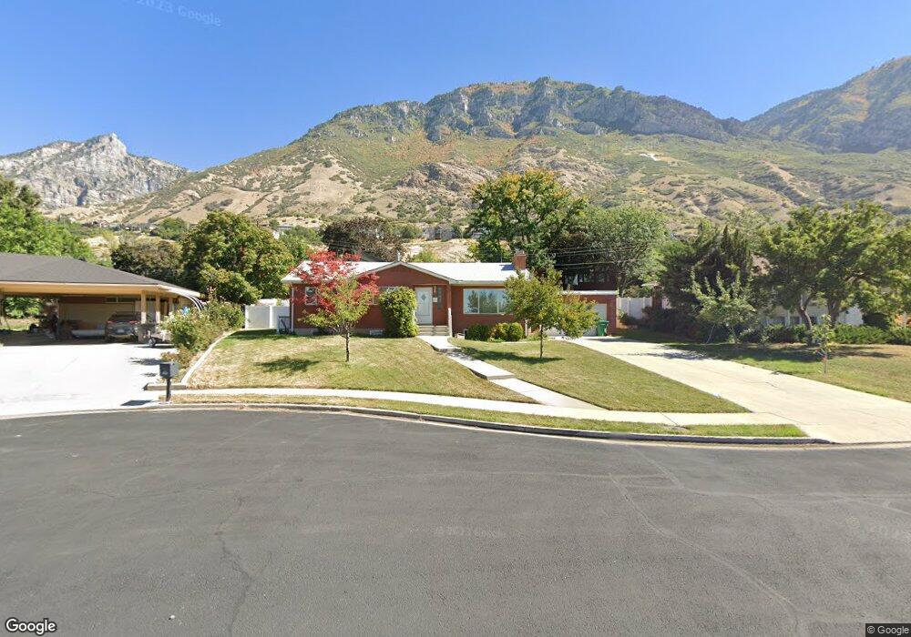
1170 Holly Cir Provo, UT 84604
Wasatch NeighborhoodEstimated Value: $633,000 - $846,000
5
Beds
3
Baths
1,437
Sq Ft
$503/Sq Ft
Est. Value
About This Home
This home is located at 1170 Holly Cir, Provo, UT 84604 and is currently estimated at $722,860, approximately $503 per square foot. 1170 Holly Cir is a home located in Utah County with nearby schools including Wasatch Elementary School, Centennial Middle School, and Timpview High School.
Ownership History
Date
Name
Owned For
Owner Type
Purchase Details
Closed on
Jun 26, 2025
Sold by
David W And Patricia S Cobia Family Trus and Cobia Richard S
Bought by
Jacobson David W and Jacobson Kathy Cobia
Current Estimated Value
Home Financials for this Owner
Home Financials are based on the most recent Mortgage that was taken out on this home.
Original Mortgage
$190,000
Outstanding Balance
$189,676
Interest Rate
6.81%
Mortgage Type
New Conventional
Estimated Equity
$533,184
Purchase Details
Closed on
Sep 13, 2012
Sold by
Cobia David W and Cobia Patricia S
Bought by
Cobia David W and Cobia Patricia S
Purchase Details
Closed on
Jan 26, 1997
Sold by
Wallace Robert M and Wallace Sheri Peterson
Bought by
Cobia David W and Cobia Patricia S
Home Financials for this Owner
Home Financials are based on the most recent Mortgage that was taken out on this home.
Original Mortgage
$75,594
Interest Rate
7.05%
Create a Home Valuation Report for This Property
The Home Valuation Report is an in-depth analysis detailing your home's value as well as a comparison with similar homes in the area
Home Values in the Area
Average Home Value in this Area
Purchase History
| Date | Buyer | Sale Price | Title Company |
|---|---|---|---|
| Jacobson David W | -- | Cottonwood Title | |
| Cobia David W | -- | None Available | |
| Cobia David W | -- | Provo Land Title |
Source: Public Records
Mortgage History
| Date | Status | Borrower | Loan Amount |
|---|---|---|---|
| Open | Jacobson David W | $190,000 | |
| Previous Owner | Cobia David W | $75,594 |
Source: Public Records
Tax History Compared to Growth
Tax History
| Year | Tax Paid | Tax Assessment Tax Assessment Total Assessment is a certain percentage of the fair market value that is determined by local assessors to be the total taxable value of land and additions on the property. | Land | Improvement |
|---|---|---|---|---|
| 2025 | $2,954 | $327,470 | $252,000 | $343,400 |
| 2024 | $2,954 | $290,785 | $0 | $0 |
| 2023 | $2,837 | $275,275 | $0 | $0 |
| 2022 | $2,884 | $282,205 | $0 | $0 |
| 2021 | $2,345 | $400,200 | $196,800 | $203,400 |
| 2020 | $2,230 | $356,800 | $157,400 | $199,400 |
| 2019 | $2,065 | $343,500 | $157,400 | $186,100 |
| 2018 | $1,847 | $311,700 | $149,900 | $161,800 |
| 2017 | $1,730 | $160,435 | $0 | $0 |
| 2016 | $1,704 | $147,290 | $0 | $0 |
| 2015 | $1,648 | $143,990 | $0 | $0 |
| 2014 | $1,526 | $138,930 | $0 | $0 |
Source: Public Records
Map
Nearby Homes
- 1175 N Locust Ln
- 1205 N Old Willow Ln
- 1559 Oak Cliff Dr
- 990 Cedar Ave
- 734 Hillsdale Ln
- 915 E 820 N Unit 24
- 907 E 820 N Unit 11
- 1215 N Terrace Dr
- 617 N Seven Peaks Blvd Unit 10
- 1604 N Willow Ln
- 635 N Ridge Dr Unit 25
- 788 N 700 E Unit 4
- 1754 N 1550 E
- 611 N 700 E Unit 5
- 561 N 700 E
- 1051 E 300 N
- 541 E 500 N Unit 10
- 541 E 500 N Unit 12
- 615 E 420 N
- 948 E 150 N
- 1154 Holly Cir
- 1191 Locust Ln
- 1188 Holly Cir
- 1209 Locust Ln
- 1209 N Locust Ln
- 1311 Apple Ave
- 1115 N Locust Ln
- 1115 Locust Ln
- 1161 Holly Cir
- 1145 Holly Cir
- 1179 Holly Cir
- 1225 Locust Ln
- 1225 N Locust Ln
- 1289 Apple Ave
- 1276 Aspen Ave
- 1192 N Locust Ln
- 1355 Apple Ave
- 1263 Locust Ln
- 1230 Aspen Ave
- 1204 Locust Ln