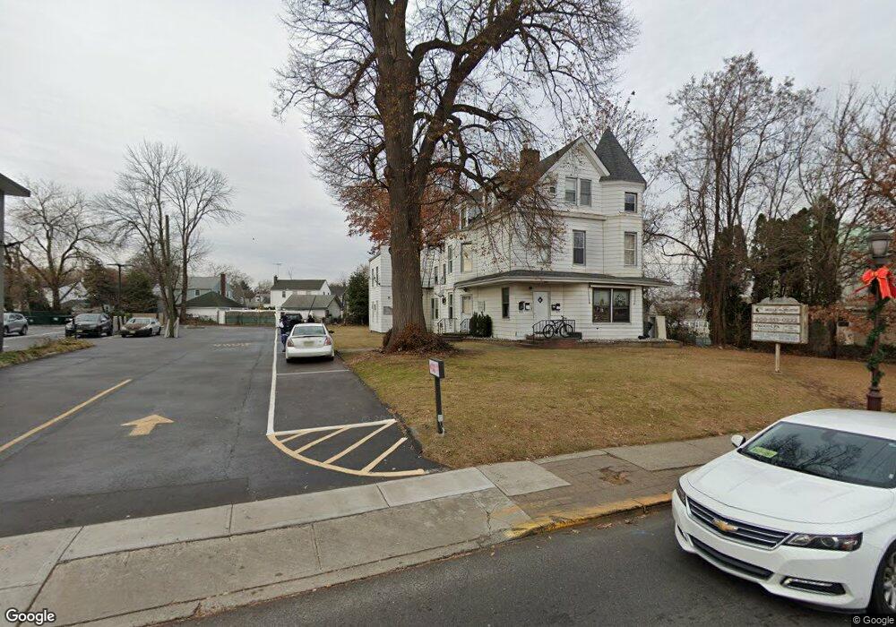
1170 Liberty Ave Hillside, NJ 07205
Estimated Value: $965,831
--
Bed
--
Bath
4,375
Sq Ft
$221/Sq Ft
Est. Value
About This Home
This home is located at 1170 Liberty Ave, Hillside, NJ 07205 and is currently estimated at $965,831, approximately $220 per square foot. 1170 Liberty Ave is a home with nearby schools including Abram P. Morris-Saybrook Elementary School, Hurden Looker School, and Calvin Coolidge Elementary School.
Ownership History
Date
Name
Owned For
Owner Type
Purchase Details
Closed on
Jan 9, 2013
Sold by
1170 Loberty Ave Llc
Bought by
Rsr Two Llc
Current Estimated Value
Home Financials for this Owner
Home Financials are based on the most recent Mortgage that was taken out on this home.
Original Mortgage
$330,000
Outstanding Balance
$229,342
Interest Rate
3.36%
Mortgage Type
Commercial
Estimated Equity
$736,489
Purchase Details
Closed on
Apr 24, 2009
Sold by
Rodrigues Aurelio
Bought by
1170 Liberty Ave Llc
Purchase Details
Closed on
Nov 26, 2007
Sold by
Gross Joseph and Brown Gross Eunice
Bought by
Rodrigues Aurelio
Purchase Details
Closed on
Jun 29, 2001
Sold by
Soloway Lester and Levine Roy
Bought by
Gross Joseph and Gross Eunice
Home Financials for this Owner
Home Financials are based on the most recent Mortgage that was taken out on this home.
Original Mortgage
$303,000
Interest Rate
7.2%
Mortgage Type
FHA
Create a Home Valuation Report for This Property
The Home Valuation Report is an in-depth analysis detailing your home's value as well as a comparison with similar homes in the area
Home Values in the Area
Average Home Value in this Area
Purchase History
| Date | Buyer | Sale Price | Title Company |
|---|---|---|---|
| Rsr Two Llc | $430,000 | None Available | |
| 1170 Liberty Ave Llc | -- | Chicago Title Insurance Co | |
| Rodrigues Aurelio | $440,000 | Chicago Title Insurance Co | |
| Gross Joseph | $270,000 | -- |
Source: Public Records
Mortgage History
| Date | Status | Borrower | Loan Amount |
|---|---|---|---|
| Open | Rsr Two Llc | $330,000 | |
| Previous Owner | Gross Joseph | $303,000 |
Source: Public Records
Tax History Compared to Growth
Tax History
| Year | Tax Paid | Tax Assessment Tax Assessment Total Assessment is a certain percentage of the fair market value that is determined by local assessors to be the total taxable value of land and additions on the property. | Land | Improvement |
|---|---|---|---|---|
| 2025 | $15,895 | $192,600 | $82,000 | $110,600 |
| 2024 | $15,433 | $192,600 | $82,000 | $110,600 |
| 2023 | $15,433 | $192,600 | $82,000 | $110,600 |
| 2022 | $15,291 | $192,600 | $82,000 | $110,600 |
| 2021 | $15,190 | $192,600 | $82,000 | $110,600 |
| 2020 | $15,102 | $192,600 | $82,000 | $110,600 |
| 2019 | $14,809 | $192,600 | $82,000 | $110,600 |
| 2018 | $14,661 | $192,600 | $82,000 | $110,600 |
| 2017 | $14,572 | $192,600 | $82,000 | $110,600 |
| 2016 | $14,555 | $192,600 | $82,000 | $110,600 |
| 2015 | $14,426 | $192,600 | $82,000 | $110,600 |
| 2014 | $14,198 | $192,600 | $82,000 | $110,600 |
Source: Public Records
Map
Nearby Homes
- 292 Crann St
- 314 Fitzpatrick St
- 507 Locust Ave
- 105 Liberty Ct Unit 105
- 257 Herbert Ave
- 393 Harvard Ave
- 1322 Marcella Dr
- 1375 Brookfall Ave
- 1393 Cornell Place
- 220 Silver Ave
- 553 Harvard Ave
- 557 Yale Ave
- 525 Us Highway 22
- 537 Us Highway 22
- 149 Baltimore Ave
- 542 Leo St
- 155 Silver Ave
- 169 Valley View Rd
- 1282 Baker St
- 1290 Baker St
- 510 Mcmichael Place
- 512 Mcmichael Place
- 1156 Liberty Ave
- 508 Mcmichael Place
- 516 Mcmichael Place
- 528 Mcmichael Place
- 1155 Liberty Ave
- 310 Crann St Unit 4
- 310 Crann St Unit 1
- 530 Mcmichael Place
- 1171 Liberty Ave
- 532 Mcmichael Place
- 1151 Liberty Ave
- 306 Crann St
- 293 Crann St
- 511 Mcmichael Place
- 501 Mcmichael Place
- 515 Mcmichael Place
- 507-9 Mcmichael Place
- 507 Mcmichael Place Unit 9