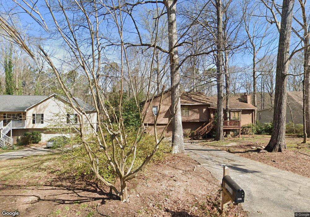
1170 Rolling Green Dr Unit 1 Acworth, GA 30102
Oak Grove NeighborhoodEstimated Value: $317,341 - $355,000
3
Beds
2
Baths
1,464
Sq Ft
$230/Sq Ft
Est. Value
About This Home
This home is located at 1170 Rolling Green Dr Unit 1, Acworth, GA 30102 and is currently estimated at $336,171, approximately $229 per square foot. 1170 Rolling Green Dr Unit 1 is a home located in Cherokee County with nearby schools including Carmel Elementary School, Woodstock Middle School, and Woodstock High School.
Ownership History
Date
Name
Owned For
Owner Type
Purchase Details
Closed on
Feb 27, 1998
Sold by
Irion Toni K
Bought by
Greenhaw Lance M
Current Estimated Value
Home Financials for this Owner
Home Financials are based on the most recent Mortgage that was taken out on this home.
Original Mortgage
$76,145
Outstanding Balance
$13,122
Interest Rate
7.06%
Estimated Equity
$323,049
Create a Home Valuation Report for This Property
The Home Valuation Report is an in-depth analysis detailing your home's value as well as a comparison with similar homes in the area
Home Values in the Area
Average Home Value in this Area
Purchase History
| Date | Buyer | Sale Price | Title Company |
|---|---|---|---|
| Greenhaw Lance M | $78,500 | -- |
Source: Public Records
Mortgage History
| Date | Status | Borrower | Loan Amount |
|---|---|---|---|
| Open | Greenhaw Lance M | $76,145 |
Source: Public Records
Tax History Compared to Growth
Tax History
| Year | Tax Paid | Tax Assessment Tax Assessment Total Assessment is a certain percentage of the fair market value that is determined by local assessors to be the total taxable value of land and additions on the property. | Land | Improvement |
|---|---|---|---|---|
| 2025 | $2,871 | $109,328 | $32,000 | $77,328 |
| 2024 | $2,698 | $103,808 | $26,000 | $77,808 |
| 2023 | $2,699 | $103,848 | $26,000 | $77,848 |
| 2022 | $2,395 | $91,128 | $22,000 | $69,128 |
| 2021 | $2,025 | $71,328 | $18,000 | $53,328 |
| 2020 | $1,744 | $61,368 | $14,000 | $47,368 |
| 2019 | $1,670 | $58,760 | $14,000 | $44,760 |
| 2018 | $1,512 | $52,880 | $11,200 | $41,680 |
| 2017 | $1,492 | $129,500 | $11,200 | $40,600 |
| 2016 | $1,466 | $125,900 | $11,200 | $39,160 |
| 2015 | $1,410 | $119,900 | $11,200 | $36,760 |
| 2014 | $1,316 | $111,700 | $10,400 | $34,280 |
Source: Public Records
Map
Nearby Homes
- 1071 Ferry Creek Way
- 1172 Ridgeside Dr NW
- 1220 Wade Green Cir NW Unit 1
- 4949 Woodland Way NW
- 4815 Wade Green Rd NW Unit 1
- 4815 Wade Green Rd NW
- 5464 Wade Green Rd
- 1033 Justice Ln NW
- 1361 Summit Ln NW
- 5357 Wade Green Rd
- 243 Odell St
- 4955 Day Lily Way NW
- 367 Lake Forest Dr
- 4809 Burlington Ct NW
- 5119 Verbena Dr NW
- 1140 Reading Dr NW
- 805 Silver Mound Cir NW
- 1159 Midland Dr NW
- 611 Ashley Forest Dr NW
- 1178 Rolling Green Dr
- 1154 Rolling Green Dr Unit Above Garage
- 1154 Rolling Green Dr Unit Apartment
- 1154 Rolling Green Dr
- 1186 Rolling Green Dr Unit 1
- 1072 Ferry Creek Way
- 1064 Ferry Creek Way
- 1080 Ferry Creek Way
- 1088 Ferry Creek Way
- 1192 Rolling Green Dr Unit 1
- 1171 Rolling Green Dr
- 1163 Rolling Green Dr
- 1146 Rolling Green Dr
- 1179 Rolling Green Dr Unit 1
- 1098 Ferry Creek Way
- 1155 Rolling Green Dr
- 1200 Rolling Green Dr
- 1187 Rolling Green Dr
- 1056 Ferry Creek Way
- 1056 Ferry Creek Way