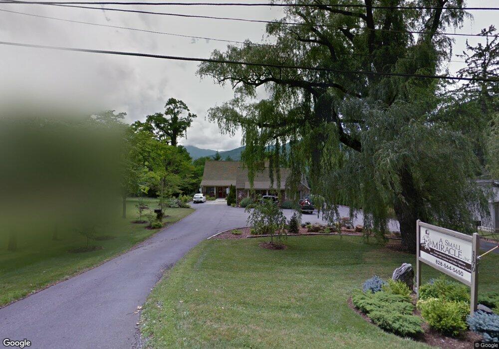
1170 S Main St Waynesville, NC 28786
Estimated Value: $687,162
--
Bed
--
Bath
1,310
Sq Ft
$525/Sq Ft
Est. Value
About This Home
This home is located at 1170 S Main St, Waynesville, NC 28786 and is currently estimated at $687,162, approximately $524 per square foot. 1170 S Main St is a home located in Haywood County with nearby schools including Hazelwood Elementary, Waynesville Middle, and Tuscola High.
Ownership History
Date
Name
Owned For
Owner Type
Purchase Details
Closed on
Oct 12, 2011
Sold by
Atlas Nc I Spe Llc
Bought by
Three Dogs Properties Llc
Current Estimated Value
Home Financials for this Owner
Home Financials are based on the most recent Mortgage that was taken out on this home.
Original Mortgage
$232,000
Outstanding Balance
$159,449
Interest Rate
4.26%
Mortgage Type
Future Advance Clause Open End Mortgage
Estimated Equity
$527,713
Purchase Details
Closed on
Jun 21, 2011
Sold by
Gardner David B and Gardner Michelle Gilbert
Bought by
Branch Banking & Trust Company
Create a Home Valuation Report for This Property
The Home Valuation Report is an in-depth analysis detailing your home's value as well as a comparison with similar homes in the area
Home Values in the Area
Average Home Value in this Area
Purchase History
| Date | Buyer | Sale Price | Title Company |
|---|---|---|---|
| Three Dogs Properties Llc | $290,000 | None Available | |
| Branch Banking & Trust Company | $256,000 | None Available |
Source: Public Records
Mortgage History
| Date | Status | Borrower | Loan Amount |
|---|---|---|---|
| Open | Three Dogs Properties Llc | $232,000 |
Source: Public Records
Tax History Compared to Growth
Tax History
| Year | Tax Paid | Tax Assessment Tax Assessment Total Assessment is a certain percentage of the fair market value that is determined by local assessors to be the total taxable value of land and additions on the property. | Land | Improvement |
|---|---|---|---|---|
| 2025 | -- | $437,600 | $84,400 | $353,200 |
| 2024 | $2,407 | $437,600 | $84,400 | $353,200 |
| 2023 | $2,407 | $437,600 | $84,400 | $353,200 |
| 2022 | $2,341 | $437,600 | $84,400 | $353,200 |
| 2021 | $2,341 | $437,600 | $84,400 | $353,200 |
| 2020 | $2,094 | $358,000 | $84,000 | $274,000 |
| 2019 | $2,094 | $358,000 | $84,000 | $274,000 |
| 2018 | $2,094 | $358,000 | $84,000 | $274,000 |
| 2017 | $2,094 | $358,000 | $0 | $0 |
| 2016 | $2,252 | $397,800 | $0 | $0 |
| 2015 | $2,252 | $397,800 | $0 | $0 |
| 2014 | $2,153 | $397,800 | $0 | $0 |
Source: Public Records
Map
Nearby Homes
- 56 Kentucky Ave
- 271 Brook St
- 684 Woodfield Dr
- TBD Adams St Unit 1
- 165 Country Club Dr
- 1193 Brown Ave
- 142 Country Club Dr
- 152 Springview Dr
- 72 Raines Blvd
- 419 Country Club Dr
- 55 Scates St
- 34 Bowden Ln
- 71 Auburn Park Dr
- 49 Robinson St
- 154 Lowell St
- 00 Longview Dr Unit 6
- 00 Longview Dr Unit 7
- 00 Longview Dr Unit 8
- 251 Westwood Cir
- 261 Westwood Cir
- 1200 S Main St
- 84 Mississippi Ave
- 104 Mississippi Ave
- 104 Mississippi Ave Unit 106
- 106 Mississippi Ave
- 76 Mississippi Ave
- 60 Mississippi Ave
- 101 Mississippi Ave
- 115 Mississippi Ave
- 1153 S Main St
- 85 Mississippi Ave
- 48 Mississippi Ave
- 211 Virginia Ave
- 209 Virginia Ave
- 1193 S Main St
- 197 Virginia Ave
- 195 Virginia Ave
- 51 Mississippi Ave
- 1102 S Main St
- 1147 S Main St