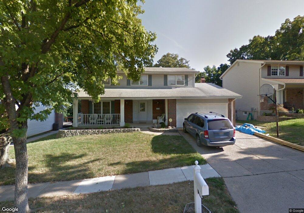
1170 Summit Meadows Dr Fenton, MO 63026
Estimated Value: $369,000 - $382,000
4
Beds
3
Baths
1,948
Sq Ft
$192/Sq Ft
Est. Value
About This Home
This home is located at 1170 Summit Meadows Dr, Fenton, MO 63026 and is currently estimated at $374,457, approximately $192 per square foot. 1170 Summit Meadows Dr is a home located in St. Louis County with nearby schools including Bowles Elementary School, Rockwood South Middle School, and Rockwood Summit Senior High School.
Ownership History
Date
Name
Owned For
Owner Type
Purchase Details
Closed on
Jul 21, 2003
Sold by
Povich David Thomas and Povich Denise Marie
Bought by
Adams James E and Adams Kimberly A
Current Estimated Value
Home Financials for this Owner
Home Financials are based on the most recent Mortgage that was taken out on this home.
Original Mortgage
$88,150
Outstanding Balance
$37,279
Interest Rate
5.19%
Mortgage Type
Unknown
Estimated Equity
$337,178
Purchase Details
Closed on
May 15, 1999
Sold by
Povich David T and Povich Denise M
Bought by
Povich David Thomas and Povich Denise Marie
Purchase Details
Closed on
Aug 15, 1997
Sold by
Norman Brent B and Norman Patricia A
Bought by
Povich David T and Povich Denise M
Home Financials for this Owner
Home Financials are based on the most recent Mortgage that was taken out on this home.
Original Mortgage
$85,000
Interest Rate
7.6%
Create a Home Valuation Report for This Property
The Home Valuation Report is an in-depth analysis detailing your home's value as well as a comparison with similar homes in the area
Home Values in the Area
Average Home Value in this Area
Purchase History
| Date | Buyer | Sale Price | Title Company |
|---|---|---|---|
| Adams James E | $174,900 | -- | |
| Povich David Thomas | -- | -- | |
| Povich David T | -- | First American Title Ins Co |
Source: Public Records
Mortgage History
| Date | Status | Borrower | Loan Amount |
|---|---|---|---|
| Open | Adams James E | $88,150 | |
| Previous Owner | Povich David T | $85,000 |
Source: Public Records
Tax History Compared to Growth
Tax History
| Year | Tax Paid | Tax Assessment Tax Assessment Total Assessment is a certain percentage of the fair market value that is determined by local assessors to be the total taxable value of land and additions on the property. | Land | Improvement |
|---|---|---|---|---|
| 2025 | $4,227 | $62,990 | $22,310 | $40,680 |
| 2024 | $4,227 | $56,690 | $18,160 | $38,530 |
| 2023 | $4,223 | $56,690 | $18,160 | $38,530 |
| 2022 | $3,840 | $48,010 | $18,160 | $29,850 |
| 2021 | $3,810 | $48,010 | $18,160 | $29,850 |
| 2020 | $3,744 | $45,350 | $15,560 | $29,790 |
| 2019 | $3,755 | $45,350 | $15,560 | $29,790 |
| 2018 | $3,565 | $41,300 | $11,700 | $29,600 |
| 2017 | $3,537 | $41,300 | $11,700 | $29,600 |
| 2016 | $3,019 | $35,560 | $9,800 | $25,760 |
| 2015 | $2,957 | $35,560 | $9,800 | $25,760 |
| 2014 | $3,055 | $35,830 | $6,060 | $29,770 |
Source: Public Records
Map
Nearby Homes
- 1248 Green Knoll Dr
- 678 Greensleeves Dr
- 683 Greenholme Ct
- 260 Trueman Heritage Pkwy
- 818 Mary Lee Ct
- The Westhampton Plan at Bowles Crossing
- The Rockport Plan at Bowles Crossing
- The Richmond Plan at Bowles Crossing
- The Liberty Plan at Bowles Crossing
- The Brookfield Plan at Bowles Crossing
- The Arlington Plan at Bowles Crossing
- 82 May Valley Ln
- 811 Mary Lee Ct
- The Westhampton Plan at Hawkins Point
- The Rockport Plan at Hawkins Point
- The Brookfield Plan at Hawkins Point
- The Liberty Plan at Hawkins Point
- The Arlington Plan at Hawkins Point
- 1009 Remington Oaks Ct
- 800 Mary Lee Ct
- 1166 Summit Meadows Dr
- 1174 Summit Meadows Dr
- 1171 Summit Meadows Dr
- 1175 Summit Meadows Dr
- 1241 Green Knoll Dr
- 1167 Summit Meadows Dr
- 1243 Green Knoll Dr
- 1179 Summit Meadows Dr
- 1245 Green Knoll Dr
- 1247 Green Knoll Dr
- 1239 Green Knoll Dr
- 1163 Summit Meadows Dr
- 569 Summit View Ct
- 1237 Green Knoll Dr
- 1186 Summit Meadows Dr
- 565 Summit View Ct
- 1251 Green Knoll Dr
- 1159 Summit Meadows Dr
- 557 Summit View Dr
- 573 Summit View Ct