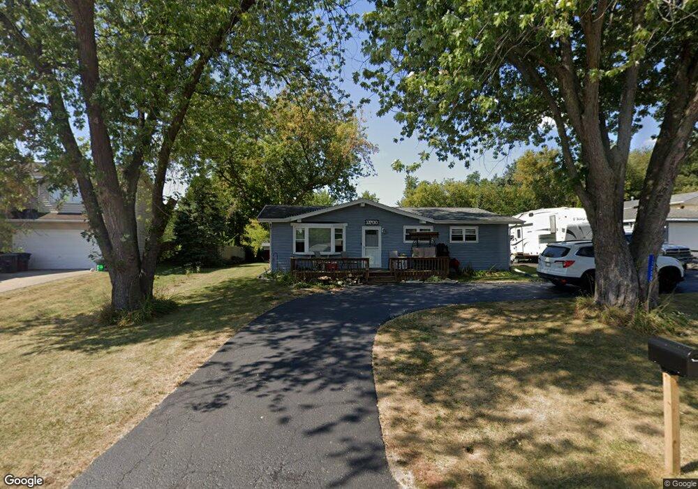
11700 223rd Ave Bristol, WI 53104
Estimated Value: $273,751 - $316,000
3
Beds
1
Bath
960
Sq Ft
$313/Sq Ft
Est. Value
About This Home
This home is located at 11700 223rd Ave, Bristol, WI 53104 and is currently estimated at $300,188, approximately $312 per square foot. 11700 223rd Ave is a home located in Kenosha County with nearby schools including Salem Elementary School and Central High School.
Ownership History
Date
Name
Owned For
Owner Type
Purchase Details
Closed on
Feb 24, 2021
Sold by
Cox Christopher
Bought by
Cox Christopher T and Cox Autumn R
Current Estimated Value
Purchase Details
Closed on
Apr 30, 2012
Sold by
Pawlowski Gary
Bought by
Cox Christopher
Home Financials for this Owner
Home Financials are based on the most recent Mortgage that was taken out on this home.
Original Mortgage
$126,199
Outstanding Balance
$88,334
Interest Rate
4.12%
Mortgage Type
FHA
Estimated Equity
$211,854
Create a Home Valuation Report for This Property
The Home Valuation Report is an in-depth analysis detailing your home's value as well as a comparison with similar homes in the area
Home Values in the Area
Average Home Value in this Area
Purchase History
| Date | Buyer | Sale Price | Title Company |
|---|---|---|---|
| Cox Christopher T | -- | None Available | |
| Cox Christopher | $129,500 | Blackhawk Title Services |
Source: Public Records
Mortgage History
| Date | Status | Borrower | Loan Amount |
|---|---|---|---|
| Open | Cox Christopher | $126,199 |
Source: Public Records
Tax History Compared to Growth
Tax History
| Year | Tax Paid | Tax Assessment Tax Assessment Total Assessment is a certain percentage of the fair market value that is determined by local assessors to be the total taxable value of land and additions on the property. | Land | Improvement |
|---|---|---|---|---|
| 2024 | $3,060 | $211,000 | $74,800 | $136,200 |
| 2023 | $2,938 | $211,000 | $74,800 | $136,200 |
| 2022 | $3,383 | $202,100 | $72,000 | $130,100 |
| 2021 | $3,425 | $202,100 | $72,000 | $130,100 |
| 2020 | $3,303 | $176,900 | $68,100 | $108,800 |
| 2019 | $3,193 | $176,900 | $68,100 | $108,800 |
| 2018 | $2,972 | $151,900 | $64,900 | $87,000 |
| 2017 | $3,197 | $151,900 | $64,900 | $87,000 |
| 2016 | $3,130 | $139,600 | $61,000 | $78,600 |
| 2015 | $2,778 | $139,600 | $61,000 | $78,600 |
| 2014 | -- | $130,600 | $56,700 | $73,900 |
Source: Public Records
Map
Nearby Homes
- 11621 224th Ave
- 21605 117th St
- 11736 231st Ct
- 11706 214th Ave
- 22727 126th St
- 12725 228th Ave
- 11207 234th Ct
- 12290 233rd Ave
- 12789 228th Ave
- Lt35 128th St
- 23607 125th St
- 12719 234th Ave
- 198 Bridgewood Dr
- 188 Oakwood Dr
- 11825 243rd Ave
- 324 Elmwood Ln
- 24412 118th St
- 394 Birchwood Dr
- 602 Anita Ave
- 425 Joren Trail
- 11710 223rd Ave
- 11711 223rd Ave
- 22223 117th St
- 11720 223rd Ave
- 11717 223rd Ave
- 22216 117th St
- 22215 117th St
- 11723 223rd Ave
- 11703 224th Ave
- 11635 224th Ave
- 11711 224th Ave
- 22211 117th St
- 11632 223rd Ave
- 11735 223rd Ave
- 11725 224th Ave
- 22207 117th St
- 11619 223rd Ave
- 11616 223rd Ave
- 22202 117th St
- 22205 117th St