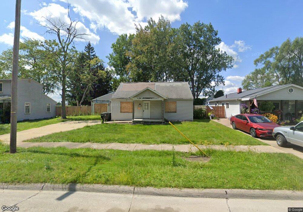
11700 Cornell St Taylor, MI 48180
Estimated Value: $140,472 - $164,000
Studio
--
Bath
1,060
Sq Ft
$145/Sq Ft
Est. Value
About This Home
This home is located at 11700 Cornell St, Taylor, MI 48180 and is currently estimated at $154,118, approximately $145 per square foot. 11700 Cornell St is a home located in Wayne County with nearby schools including Bernice Mcdowell Elementary School, Robert J. West Middle School, and Taylor High School.
Ownership History
Date
Name
Owned For
Owner Type
Purchase Details
Closed on
Sep 23, 2024
Sold by
New Hope Community Development Non Profi
Bought by
New Hope Community Development Non Profit Hou and Arp Partner Properties Llc
Current Estimated Value
Purchase Details
Closed on
Jul 5, 2024
Sold by
Federal Home Loan Mortgage Corporation
Bought by
New Hope Community Development Non-Profit Hou
Purchase Details
Closed on
Dec 15, 2022
Sold by
Wayne County
Bought by
Federal Home Loan Mortgage Corporation
Create a Home Valuation Report for This Property
The Home Valuation Report is an in-depth analysis detailing your home's value as well as a comparison with similar homes in the area
Home Values in the Area
Average Home Value in this Area
Purchase History
| Date | Buyer | Sale Price | Title Company |
|---|---|---|---|
| New Hope Community Development Non Profit Hou | -- | None Listed On Document | |
| New Hope Community Development Non-Profit Hou | $30,000 | None Listed On Document | |
| New Hope Community Development Non-Profit Hou | $30,000 | None Listed On Document | |
| Federal Home Loan Mortgage Corporation | $91,784 | -- |
Source: Public Records
Tax History
| Year | Tax Paid | Tax Assessment Tax Assessment Total Assessment is a certain percentage of the fair market value that is determined by local assessors to be the total taxable value of land and additions on the property. | Land | Improvement |
|---|---|---|---|---|
| 2025 | $4,520 | $73,800 | $0 | $0 |
| 2024 | $5,826 | $65,200 | $0 | $0 |
| 2023 | $1,909 | $54,800 | $0 | $0 |
| 2022 | $1,341 | $46,900 | $0 | $0 |
| 2021 | $1,532 | $43,000 | $0 | $0 |
| 2020 | $1,510 | $38,500 | $0 | $0 |
| 2019 | $204,568 | $35,500 | $0 | $0 |
| 2018 | $1,152 | $27,100 | $0 | $0 |
| 2017 | $1,955 | $26,800 | $0 | $0 |
| 2016 | $2,092 | $26,100 | $0 | $0 |
| 2015 | $3,060 | $30,600 | $0 | $0 |
| 2013 | $3,080 | $31,800 | $0 | $0 |
| 2012 | $1,173 | $31,400 | $13,200 | $18,200 |
Source: Public Records
Map
Nearby Homes
- 11725 Cornell St
- 11724 Syracuse St
- 23722 Brest
- Telegraph Telegraph Rd
- 11078 Pine St
- 000 Pine Lot A St
- 000 Beechdaly
- 000 Pine Lot B St
- 12312 Cornell St
- 23970 Northstone Village Dr Unit 6
- 11801 Moran St
- 10769 Birch St
- 23062 Northline Rd
- 22675 Goddard Rd
- 11187 Pardee Rd
- 10935 Westlake St
- 6445 Pardee Rd
- 22155 Maplelawn Ave
- 25112 Madden St
- 22901 Woodcreek Dr Unit 61
- 11684 Cornell St
- 11708 Cornell St
- 11676 Cornell St
- 11724 Cornell St
- 11668 Cornell St Unit Bldg-Unit
- 11668 Cornell St
- 11732 Cornell St
- 11691 Cornell St
- 11709 Cornell St
- 11660 Cornell St
- 11740 Cornell St
- 11737 Cornell St
- 11667 Cornell St
- 11748 Cornell St
- 11756 Cornell St
- 11751 Cornell St
- 11650 Cornell St
- 11647 Westpoint St
- 11700 Syracuse St
- 11692 Syracuse St
Your Personal Tour Guide
Ask me questions while you tour the home.