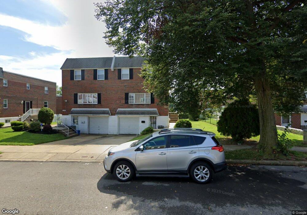
11703 Lockart Rd Philadelphia, PA 19116
Somerton NeighborhoodEstimated Value: $409,372 - $463,000
4
Beds
1
Bath
1,764
Sq Ft
$244/Sq Ft
Est. Value
About This Home
This home is located at 11703 Lockart Rd, Philadelphia, PA 19116 and is currently estimated at $430,093, approximately $243 per square foot. 11703 Lockart Rd is a home with nearby schools including Watson Comly School, CCA Baldi Middle School, and George Washington High School.
Ownership History
Date
Name
Owned For
Owner Type
Purchase Details
Closed on
Oct 23, 2003
Sold by
Abramowitz David and Abramowitz Sheryl Kane
Bought by
Mathews Suja Roby
Current Estimated Value
Home Financials for this Owner
Home Financials are based on the most recent Mortgage that was taken out on this home.
Original Mortgage
$153,600
Outstanding Balance
$70,792
Interest Rate
6.03%
Mortgage Type
Purchase Money Mortgage
Estimated Equity
$359,301
Create a Home Valuation Report for This Property
The Home Valuation Report is an in-depth analysis detailing your home's value as well as a comparison with similar homes in the area
Home Values in the Area
Average Home Value in this Area
Purchase History
| Date | Buyer | Sale Price | Title Company |
|---|---|---|---|
| Mathews Suja Roby | $192,000 | Fidelity National Title Insu |
Source: Public Records
Mortgage History
| Date | Status | Borrower | Loan Amount |
|---|---|---|---|
| Open | Mathews Suja Roby | $153,600 | |
| Closed | Mathews Suja Roby | $28,800 |
Source: Public Records
Tax History Compared to Growth
Tax History
| Year | Tax Paid | Tax Assessment Tax Assessment Total Assessment is a certain percentage of the fair market value that is determined by local assessors to be the total taxable value of land and additions on the property. | Land | Improvement |
|---|---|---|---|---|
| 2025 | $4,296 | $386,600 | $77,320 | $309,280 |
| 2024 | $4,296 | $386,600 | $77,320 | $309,280 |
| 2023 | $4,296 | $306,900 | $61,380 | $245,520 |
| 2022 | $3,666 | $261,900 | $61,380 | $200,520 |
| 2021 | $3,548 | $0 | $0 | $0 |
| 2020 | $3,548 | $0 | $0 | $0 |
| 2019 | $3,341 | $0 | $0 | $0 |
| 2018 | $3,064 | $0 | $0 | $0 |
| 2017 | $3,064 | $0 | $0 | $0 |
| 2016 | $2,644 | $0 | $0 | $0 |
| 2015 | $2,531 | $0 | $0 | $0 |
| 2014 | -- | $218,900 | $86,505 | $132,395 |
| 2012 | -- | $28,288 | $3,506 | $24,782 |
Source: Public Records
Map
Nearby Homes
- 11722 Audubon Ave
- 166 Rennard St
- 11169 Hendrix St
- 11992 Lockart Rd
- 11715 Jeanes St
- 11961 Dumont Rd
- 11243 Jeanes Place
- 11114 Ridgeway St
- 11116 Audubon Ave
- 11022 Ferndale St
- 133 Gardner St
- 11990 Rennard St
- 509 Larkspur St
- 11012 Audubon Ave
- 358 Tomlinson Terrace
- 526 Larkspur St
- 10922 Lockart Rd
- 3175 Kathy Ln
- 375 Avon St
- 290 Byberry Rd Unit 18
- 11705 Lockart Rd
- 11707 Lockart Rd
- 11701 Lockart Rd
- 11709 Lockart Rd
- 11704 Audubon Ave
- 11706 Audubon Ave
- 11708 Audubon Ave
- 11702 Audubon Ave
- 11700 Audubon Ave
- 11710 Audubon Ave
- 11704 Lockart Rd
- 11711 Lockart Rd
- 11702 Lockart Rd
- 11706 Lockart Rd
- 11700 Lockart Rd
- 11713 Lockart Rd
- 11708 Lockart Rd
- 11712 Audubon Ave
- 11714 Audubon Ave
- 11715 Lockart Rd