Estimated Value: $84,000 - $172,000
3
Beds
2
Baths
1,200
Sq Ft
$106/Sq Ft
Est. Value
About This Home
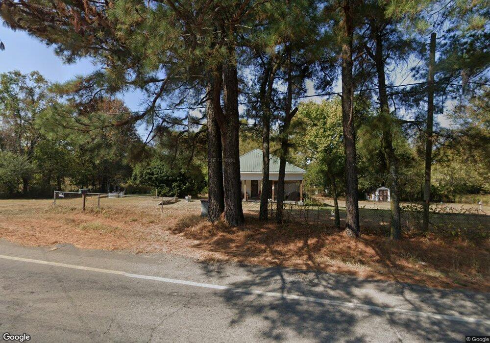
This home is located at 11705 N Highway 23, Ozark, AR 72949 and is currently estimated at $127,463, approximately $106 per square foot. 11705 N Highway 23 is a home located in Franklin County with nearby schools including Elgin B. Milton Elementary School, Ozark Kindergarten School, and Ozark Upper Elementary School.
Ownership History
Date
Name
Owned For
Owner Type
Purchase Details
Closed on
Feb 27, 2023
Sold by
John R Fisk Enterprises Llc
Bought by
Foster Daniel Lee
Current Estimated Value
Purchase Details
Closed on
Jun 8, 2020
Sold by
Cantrell Bryan and Turner Mary Beti
Bought by
John R Fisk Enterprises Llc
Purchase Details
Closed on
Feb 12, 2018
Sold by
Diffee Freda A and Taylor David
Bought by
Cantrell Bryan and Turner Mary Beth
Purchase Details
Closed on
Apr 18, 2002
Bought by
Diffee and Diffee
Purchase Details
Closed on
Jul 1, 1984
Bought by
Patterson and Diffe
Purchase Details
Closed on
Nov 1, 1982
Bought by
Pressgrove and Patterson
Create a Home Valuation Report for This Property
The Home Valuation Report is an in-depth analysis detailing your home's value as well as a comparison with similar homes in the area
Home Values in the Area
Average Home Value in this Area
Purchase History
| Date | Buyer | Sale Price | Title Company |
|---|---|---|---|
| Foster Daniel Lee | $161,500 | Pope County Title | |
| John R Fisk Enterprises Llc | $15,000 | None Available | |
| Cantrell Bryan | $11,000 | None Available | |
| Diffee | -- | -- | |
| Patterson | $32,000 | -- | |
| Pressgrove | -- | -- |
Source: Public Records
Tax History Compared to Growth
Tax History
| Year | Tax Paid | Tax Assessment Tax Assessment Total Assessment is a certain percentage of the fair market value that is determined by local assessors to be the total taxable value of land and additions on the property. | Land | Improvement |
|---|---|---|---|---|
| 2024 | $41 | $3,620 | $1,600 | $2,020 |
| 2023 | $41 | $3,620 | $1,600 | $2,020 |
| 2022 | $213 | $3,620 | $1,600 | $2,020 |
| 2021 | $173 | $3,620 | $1,600 | $2,020 |
| 2020 | $380 | $7,930 | $1,600 | $6,330 |
| 2019 | $420 | $7,930 | $1,600 | $6,330 |
| 2018 | $70 | $7,930 | $1,600 | $6,330 |
| 2017 | $24 | $7,930 | $1,600 | $6,330 |
| 2016 | $7 | $7,459 | $1,453 | $6,006 |
| 2015 | -- | $7,104 | $1,384 | $5,720 |
| 2014 | -- | $7,120 | $1,400 | $5,720 |
| 2013 | -- | $7,120 | $1,400 | $5,720 |
Source: Public Records
Map
Nearby Homes
- 1146 Wire Rd
- TBD Commercial St
- tbd Hwy 64 & Adams R Tbd
- 1214 Cataberry Run Rd
- 1832 Lone Oak Rd
- 719 Norma Ln
- 4 acres Rollin Hills Ln
- 14441 Lower Jethro Rd
- 13542 Watalula Rd
- 19940 Arkansas 23
- 1900 Arkansas 23
- 1501 N 18th St
- 15061 N Highway 23
- 1201 N 18th St
- 3636 Highway 352
- 1912 Johnson St
- 617 N 35th St
- 4205 Woodland W
- 4150 Low Gap Rd
- 1208 Helberg Ln
- 11705 Arkansas 23
- 327 Highway 352
- 409 Highway 352
- 11504 Somerset Ln
- 11433 Somerset Ln
- 519 Highway 352
- 11401 Somerset Ln
- 11328 N Highway 23
- 621 Highway 352
- 806 Highway 352
- 632 Duncan Rd
- 739 Highway 352
- 718 Duncan Rd
- 824 Duncan Rd
- 829 Duncan Rd
- 522 Wire Rd
- 12522 N Highway 23
- 1026 Duncan Rd
- 1008 Highway 352