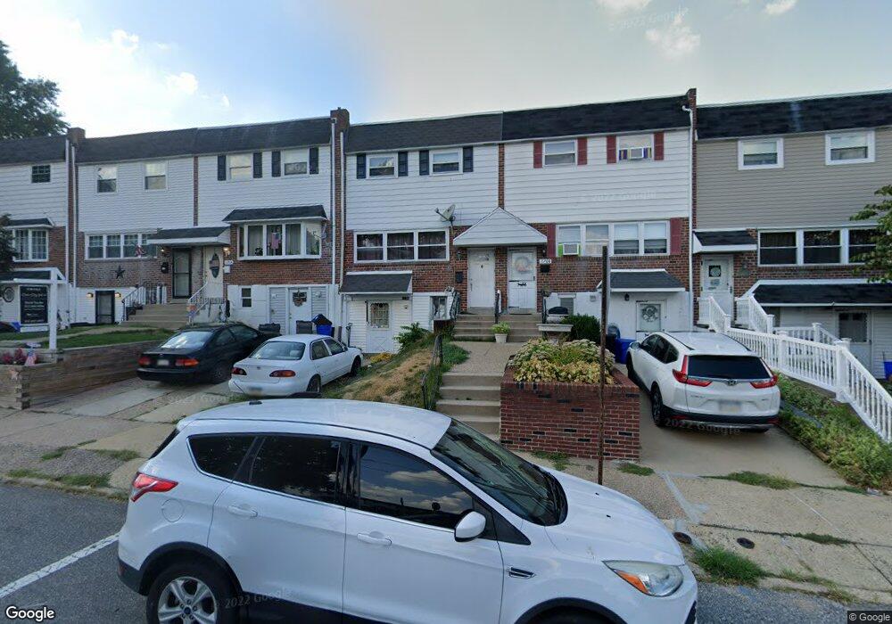
11708 Corry Rd Philadelphia, PA 19154
Parkwood NeighborhoodEstimated Value: $309,000 - $355,000
3
Beds
2
Baths
1,400
Sq Ft
$235/Sq Ft
Est. Value
About This Home
This home is located at 11708 Corry Rd, Philadelphia, PA 19154 and is currently estimated at $329,458, approximately $235 per square foot. 11708 Corry Rd is a home located in Philadelphia County with nearby schools including A. L. Fitzpatrick School, George Washington High School, and St. Martha Elementary School.
Ownership History
Date
Name
Owned For
Owner Type
Purchase Details
Closed on
Apr 29, 2009
Sold by
Sims Barbara J and Ditaranto Diane M
Bought by
Murphy Regina R
Current Estimated Value
Home Financials for this Owner
Home Financials are based on the most recent Mortgage that was taken out on this home.
Original Mortgage
$181,649
Outstanding Balance
$115,079
Interest Rate
4.9%
Mortgage Type
FHA
Estimated Equity
$214,379
Purchase Details
Closed on
Jun 9, 2005
Sold by
Lutter Mary A
Bought by
Lutter Mary A and Sims Barbara J
Create a Home Valuation Report for This Property
The Home Valuation Report is an in-depth analysis detailing your home's value as well as a comparison with similar homes in the area
Home Values in the Area
Average Home Value in this Area
Purchase History
| Date | Buyer | Sale Price | Title Company |
|---|---|---|---|
| Murphy Regina R | $185,000 | None Available | |
| Lutter Mary A | -- | -- |
Source: Public Records
Mortgage History
| Date | Status | Borrower | Loan Amount |
|---|---|---|---|
| Open | Murphy Regina R | $181,649 |
Source: Public Records
Tax History Compared to Growth
Tax History
| Year | Tax Paid | Tax Assessment Tax Assessment Total Assessment is a certain percentage of the fair market value that is determined by local assessors to be the total taxable value of land and additions on the property. | Land | Improvement |
|---|---|---|---|---|
| 2025 | $3,550 | $309,000 | $61,800 | $247,200 |
| 2024 | $3,550 | $309,000 | $61,800 | $247,200 |
| 2023 | $3,550 | $253,600 | $50,720 | $202,880 |
| 2022 | $2,954 | $253,600 | $50,720 | $202,880 |
| 2021 | $2,954 | $0 | $0 | $0 |
| 2020 | $2,954 | $0 | $0 | $0 |
| 2019 | $2,781 | $0 | $0 | $0 |
| 2018 | $2,608 | $0 | $0 | $0 |
| 2017 | $2,608 | $0 | $0 | $0 |
| 2016 | $2,608 | $0 | $0 | $0 |
| 2015 | $2,496 | $0 | $0 | $0 |
| 2014 | -- | $186,300 | $59,540 | $126,760 |
| 2012 | -- | $21,856 | $3,778 | $18,078 |
Source: Public Records
Map
Nearby Homes
- 3125 Comly Rd
- 3115 Comly Rd
- 3045 Comly Rd
- 11830 Basile Rd
- 11819 Academy Rd Unit A6/19B
- 3511 Newberry Rd
- 11745 Colman Rd
- 12011 Legion St
- 3242 Rhett Rd
- 3674 Salina Rd
- 12018 Academy Rd
- 12025 Waldemire Dr
- 3349 Fairdale Rd
- 3302 Fairdale Rd
- 12125 Barbary Rd
- 12135 Academy Rd Unit 10
- 12011 Templeton Dr
- 3327 Morning Glory Rd
- 12135 00 Academy Rd Unit 78
- 11935 Covert Rd
- 11710 Corry Rd
- 11706 Corry Rd
- 11712 Corry Rd
- 11704 Corry Rd
- 11702 Corry Rd
- 11700 Corry Rd
- 11714 Corry Rd
- 11716 Corry Rd
- 11703 Lanett Rd
- 11718 Corry Rd
- 11701 Lanett Rd
- 3121 Derry Rd
- 11711 Lanett Rd
- 11707 Lanett Rd
- 11705 Lanett Rd
- 11713 Lanett Rd
- 11709 Lanett Rd
- 11720 Corry Rd
- 3166 Derry Rd
- 3119 Derry Rd