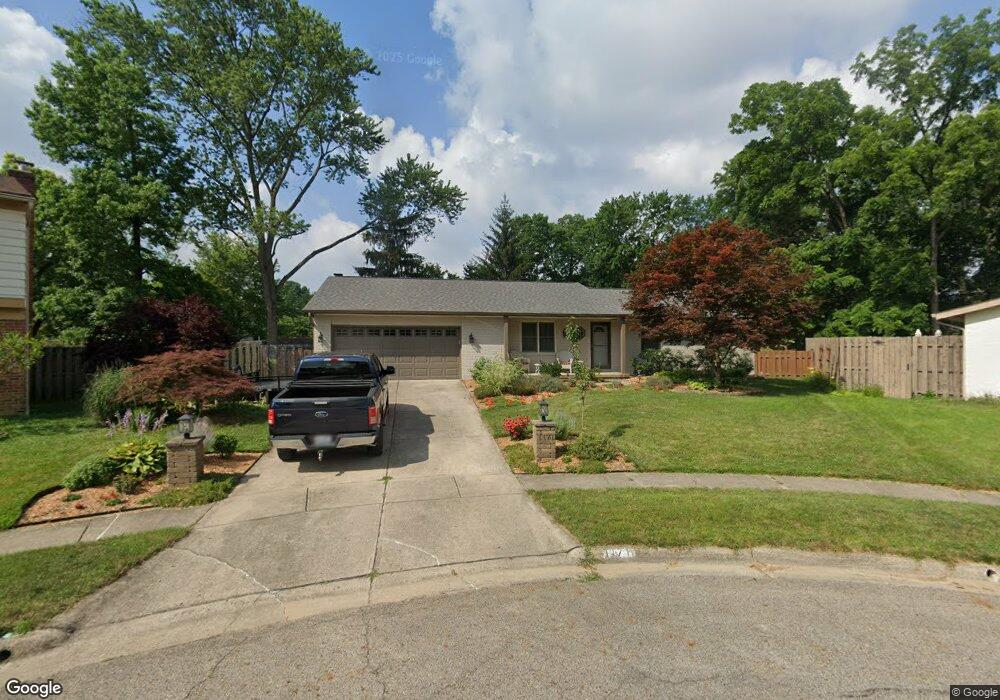
1171 Rockport Ln Columbus, OH 43235
The Gables NeighborhoodEstimated Value: $429,031 - $480,000
3
Beds
2
Baths
1,826
Sq Ft
$252/Sq Ft
Est. Value
About This Home
This home is located at 1171 Rockport Ln, Columbus, OH 43235 and is currently estimated at $460,258, approximately $252 per square foot. 1171 Rockport Ln is a home located in Franklin County with nearby schools including Gables Elementary School, Ridgeview Middle School, and Centennial High School.
Ownership History
Date
Name
Owned For
Owner Type
Purchase Details
Closed on
Jun 7, 2011
Sold by
Korte Joel P and The Joel P Korte Trust
Bought by
North Justin A and North Kristi L
Current Estimated Value
Home Financials for this Owner
Home Financials are based on the most recent Mortgage that was taken out on this home.
Original Mortgage
$164,000
Outstanding Balance
$113,270
Interest Rate
4.67%
Mortgage Type
New Conventional
Estimated Equity
$346,988
Purchase Details
Closed on
Nov 13, 2006
Sold by
Korte Joel P
Bought by
Korte Joel P and Joel P Korte Trust
Purchase Details
Closed on
Mar 8, 2005
Sold by
Korte John D and Korte Sue A
Bought by
Korte Joel P
Purchase Details
Closed on
Sep 8, 1995
Sold by
Sellers Marjorie
Bought by
Korte John D and Korte Sue Anne
Purchase Details
Closed on
Dec 1, 1977
Create a Home Valuation Report for This Property
The Home Valuation Report is an in-depth analysis detailing your home's value as well as a comparison with similar homes in the area
Home Values in the Area
Average Home Value in this Area
Purchase History
| Date | Buyer | Sale Price | Title Company |
|---|---|---|---|
| North Justin A | $205,000 | Real Living | |
| Korte Joel P | -- | Attorney | |
| Korte Joel P | $215,000 | -- | |
| Korte John D | $158,000 | -- | |
| -- | $71,900 | -- |
Source: Public Records
Mortgage History
| Date | Status | Borrower | Loan Amount |
|---|---|---|---|
| Open | North Justin A | $164,000 |
Source: Public Records
Tax History Compared to Growth
Tax History
| Year | Tax Paid | Tax Assessment Tax Assessment Total Assessment is a certain percentage of the fair market value that is determined by local assessors to be the total taxable value of land and additions on the property. | Land | Improvement |
|---|---|---|---|---|
| 2024 | $5,491 | $122,360 | $51,450 | $70,910 |
| 2023 | $5,421 | $122,360 | $51,450 | $70,910 |
| 2022 | $4,166 | $80,330 | $19,710 | $60,620 |
| 2021 | $4,174 | $80,330 | $19,710 | $60,620 |
| 2020 | $4,179 | $80,330 | $19,710 | $60,620 |
| 2019 | $3,873 | $63,840 | $15,750 | $48,090 |
| 2018 | $4,172 | $63,840 | $15,750 | $48,090 |
| 2017 | $4,402 | $63,840 | $15,750 | $48,090 |
| 2016 | $4,934 | $74,490 | $18,800 | $55,690 |
| 2015 | $4,479 | $74,490 | $18,800 | $55,690 |
| 2014 | $4,490 | $74,490 | $18,800 | $55,690 |
| 2013 | $2,109 | $70,910 | $17,885 | $53,025 |
Source: Public Records
Map
Nearby Homes
- 1213 Nantucket Ave
- 1246 Southport Dr
- 5363 Godown Rd
- 1161 Bethel Rd Unit 103/104
- 5016 Postlewaite Rd Unit 5016
- 1147 Langland Dr
- 928 Linworth Village Dr
- 1540 Slade Ave Unit 303
- 895 Linworth Village Dr
- 1505 Eastmeadow Place
- 5773 Middlefield Dr
- 5111 Portland St
- 1558 Denbigh Dr
- 5854 Aqua Bay Dr Unit 5854
- 5111 Schuylkill St
- 1683 Saint Albans Ct Unit 22-83
- 1466 Weybridge Rd
- 5936 Aqua Bay Dr
- 5938 Aqua Bay Dr
- 5881 Rocky Rill Rd
- 1174 Rockport Ln
- 1165 Rockport Ln
- 1184 Nantucket Ave
- 1215 Southport Dr
- 1219 Southport Dr
- 1204 Nantucket Ave
- 1170 Nantucket Ave
- 1157 Rockport Ln
- 1216 Nantucket Ave
- 1162 Nantucket Ave
- 1168 Rockport Ln
- 1218 Southport Dr
- 1227 Southport Dr
- 5278 Heathmoor St
- 1224 Nantucket Ave
- 1150 Nantucket Ave
- 1150 Rockport Ln
- 1141 Rockport Ln
- 1201 Nantucket Ave
- 1167 Nantucket Ave