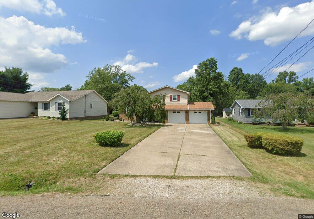
1171 Stark Dr Alliance, OH 44601
Estimated Value: $169,000 - $181,000
3
Beds
2
Baths
1,070
Sq Ft
$165/Sq Ft
Est. Value
About This Home
This home is located at 1171 Stark Dr, Alliance, OH 44601 and is currently estimated at $176,529, approximately $164 per square foot. 1171 Stark Dr is a home located in Stark County with nearby schools including Alliance Elementary School at Rockhill, Alliance Intermediate School at Northside, and Alliance Middle School.
Ownership History
Date
Name
Owned For
Owner Type
Purchase Details
Closed on
Feb 11, 2019
Sold by
Nicholson Jackson Lesa and Nicholson Leslie H
Bought by
Nicholson Jackson Lesa and Nicholson Leslie H
Current Estimated Value
Purchase Details
Closed on
Jan 9, 2019
Sold by
Jackson Lesa Nicholson
Bought by
Nicholson Leslie H and Nicholson Laron A
Purchase Details
Closed on
Dec 28, 2018
Sold by
Nicholson Jackson Lesa
Bought by
Nicholson Leslie H and Nicholson Laron A
Purchase Details
Closed on
May 25, 2011
Sold by
Nicholson Leslie and Nicholson Sandra
Bought by
Nicholson Jackson Lesa
Purchase Details
Closed on
Nov 12, 1996
Sold by
Streza Ann M
Bought by
Nicholson Leslie and Nicholson Sandra
Home Financials for this Owner
Home Financials are based on the most recent Mortgage that was taken out on this home.
Original Mortgage
$53,600
Interest Rate
8.26%
Mortgage Type
New Conventional
Create a Home Valuation Report for This Property
The Home Valuation Report is an in-depth analysis detailing your home's value as well as a comparison with similar homes in the area
Home Values in the Area
Average Home Value in this Area
Purchase History
| Date | Buyer | Sale Price | Title Company |
|---|---|---|---|
| Nicholson Jackson Lesa | -- | None Available | |
| Nicholson Leslie H | $32,900 | None Available | |
| Nicholson Leslie H | $32,900 | None Available | |
| Nicholson Jackson Lesa | -- | Attorney | |
| Nicholson Leslie | $80,000 | -- |
Source: Public Records
Mortgage History
| Date | Status | Borrower | Loan Amount |
|---|---|---|---|
| Previous Owner | Nicholson Leslie | $53,600 |
Source: Public Records
Tax History
| Year | Tax Paid | Tax Assessment Tax Assessment Total Assessment is a certain percentage of the fair market value that is determined by local assessors to be the total taxable value of land and additions on the property. | Land | Improvement |
|---|---|---|---|---|
| 2025 | -- | $46,730 | $15,820 | $30,910 |
| 2024 | -- | $46,730 | $15,820 | $30,910 |
| 2023 | $1,550 | $37,670 | $11,450 | $26,220 |
| 2022 | $935 | $37,670 | $11,450 | $26,220 |
| 2021 | $921 | $37,670 | $11,450 | $26,220 |
| 2020 | $1,533 | $34,480 | $9,980 | $24,500 |
| 2019 | $290 | $34,480 | $9,980 | $24,500 |
Source: Public Records
Map
Nearby Homes
- 2580 Edgewood Ave
- 0 Federal Ave
- 2630 Blenheim Ave
- 1016 Roseland Rd
- 1718 Fernwood Blvd
- 2635 Blenheim Ave
- 1534 Fernwood Blvd
- 864 W College Rd
- 856 Birchwood Dr
- 1539 Parkway Blvd
- 2625 Belleflower Dr
- 3018 Blenheim Ave
- 2420 Beechwood Ave
- 2705 Shunk Ave
- 1310 Overlook Dr
- 720 Vincent Blvd
- 1156 Parkside Dr
- 1601 Raywood Rd
- 0 Winchester St
- 0 Winchester St Unit 5162877
- 1165 Stark Dr
- 1185 Stark Dr
- 1155 Stark Dr
- 1166 Stark Dr
- 1186 Stark Dr
- 2315 Eastern Ave
- 2151 Crestview Ave
- 2151 Crestview Ave
- 2151 Crestview Ave
- 2151 Crestview Ave
- 1133 Stark Dr
- 2329 Eastern Ave
- 2354 Crestview Ave
- 2345 Eastern Ave
- 2341 Crestview Ave
- 1090 Stark Dr
- 2370 Crestview Ave
- 2096 Crestview Ave
- 2361 Crestview Ave
- 2154 Center Ave
Your Personal Tour Guide
Ask me questions while you tour the home.