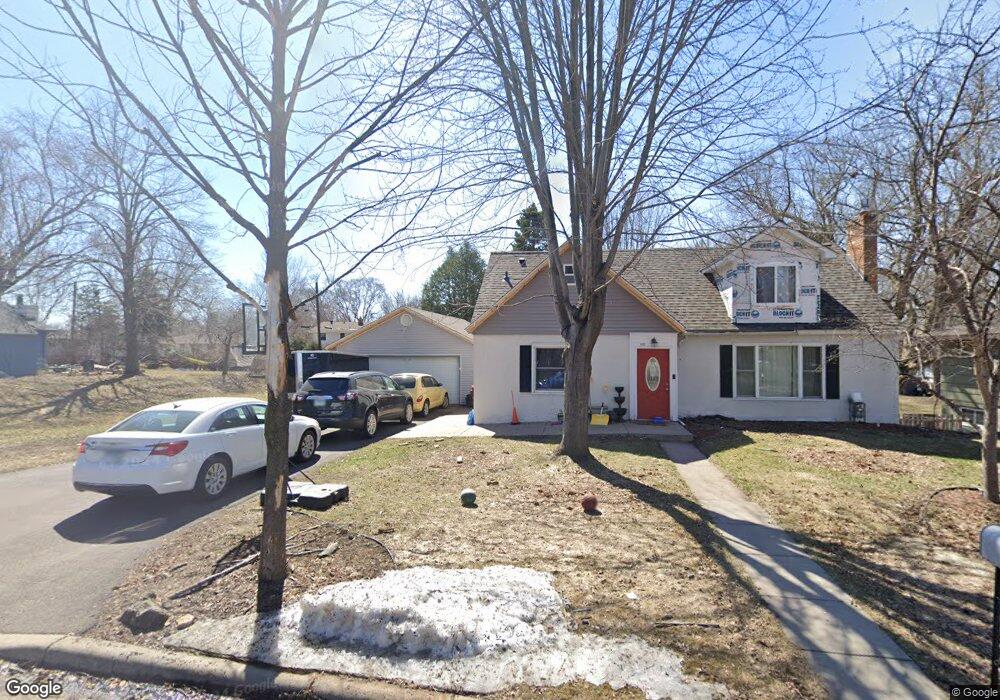
1172 Lealand Rd E Maplewood, MN 55109
Sherwood Glen NeighborhoodEstimated Value: $313,000 - $372,000
4
Beds
2
Baths
628
Sq Ft
$545/Sq Ft
Est. Value
About This Home
This home is located at 1172 Lealand Rd E, Maplewood, MN 55109 and is currently estimated at $342,542, approximately $545 per square foot. 1172 Lealand Rd E is a home located in Ramsey County with nearby schools including Weaver Elementary School, John Glenn Middle School, and St Jerome Elementary School.
Ownership History
Date
Name
Owned For
Owner Type
Purchase Details
Closed on
Oct 26, 2018
Sold by
Sarrack Jacob D
Bought by
Phillips Erin Victor and Phillips Joan Marie
Current Estimated Value
Home Financials for this Owner
Home Financials are based on the most recent Mortgage that was taken out on this home.
Original Mortgage
$250,000
Outstanding Balance
$219,375
Interest Rate
4.7%
Estimated Equity
$123,167
Purchase Details
Closed on
May 22, 2008
Sold by
Hsbc Mortgage Services Inc
Bought by
Sarrack Jacob D and Oconnell Sara
Purchase Details
Closed on
Aug 24, 2001
Sold by
Herzog Paul F and Herzog Barbara J
Bought by
Saxby Calvin M and Saxby Cheryl L
Create a Home Valuation Report for This Property
The Home Valuation Report is an in-depth analysis detailing your home's value as well as a comparison with similar homes in the area
Home Values in the Area
Average Home Value in this Area
Purchase History
| Date | Buyer | Sale Price | Title Company |
|---|---|---|---|
| Phillips Erin Victor | $250,000 | Titlesmart Inc | |
| Sarrack Jacob D | $183,750 | -- | |
| Saxby Calvin M | $154,900 | -- |
Source: Public Records
Mortgage History
| Date | Status | Borrower | Loan Amount |
|---|---|---|---|
| Open | Phillips Erin Victor | $250,000 |
Source: Public Records
Tax History
| Year | Tax Paid | Tax Assessment Tax Assessment Total Assessment is a certain percentage of the fair market value that is determined by local assessors to be the total taxable value of land and additions on the property. | Land | Improvement |
|---|---|---|---|---|
| 2025 | $4,864 | $322,400 | $74,800 | $247,600 |
| 2023 | $4,864 | $314,700 | $74,800 | $239,900 |
| 2022 | $4,292 | $298,500 | $74,800 | $223,700 |
| 2021 | $4,070 | $262,300 | $74,800 | $187,500 |
| 2020 | $4,232 | $252,000 | $74,800 | $177,200 |
| 2019 | $3,422 | $244,800 | $74,800 | $170,000 |
| 2018 | $3,498 | $198,500 | $74,800 | $123,700 |
| 2017 | $3,630 | $196,800 | $74,800 | $122,000 |
| 2016 | $3,652 | $0 | $0 | $0 |
| 2015 | $3,714 | $195,300 | $68,600 | $126,700 |
| 2014 | $3,132 | $0 | $0 | $0 |
Source: Public Records
Map
Nearby Homes
- 1200 Leland Rd E
- 1290 Belmont Ln E
- 2022 English St
- 1461 Grandview Ave E
- 2125 Hazelwood St
- 1800 Edward St
- 1855 Birmingham St
- 1745 Duluth St
- 2420 Hazelwood St
- 2457 Dianna Ln
- 1984 Prosperity Rd
- 1255 County Road C E
- TBD Eldridge Ave E
- 822 Palm Ct
- 2180 N English St
- 1894 Maryknoll Ave N
- 2655 N Barclay St
- 1633 Etna St
- 2053 Edgerton St
- 1612 County Road C E
- 1172 Lealand Rd E
- 1170 Lealand Rd E
- 1190 Lealand Rd
- 1190 Lealand Rd E
- 1160 Lealand Rd E
- 1160 Lealand Rd E
- xxxx Leland Rd E
- 1171 Lealand Rd E
- 1187 Junction Ave
- 1194 Lealand Rd
- 1194 Leland Rd E
- 1194 Lealand Rd E
- 1187 Lealand Rd
- 1161 Lealand Rd
- 1152 Lealand Rd E
- 1195 Junction Ave
- 1200 Lealand Rd
- 1197 Lealand Rd
- 1197 Lealand Rd E
- 1200 Lealand Rd E
Your Personal Tour Guide
Ask me questions while you tour the home.