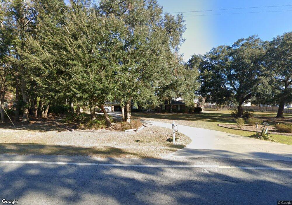
1172 Talmadge Rd Allenhurst, GA 31301
Estimated Value: $236,000 - $270,704
3
Beds
2
Baths
1,870
Sq Ft
$137/Sq Ft
Est. Value
About This Home
This home is located at 1172 Talmadge Rd, Allenhurst, GA 31301 and is currently estimated at $256,676, approximately $137 per square foot. 1172 Talmadge Rd is a home located in Liberty County with nearby schools including Frank Long Elementary School, Lewis Frasier Middle School, and Liberty County High School.
Ownership History
Date
Name
Owned For
Owner Type
Purchase Details
Closed on
May 15, 2014
Sold by
Cooke Richard W
Bought by
Cooke Richard W and Cooke Glenda M
Current Estimated Value
Purchase Details
Closed on
Nov 12, 1997
Sold by
Cooke Richard W
Bought by
Cooke Richard W and Cooke Gloria
Purchase Details
Closed on
Dec 22, 1986
Sold by
Norman Daniel E
Bought by
Cooke Richard W
Purchase Details
Closed on
Jul 19, 1985
Bought by
Norman Daniel E
Create a Home Valuation Report for This Property
The Home Valuation Report is an in-depth analysis detailing your home's value as well as a comparison with similar homes in the area
Home Values in the Area
Average Home Value in this Area
Purchase History
| Date | Buyer | Sale Price | Title Company |
|---|---|---|---|
| Cooke Richard W | -- | -- | |
| Cooke Richard W | $9,800 | -- | |
| Cooke Richard W | $12,000 | -- | |
| Norman Daniel E | $3,000 | -- |
Source: Public Records
Tax History Compared to Growth
Tax History
| Year | Tax Paid | Tax Assessment Tax Assessment Total Assessment is a certain percentage of the fair market value that is determined by local assessors to be the total taxable value of land and additions on the property. | Land | Improvement |
|---|---|---|---|---|
| 2024 | $2,199 | $78,338 | $2,160 | $76,178 |
| 2023 | $2,199 | $69,280 | $2,160 | $67,120 |
| 2022 | $1,480 | $57,006 | $2,160 | $54,846 |
| 2021 | $1,278 | $52,081 | $2,160 | $49,921 |
| 2020 | $1,862 | $52,988 | $2,160 | $50,828 |
| 2019 | $1,825 | $53,270 | $2,160 | $51,110 |
| 2018 | $1,836 | $54,176 | $2,160 | $52,016 |
| 2017 | $2,335 | $55,036 | $2,160 | $52,876 |
| 2016 | $1,769 | $55,897 | $2,160 | $53,737 |
| 2015 | $1,873 | $55,897 | $2,160 | $53,737 |
| 2014 | $1,873 | $58,762 | $2,160 | $56,602 |
| 2013 | -- | $55,893 | $2,160 | $53,733 |
Source: Public Records
Map
Nearby Homes
- 1343 Talmadge Rd
- 169 Wellspring Terrace
- 801 Talmadge Rd
- 304 Thompson Rd
- 311 Strickland Rd
- 151 Hunters Branch Dr
- 1801 Dunlevie Rd
- 1105 Buckhead Loop
- 619 Mccumber Dr
- 480 Mccumber Dr
- 129 Vandiver Rd
- 127 Busbee Rd
- 1600 Dunlevie Rd Unit 16
- 1600 Dunlevie Rd Unit 50
- 166 Stephanie Dr
- 194 Mccumber Dr
- 128 Nashview Trail
- 40 Red Blossom Ct
- 0 & 1 Denise Ln
- 1170 Talmadge Rd
- 83 Morningside Dr
- 99 Morningside Dr
- 113 Morningside Dr
- 1163 Talmadge Rd
- 127 Morningside Dr
- 49 Morningside Dr
- 143 Morningside Dr
- 33 Morningside Dr
- 830 Wilder Rd
- 19 Morningside Dr
- 43 Henry Herbert Rd
- 173 Morningside Dr
- 1070 Talmadge Rd
- 9 Morningside Dr
- 1083 Talmadge Rd
- 1213 Talmadge Rd
- 769 Wilder Rd
- 1281 Talmadge Rd
- 1213 Talmadge Rd