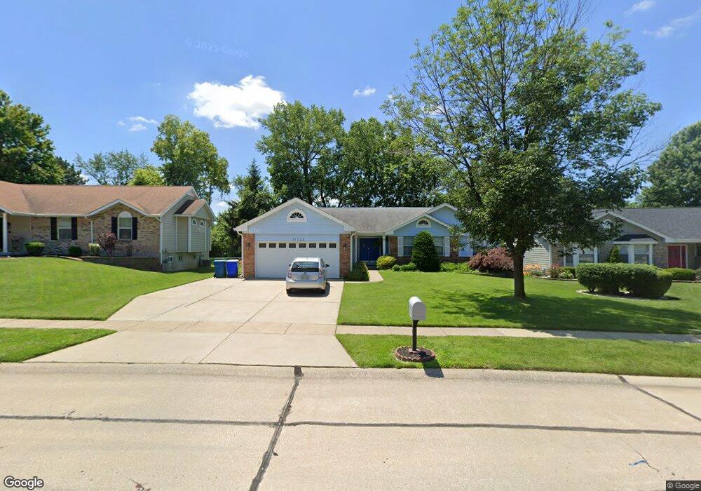
11724 Avery Ln Bridgeton, MO 63044
Estimated Value: $309,000 - $371,000
3
Beds
3
Baths
1,916
Sq Ft
$183/Sq Ft
Est. Value
About This Home
This home is located at 11724 Avery Ln, Bridgeton, MO 63044 and is currently estimated at $349,806, approximately $182 per square foot. 11724 Avery Ln is a home located in St. Louis County with nearby schools including Robert Drummond Elementary School, Holman Middle School, and Pattonville High School.
Ownership History
Date
Name
Owned For
Owner Type
Purchase Details
Closed on
Aug 27, 2002
Sold by
Hutcherson Michael G and Hutcherson Sherree L
Bought by
Swope Steven C and Swope Catherine C
Current Estimated Value
Home Financials for this Owner
Home Financials are based on the most recent Mortgage that was taken out on this home.
Original Mortgage
$162,000
Outstanding Balance
$67,863
Interest Rate
6.41%
Estimated Equity
$281,943
Create a Home Valuation Report for This Property
The Home Valuation Report is an in-depth analysis detailing your home's value as well as a comparison with similar homes in the area
Home Values in the Area
Average Home Value in this Area
Purchase History
| Date | Buyer | Sale Price | Title Company |
|---|---|---|---|
| Swope Steven C | $187,000 | -- |
Source: Public Records
Mortgage History
| Date | Status | Borrower | Loan Amount |
|---|---|---|---|
| Open | Swope Steven C | $162,000 |
Source: Public Records
Tax History
| Year | Tax Paid | Tax Assessment Tax Assessment Total Assessment is a certain percentage of the fair market value that is determined by local assessors to be the total taxable value of land and additions on the property. | Land | Improvement |
|---|---|---|---|---|
| 2025 | $4,890 | $64,690 | $11,130 | $53,560 |
| 2024 | $4,890 | $60,440 | $9,410 | $51,030 |
| 2023 | $4,909 | $60,440 | $9,410 | $51,030 |
| 2022 | $4,529 | $50,310 | $7,710 | $42,600 |
| 2021 | $4,469 | $50,310 | $7,710 | $42,600 |
| 2020 | $4,029 | $44,000 | $6,840 | $37,160 |
| 2019 | $4,039 | $44,000 | $6,840 | $37,160 |
| 2018 | $3,447 | $34,600 | $5,130 | $29,470 |
| 2017 | $3,394 | $34,600 | $5,130 | $29,470 |
| 2016 | $3,204 | $32,100 | $2,740 | $29,360 |
Source: Public Records
Map
Nearby Homes
- 11660 Mark Twain Ln
- 11533 Old Saint Charles Rd
- 3701 Harmann Estates Dr
- 4110 Fee Rd
- 3705 Dax Ln
- 11815 Archerton Dr
- 3623 Bridgeton Valley Cir
- 3746 Fee Rd
- 11424 Burgess Ave
- 4105 Banks Rd
- 3303 Haas Ave
- 3202 Denmark Dr Unit C
- 4229 Carrollton Dr Unit A
- 11239 Terry Ave
- 11658 Jaquetta Ct
- 3122 Carnaby Ln Unit A
- 3724 Adie Rd
- 3716 Adie Rd
- 3137 Roger Williams Dr Unit C
- 3107 Garnette Dr Unit A7
Your Personal Tour Guide
Ask me questions while you tour the home.