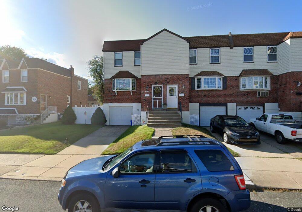
11734 Millbrook Rd Philadelphia, PA 19154
Northeast Philadelphia NeighborhoodEstimated Value: $327,000 - $353,000
4
Beds
1
Bath
1,528
Sq Ft
$222/Sq Ft
Est. Value
About This Home
This home is located at 11734 Millbrook Rd, Philadelphia, PA 19154 and is currently estimated at $339,965, approximately $222 per square foot. 11734 Millbrook Rd is a home located in Philadelphia County with nearby schools including A. L. Fitzpatrick School, George Washington High School, and Our Lady of Calvary School.
Ownership History
Date
Name
Owned For
Owner Type
Purchase Details
Closed on
Jun 17, 2003
Sold by
Duxbury Dale L
Bought by
Duxbury Dale R
Current Estimated Value
Home Financials for this Owner
Home Financials are based on the most recent Mortgage that was taken out on this home.
Original Mortgage
$99,200
Interest Rate
5.45%
Mortgage Type
Purchase Money Mortgage
Purchase Details
Closed on
Aug 20, 1999
Sold by
Duxbury Dale L and Duxbury Juanita M
Bought by
Duxbury Dale L
Create a Home Valuation Report for This Property
The Home Valuation Report is an in-depth analysis detailing your home's value as well as a comparison with similar homes in the area
Home Values in the Area
Average Home Value in this Area
Purchase History
| Date | Buyer | Sale Price | Title Company |
|---|---|---|---|
| Duxbury Dale R | $124,000 | -- | |
| Duxbury Dale L | -- | -- |
Source: Public Records
Mortgage History
| Date | Status | Borrower | Loan Amount |
|---|---|---|---|
| Closed | Duxbury Dale R | $99,200 |
Source: Public Records
Tax History Compared to Growth
Tax History
| Year | Tax Paid | Tax Assessment Tax Assessment Total Assessment is a certain percentage of the fair market value that is determined by local assessors to be the total taxable value of land and additions on the property. | Land | Improvement |
|---|---|---|---|---|
| 2026 | $3,561 | $312,500 | $62,500 | $250,000 |
| 2025 | $3,561 | $312,500 | $62,500 | $250,000 |
| 2024 | $3,561 | $312,500 | $62,500 | $250,000 |
| 2023 | $3,561 | $254,400 | $50,880 | $203,520 |
| 2022 | $2,224 | $209,400 | $50,880 | $158,520 |
| 2021 | $2,854 | $0 | $0 | $0 |
| 2020 | $2,854 | $0 | $0 | $0 |
| 2019 | $2,688 | $0 | $0 | $0 |
| 2018 | $2,660 | $0 | $0 | $0 |
| 2017 | $2,660 | $0 | $0 | $0 |
| 2016 | $2,240 | $0 | $0 | $0 |
| 2015 | $2,144 | $0 | $0 | $0 |
| 2014 | -- | $190,000 | $87,094 | $102,906 |
| 2012 | -- | $24,064 | $4,747 | $19,317 |
Source: Public Records
Map
Nearby Homes
- 4210 Greenmount Rd
- 4208 Greenmount Rd
- 11913 Millbrook Rd
- 4207 Fairdale Rd
- 4374 Deerpath Ln
- 238 Dimarco Dr
- 221 Ridgefield Rd
- 11125 Kirby Dr
- 1236 Whittier Ave
- 12008 Elmore Rd
- 1126 Evelyn Ave
- 3803 Dorchester Rd
- 3798 Chalfont Dr
- 11935 Covert Rd
- 3850 Woodhaven Rd Unit 302
- 3850 00 Woodhaven Rd Unit 907
- 4161 Orchard Ln
- 10932 Templeton Dr
- 12011 Templeton Dr
- 10935 Carey Plaza
- 11736 Millbrook Rd
- 11730 Millbrook Rd
- 11738 Millbrook Rd
- 11732 Millbrook Rd
- 11728 Millbrook Rd
- 11740 Millbrook Rd
- 11726 Millbrook Rd
- 11724 Millbrook Rd
- 4307 Deerpath Ln
- 4309 Deerpath Ln
- 4309 Deerpath Ln Unit A
- 11722 Millbrook Rd
- 11742 Millbrook Rd
- 4311 Deerpath Ln
- 4305 Deerpath Ln
- 4303 Deerpath Ln
- 11720 Millbrook Rd
- 4301 Deerpath Ln Unit A
- 4301 Deerpath Ln
- 4315 Deerpath Ln