Estimated Value: $266,385 - $312,000
3
Beds
2
Baths
924
Sq Ft
$316/Sq Ft
Est. Value
About This Home
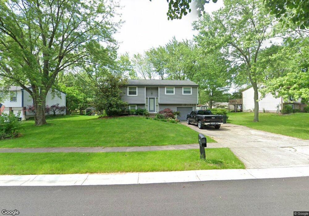
This home is located at 1174 Anthony Ln, Mason, OH 45040 and is currently estimated at $292,346, approximately $316 per square foot. 1174 Anthony Ln is a home located in Warren County with nearby schools including Mason Intermediate Elementary School, Mason Middle School, and William Mason High School.
Ownership History
Date
Name
Owned For
Owner Type
Purchase Details
Closed on
Feb 14, 2003
Sold by
Sites Randolph
Bought by
Mangus Linda S
Current Estimated Value
Home Financials for this Owner
Home Financials are based on the most recent Mortgage that was taken out on this home.
Original Mortgage
$85,500
Outstanding Balance
$35,268
Interest Rate
5.94%
Mortgage Type
New Conventional
Estimated Equity
$257,078
Purchase Details
Closed on
Mar 5, 1992
Sold by
Secretary Of Housing & Ur
Bought by
Randolph Sites and Randolph P.
Purchase Details
Closed on
Nov 20, 1991
Sold by
Lawrence Duttle and Lawrence J.
Bought by
Secretary Of Housing & Ur
Purchase Details
Closed on
Feb 23, 1990
Sold by
Duttle Duttle and Duttle Larry
Bought by
Lawrence Duttle and Lawrence J.
Purchase Details
Closed on
Sep 29, 1988
Sold by
Grant Sheppard and Grant A.
Bought by
Duttle Duttle and Duttle Larry
Purchase Details
Closed on
Aug 20, 1986
Sold by
Schoenberger Schoenberger and Schoenberger Michael R
Bought by
Grant Sheppard and Grant A.
Purchase Details
Closed on
Oct 4, 1979
Sold by
Ryan Homes Inc
Purchase Details
Closed on
Jul 17, 1979
Sold by
D J Properties & Inc
Create a Home Valuation Report for This Property
The Home Valuation Report is an in-depth analysis detailing your home's value as well as a comparison with similar homes in the area
Home Values in the Area
Average Home Value in this Area
Purchase History
| Date | Buyer | Sale Price | Title Company |
|---|---|---|---|
| Mangus Linda S | $95,000 | -- | |
| Randolph Sites | -- | -- | |
| Secretary Of Housing & Ur | -- | -- | |
| Lawrence Duttle | -- | -- | |
| Duttle Duttle | $70,000 | -- | |
| Grant Sheppard | $61,200 | -- | |
| -- | $50,200 | -- | |
| -- | $52,500 | -- |
Source: Public Records
Mortgage History
| Date | Status | Borrower | Loan Amount |
|---|---|---|---|
| Open | Mangus Linda S | $85,500 |
Source: Public Records
Tax History
| Year | Tax Paid | Tax Assessment Tax Assessment Total Assessment is a certain percentage of the fair market value that is determined by local assessors to be the total taxable value of land and additions on the property. | Land | Improvement |
|---|---|---|---|---|
| 2025 | $2,981 | $73,460 | $24,500 | $48,960 |
| 2024 | $2,981 | $73,460 | $24,500 | $48,960 |
| 2023 | $2,601 | $54,152 | $10,762 | $43,389 |
| 2022 | $2,568 | $54,152 | $10,763 | $43,390 |
| 2021 | $2,433 | $54,152 | $10,763 | $43,390 |
| 2020 | $2,307 | $44,027 | $8,750 | $35,277 |
| 2019 | $2,121 | $44,027 | $8,750 | $35,277 |
| 2018 | $2,128 | $44,027 | $8,750 | $35,277 |
| 2017 | $1,952 | $37,706 | $8,274 | $29,432 |
| 2016 | $2,010 | $37,706 | $8,274 | $29,432 |
| 2015 | $2,014 | $37,706 | $8,274 | $29,432 |
| 2014 | $2,019 | $35,240 | $7,730 | $27,510 |
| 2013 | $2,024 | $39,890 | $8,750 | $31,140 |
Source: Public Records
Map
Nearby Homes
- 6300 Amber Ct
- 6404 Coverage Ct
- 6394 Coverage Ct
- 6382 Coverage Ct
- 6411 Coverage Ct
- 6378 Coverage Ct
- 6364 Coverage Ct
- 792 Majken Place
- 6354 Coverage Ct
- 6403 Nicholas Way
- 6393 Nicholas Way
- 6358 Coverage Ct
- 6179 Nicholas Way
- 6379 Coverage Ct
- 6175 Nicholas Way
- 6375 Coverage Ct
- 6171 Nicholas Way
- 6342 Coverage Ct
- 6361 Coverage Ct
- 6160 Nicholas Way
Your Personal Tour Guide
Ask me questions while you tour the home.