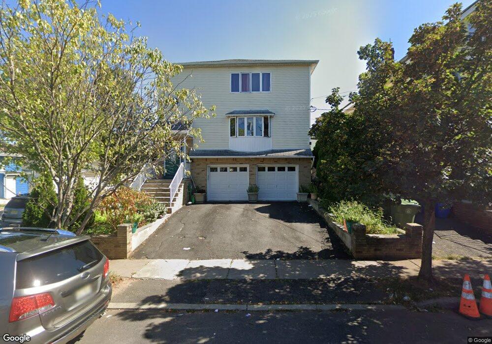
1174 Union St Linden, NJ 07036
Estimated Value: $693,913 - $949,000
Studio
--
Bath
3,000
Sq Ft
$264/Sq Ft
Est. Value
About This Home
This home is located at 1174 Union St, Linden, NJ 07036 and is currently estimated at $790,728, approximately $263 per square foot. 1174 Union St is a home located in Union County with nearby schools including Dr Charles C Polk School, Grace Wilday Junior High School, and Leonard V. Moore Middle School.
Ownership History
Date
Name
Owned For
Owner Type
Purchase Details
Closed on
Jul 1, 2021
Sold by
Ange Aime and Ange Marie
Bought by
Aime Carnes
Current Estimated Value
Home Financials for this Owner
Home Financials are based on the most recent Mortgage that was taken out on this home.
Original Mortgage
$125,000
Interest Rate
2.9%
Mortgage Type
New Conventional
Purchase Details
Closed on
Aug 4, 2017
Sold by
Aime Carnes J
Bought by
Aime Carlange and Aime Carlhens
Create a Home Valuation Report for This Property
The Home Valuation Report is an in-depth analysis detailing your home's value as well as a comparison with similar homes in the area
Home Values in the Area
Average Home Value in this Area
Purchase History
| Date | Buyer | Sale Price | Title Company |
|---|---|---|---|
| Aime Carnes | -- | Kopchak Angela Lack | |
| Carnes Aime | -- | None Listed On Document | |
| Aime Carlange | -- | None Available |
Source: Public Records
Mortgage History
| Date | Status | Borrower | Loan Amount |
|---|---|---|---|
| Previous Owner | Carnes Aime | $125,000 |
Source: Public Records
Tax History
| Year | Tax Paid | Tax Assessment Tax Assessment Total Assessment is a certain percentage of the fair market value that is determined by local assessors to be the total taxable value of land and additions on the property. | Land | Improvement |
|---|---|---|---|---|
| 2025 | $13,030 | $185,300 | $43,700 | $141,600 |
| 2024 | $12,745 | $185,300 | $43,700 | $141,600 |
| 2023 | $12,745 | $185,300 | $43,700 | $141,600 |
| 2022 | $12,812 | $185,300 | $43,700 | $141,600 |
| 2021 | $12,877 | $185,300 | $43,700 | $141,600 |
| 2020 | $12,808 | $185,300 | $43,700 | $141,600 |
| 2019 | $12,765 | $185,300 | $43,700 | $141,600 |
| 2018 | $12,762 | $185,300 | $43,700 | $141,600 |
| 2017 | $12,486 | $185,300 | $43,700 | $141,600 |
| 2016 | $12,093 | $185,300 | $43,700 | $141,600 |
| 2015 | $11,631 | $185,300 | $43,700 | $141,600 |
| 2014 | $11,405 | $185,300 | $43,700 | $141,600 |
Source: Public Records
Map
Nearby Homes
- 1310 E Henry St
- 1202 Warren St
- 806 Lincoln St
- 830 E Curtis St
- 1129 Spruce St
- 505 Saint Marks St Unit 2
- 1025 Rivington St
- 291 E 12th Ave
- 825 Jackson Ave
- 1022 Frank St
- 1123 Thompson Ave
- 811 Jackson Ave
- 930 Drake Ave
- 943 Drake Ave
- 3 Fern St
- 721 E Curtis St
- 415 E 10th Ave
- 410 Morris Place
- 918 Bower St
- 914 Bower St
- 1170 Union St
- 1023-25 Bishop Evans Way
- 1023 Bishop Evans Way Unit 25
- 1023 Bishop Evans Way Unit 2
- 1162 Union St
- 1180 Union St
- 1019 Bishop Evans Way
- 1019 Bishop Evans Way Unit 1
- 1184 Union St
- 1184 Union St Unit 1
- 1184 Union St Unit 2
- 1008 Bishop Evans Way Unit 1024
- 1015 Bishop Evans Way
- 1022 Charles St
- 1018 Bishop Evans Way
- 1190 Union St Unit 2
- 1018 Charles St
- 1016 Bishop Evans Way
- 1010 Bishop Evans Way
- 1029 Chandler Ave
Your Personal Tour Guide
Ask me questions while you tour the home.