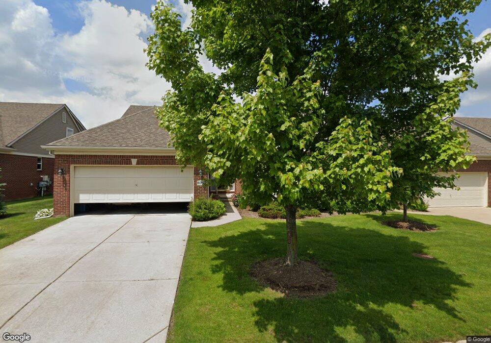
1175 Andover Cir Unit 47 Commerce Township, MI 48390
Estimated Value: $354,172 - $385,000
2
Beds
2
Baths
1,543
Sq Ft
$238/Sq Ft
Est. Value
About This Home
This home is located at 1175 Andover Cir Unit 47, Commerce Township, MI 48390 and is currently estimated at $367,043, approximately $237 per square foot. 1175 Andover Cir Unit 47 is a home located in Oakland County with nearby schools including Loon Lake Elementary School, Sarah G. Banks Middle School, and Walled Lake Central High School.
Ownership History
Date
Name
Owned For
Owner Type
Purchase Details
Closed on
Jan 4, 2023
Sold by
Aughton Jeffery and Aughton Sarah
Bought by
Aughton Jeffery S
Current Estimated Value
Purchase Details
Closed on
May 11, 2015
Sold by
Aughton Jeffery and Aughton Sarah J
Bought by
Aughton Jeffery S and Aughton Sarah J
Purchase Details
Closed on
Oct 20, 2006
Sold by
Commerce Mb Llc
Bought by
Aughton Jeffery and Aughton James
Home Financials for this Owner
Home Financials are based on the most recent Mortgage that was taken out on this home.
Original Mortgage
$177,650
Interest Rate
6.5%
Mortgage Type
Purchase Money Mortgage
Create a Home Valuation Report for This Property
The Home Valuation Report is an in-depth analysis detailing your home's value as well as a comparison with similar homes in the area
Home Values in the Area
Average Home Value in this Area
Purchase History
| Date | Buyer | Sale Price | Title Company |
|---|---|---|---|
| Aughton Jeffery S | -- | Land Title | |
| Aughton Jeffery S | -- | Land Title | |
| Aughton Jeffery S | -- | None Available | |
| Aughton Jeffery | $222,065 | Greco |
Source: Public Records
Mortgage History
| Date | Status | Borrower | Loan Amount |
|---|---|---|---|
| Previous Owner | Aughton Jeffery | $177,650 |
Source: Public Records
Tax History Compared to Growth
Tax History
| Year | Tax Paid | Tax Assessment Tax Assessment Total Assessment is a certain percentage of the fair market value that is determined by local assessors to be the total taxable value of land and additions on the property. | Land | Improvement |
|---|---|---|---|---|
| 2024 | $3,621 | $157,730 | $0 | $0 |
| 2023 | $3,430 | $144,620 | $0 | $0 |
| 2022 | $4,424 | $139,760 | $0 | $0 |
| 2021 | $4,211 | $134,950 | $0 | $0 |
| 2020 | $3,163 | $126,150 | $0 | $0 |
| 2019 | $4,053 | $122,960 | $0 | $0 |
| 2018 | $4,003 | $118,140 | $0 | $0 |
| 2017 | $3,951 | $118,140 | $0 | $0 |
| 2016 | $2,622 | $110,240 | $0 | $0 |
| 2015 | -- | $98,250 | $0 | $0 |
| 2014 | -- | $89,430 | $0 | $0 |
| 2011 | -- | $79,270 | $0 | $0 |
Source: Public Records
Map
Nearby Homes
- 1338 Andover Cir
- 1128 Andover Cir Unit 88
- 1104 Andover Cir Unit 92
- 1179 Andover Cir Unit 48
- 1736 Pine Forest Dr
- 1431 Lee Wood Ridge Rd
- 2000 Twin Sun Cir
- 1860 Twin Sun Cir
- 1500 Rustic Ln
- 1599 Chanticlair Cir
- 1625 Mc Coy St
- 1561 Waters Edge Ct
- 27202 Chesapeake Cir Unit 320
- 24202 Chesapeake Cir Unit 287
- 1588 Ladd Rd
- 770 Brushwood Dr
- 853 Adelaide Dr
- 1987 Carsons Cove
- 420 Wellsboro St
- 1640 High Pointe Dr
- 1191 Andover Cir Unit 49
- 1623 Nottingham Ct Unit 39
- 1164 Andover Cir Unit 83
- 1645 Nottingham Ct Unit 41
- 1142 Andover Cir
- 1180 Andover Cir Unit 81
- 1213 Andover Cir Unit 51
- 1661 Nottingham Ct Unit 43
- 1202 Andover Cir Unit 79
- 1601 Nottingham Ct
- 1124 Andover Cir Unit 89
- 1245 Andover Cir
- 1245 Andover Cir Unit 53
- 1610 Nottingham Ct
- 1112 Andover Cir Unit 91
- 1632 Nottingham Ct Unit 34
- 1224 Andover Cir Unit 77
- 1654 Nottingham Ct Unit 32
- 1100 Andover Cir Unit 93
- 1094 Andover Cir Unit 95