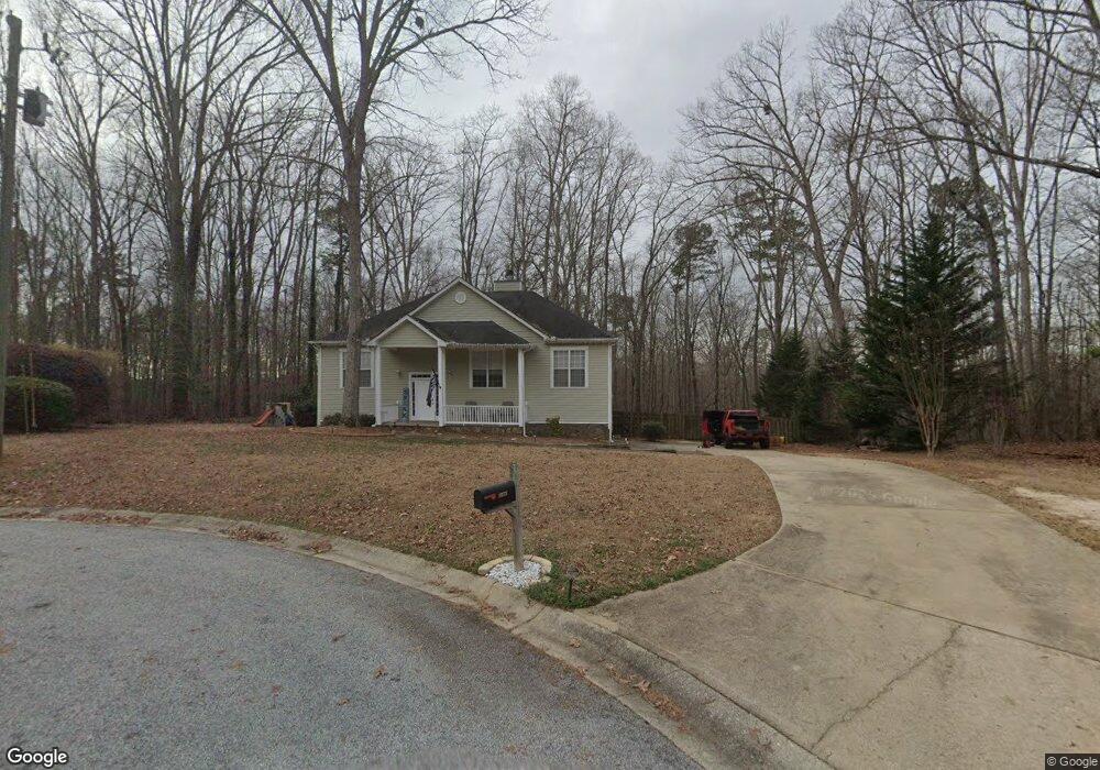
1175 Cannon Trail SW Oxford, GA 30054
Walnut Grove NeighborhoodEstimated Value: $250,000 - $338,541
4
Beds
3
Baths
1,405
Sq Ft
$214/Sq Ft
Est. Value
About This Home
This home is located at 1175 Cannon Trail SW, Oxford, GA 30054 and is currently estimated at $300,135, approximately $213 per square foot. 1175 Cannon Trail SW is a home located in Walton County with nearby schools including Walnut Grove Elementary School, Youth Middle School, and Walnut Grove High School.
Ownership History
Date
Name
Owned For
Owner Type
Purchase Details
Closed on
Jan 7, 2014
Sold by
Mckissick Malorie
Bought by
Ih3 Property Georgia Lp
Current Estimated Value
Purchase Details
Closed on
Mar 30, 2010
Sold by
Veterans Admn
Bought by
Mckissick Malorie
Home Financials for this Owner
Home Financials are based on the most recent Mortgage that was taken out on this home.
Original Mortgage
$105,305
Interest Rate
5.03%
Mortgage Type
New Conventional
Purchase Details
Closed on
Sep 1, 2009
Sold by
Wells Fargo Bank Na
Bought by
Veterans Admn
Create a Home Valuation Report for This Property
The Home Valuation Report is an in-depth analysis detailing your home's value as well as a comparison with similar homes in the area
Home Values in the Area
Average Home Value in this Area
Purchase History
| Date | Buyer | Sale Price | Title Company |
|---|---|---|---|
| Ih3 Property Georgia Lp | $80,751 | -- | |
| Mckissick Malorie | -- | -- | |
| Veterans Admn | -- | -- | |
| Wells Fargo Bank Na | $106,637 | -- |
Source: Public Records
Mortgage History
| Date | Status | Borrower | Loan Amount |
|---|---|---|---|
| Previous Owner | Mckissick Malorie | $105,305 |
Source: Public Records
Tax History Compared to Growth
Tax History
| Year | Tax Paid | Tax Assessment Tax Assessment Total Assessment is a certain percentage of the fair market value that is determined by local assessors to be the total taxable value of land and additions on the property. | Land | Improvement |
|---|---|---|---|---|
| 2024 | $3,201 | $106,560 | $8,756 | $97,804 |
| 2023 | $3,202 | $103,600 | $17,200 | $86,400 |
| 2022 | $2,885 | $89,360 | $14,400 | $74,960 |
| 2021 | $2,459 | $73,640 | $14,400 | $59,240 |
| 2020 | $2,353 | $68,640 | $12,000 | $56,640 |
| 2019 | $1,478 | $43,080 | $8,000 | $35,080 |
| 2018 | $1,491 | $43,080 | $8,000 | $35,080 |
| 2017 | $1,484 | $43,080 | $8,000 | $35,080 |
| 2016 | $1,425 | $40,480 | $8,000 | $32,480 |
| 2015 | $1,165 | $38,840 | $8,000 | $30,840 |
| 2014 | $1,080 | $37,200 | $0 | $0 |
Source: Public Records
Map
Nearby Homes
- 5605 Ashland Farm Rd
- 0 Old Highway 138 Unit TRACT 2 10443767
- 0 Old Highway 138 Unit TRACT 1 10443765
- 55 Ashland Farm Rd
- 1088 Cannon Farm Rd
- 340 Hightower Trail
- 370 Hightower Trail
- 310 Hightower Trail
- 3505 Gum Creek Rd
- 4983 Guthrie Cemetery Rd
- 4859 Highway 138
- 468 Copper Ridge Dr
- 4820 Old Highway 138
- 5430 Hightower Trail SE
- 466 Hwy 81
- 1620 Olympic Cir
- 0 Kent Rock Rd Unit Tract 5 CM1025517
- 0 Kent Rock Rd Unit Tract 3 CM1025514
- 0 Kent Rock Rd Unit 1025511
- 0 Kent Rock Rd Unit 23453236
- 1400 Cannon Ct SW
- 1170 Cannon Trail SW
- 1410 Cannon Ct SW
- 1160 Cannon Trail SW
- 1420 Cannon Ct SW
- 1405 Cannon Ct SW
- 1430 Cannon Ct SW
- 1425 Cannon Ct SW
- 1440 Cannon Ct SW
- 0 Cannon Ct Unit 8543520
- 0 Cannon Ct Unit 7068006
- 1140 Cannon Trail SW
- 1435 Cannon Ct SW
- 1445 Cannon Ct SW
- 5405 Ashland Farm Rd SW
- 1125 Cannon Trail SW
- 1130 Cannon Trail SW
- 5385 Ashland Farm Rd SW
- 5484 Highway 138 SW
- 1115 Cannon Trail SW