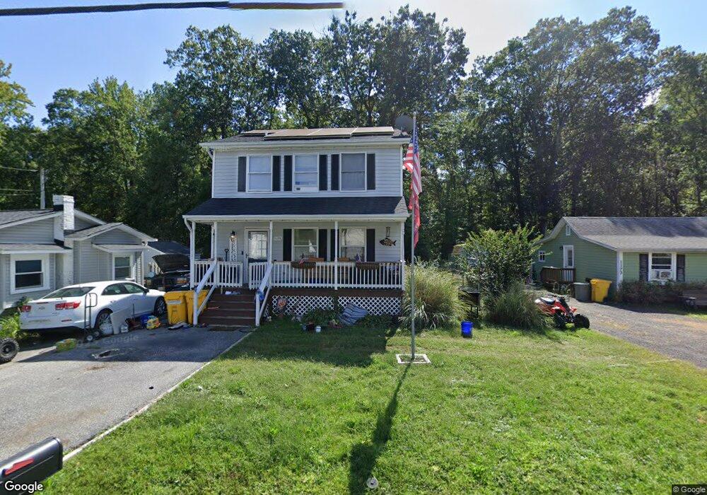
1175 Cedar Ave Shady Side, MD 20764
Estimated Value: $341,962 - $423,000
Studio
3
Baths
1,242
Sq Ft
$316/Sq Ft
Est. Value
About This Home
This home is located at 1175 Cedar Ave, Shady Side, MD 20764 and is currently estimated at $392,741, approximately $316 per square foot. 1175 Cedar Ave is a home located in Anne Arundel County with nearby schools including Shady Side Elementary School, Southern Middle School, and Southern High School.
Ownership History
Date
Name
Owned For
Owner Type
Purchase Details
Closed on
Apr 9, 2021
Sold by
Donovan Kacy L and Estate Of Janice S Donovan
Bought by
Donovan Kacy L
Current Estimated Value
Purchase Details
Closed on
Mar 26, 2002
Sold by
Donovan Jeremiah J
Bought by
Donovan Janice S
Purchase Details
Closed on
Oct 21, 1992
Sold by
Howard Richard L
Bought by
Donovan Jeremiah J
Home Financials for this Owner
Home Financials are based on the most recent Mortgage that was taken out on this home.
Original Mortgage
$116,400
Interest Rate
8.06%
Purchase Details
Closed on
May 28, 1992
Sold by
Ainsworth Robert B
Bought by
Howard Richard L
Home Financials for this Owner
Home Financials are based on the most recent Mortgage that was taken out on this home.
Original Mortgage
$76,000
Interest Rate
8.53%
Create a Home Valuation Report for This Property
The Home Valuation Report is an in-depth analysis detailing your home's value as well as a comparison with similar homes in the area
Home Values in the Area
Average Home Value in this Area
Purchase History
| Date | Buyer | Sale Price | Title Company |
|---|---|---|---|
| Donovan Kacy L | -- | Accommodation | |
| Donovan Janice S | -- | -- | |
| Donovan Jeremiah J | $115,000 | -- | |
| Howard Richard L | $30,000 | -- |
Source: Public Records
Mortgage History
| Date | Status | Borrower | Loan Amount |
|---|---|---|---|
| Previous Owner | Donovan Jeremiah J | $116,400 | |
| Previous Owner | Howard Richard L | $76,000 |
Source: Public Records
Tax History
| Year | Tax Paid | Tax Assessment Tax Assessment Total Assessment is a certain percentage of the fair market value that is determined by local assessors to be the total taxable value of land and additions on the property. | Land | Improvement |
|---|---|---|---|---|
| 2025 | $3,259 | $296,333 | -- | -- |
| 2024 | $3,259 | $279,467 | $0 | $0 |
| 2023 | $3,133 | $262,600 | $132,900 | $129,700 |
| 2022 | $2,956 | $258,200 | $0 | $0 |
| 2020 | $2,075 | $249,400 | $132,900 | $116,500 |
| 2019 | $5,508 | $237,900 | $0 | $0 |
| 2018 | $2,296 | $226,400 | $0 | $0 |
| 2017 | $2,605 | $214,900 | $0 | $0 |
| 2016 | -- | $214,900 | $0 | $0 |
| 2015 | -- | $214,900 | $0 | $0 |
| 2014 | -- | $215,700 | $0 | $0 |
Source: Public Records
Map
Nearby Homes
- 1199 Oak Ave
- 5191 Spring Ave
- 1461 Cedarhurst Rd
- 0 Haile Pkwy Unit MDAA2127474
- 1445 & 1447 Haile Pkwy
- 1436 Haile Pkwy
- 5235 Al Jones Dr
- 5250 Al Jones Dr
- 1428 Haile Pkwy
- 1408 & 1410 Haile Pkwy
- 0 Shady Side Rd Unit MDAA2113156
- 0 Shady Side Rd Unit MDAA2113166
- 1711 Columbia Beach Rd
- 5314 Al Jones Dr
- 1650 Cedar Ln
- 4949 Idlewilde Rd
- 1451 Shady Rest Rd
- 5218 Nick Rd
- 1419 Shady Rest Rd
- 1330 Jordan Dr
Your Personal Tour Guide
Ask me questions while you tour the home.