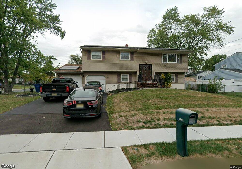
1175 Huron Rd North Brunswick, NJ 08902
Estimated Value: $577,565 - $660,000
--
Bed
--
Bath
2,074
Sq Ft
$307/Sq Ft
Est. Value
About This Home
This home is located at 1175 Huron Rd, North Brunswick, NJ 08902 and is currently estimated at $637,141, approximately $307 per square foot. 1175 Huron Rd is a home located in Middlesex County with nearby schools including John Adams Elementary School, Linwood Middle School, and North Brunswick Twp High School.
Ownership History
Date
Name
Owned For
Owner Type
Purchase Details
Closed on
Jun 25, 2004
Sold by
Roberts Joseph
Bought by
Lewis Adrian and Lewis Wanda
Current Estimated Value
Home Financials for this Owner
Home Financials are based on the most recent Mortgage that was taken out on this home.
Original Mortgage
$255,900
Outstanding Balance
$128,094
Interest Rate
6.25%
Estimated Equity
$509,047
Purchase Details
Closed on
Apr 29, 1999
Sold by
Hensley David
Bought by
Roberts Rhoda
Home Financials for this Owner
Home Financials are based on the most recent Mortgage that was taken out on this home.
Original Mortgage
$174,643
Interest Rate
6.92%
Mortgage Type
FHA
Purchase Details
Closed on
Feb 18, 1994
Sold by
Venesco Richard
Bought by
Hensley David and Hensley Elizabeth
Home Financials for this Owner
Home Financials are based on the most recent Mortgage that was taken out on this home.
Original Mortgage
$134,000
Interest Rate
7.01%
Create a Home Valuation Report for This Property
The Home Valuation Report is an in-depth analysis detailing your home's value as well as a comparison with similar homes in the area
Home Values in the Area
Average Home Value in this Area
Purchase History
| Date | Buyer | Sale Price | Title Company |
|---|---|---|---|
| Lewis Adrian | $319,900 | -- | |
| Roberts Rhoda | $176,000 | -- | |
| Hensley David | $167,000 | -- |
Source: Public Records
Mortgage History
| Date | Status | Borrower | Loan Amount |
|---|---|---|---|
| Open | Lewis Adrian | $255,900 | |
| Previous Owner | Roberts Rhoda | $174,643 | |
| Previous Owner | Hensley David | $134,000 |
Source: Public Records
Tax History Compared to Growth
Tax History
| Year | Tax Paid | Tax Assessment Tax Assessment Total Assessment is a certain percentage of the fair market value that is determined by local assessors to be the total taxable value of land and additions on the property. | Land | Improvement |
|---|---|---|---|---|
| 2025 | $11,151 | $176,000 | $59,300 | $116,700 |
| 2024 | $10,951 | $176,000 | $59,300 | $116,700 |
| 2023 | $10,951 | $176,000 | $59,300 | $116,700 |
| 2022 | $10,578 | $176,000 | $59,300 | $116,700 |
| 2021 | $7,707 | $176,000 | $59,300 | $116,700 |
| 2020 | $10,183 | $176,000 | $59,300 | $116,700 |
| 2019 | $9,976 | $176,000 | $59,300 | $116,700 |
| 2018 | $9,772 | $176,000 | $59,300 | $116,700 |
| 2017 | $9,599 | $176,000 | $59,300 | $116,700 |
| 2016 | $9,398 | $176,000 | $59,300 | $116,700 |
| 2015 | $8,944 | $170,400 | $59,300 | $111,100 |
| 2014 | $8,844 | $170,400 | $59,300 | $111,100 |
Source: Public Records
Map
Nearby Homes
- 1209 Dakota Rd
- 1464 Columbia Dr
- 1632 Hudson Ave
- 1010 N Oaks Blvd
- 210 N Oaks Blvd Unit 210
- 5208 N Oaks Blvd
- 1314 N Oaks Blvd
- 936 Patton St
- 1133 Livingston Ave Unit 11C
- 1499 La Rose Ave
- 1067 Grove St
- 3807 Birchwood Ct
- 89 Pennsylvania Way
- 3910 Birchwood Ct
- 1 Michael Ct
- 63 Pennsylvania Way
- 4511 Birchwood Ct
- 4201 Birchwood Ct
- 1078 Newton St
- 1899 Noah Dr
- 1486 Cherokee Place
- 1167 Huron Rd
- 1495 Cherokee Place
- 1178 Huron Rd
- 1170 Huron Rd
- 1478 Cherokee Place
- 1485 Cherokee Place
- 1485 Cherokee Rd
- 1481 Columbia Dr
- 1186 Huron Rd
- 1162 Huron Rd
- 1197 Huron Rd
- 1496 Columbia Dr
- 1194 Cherokee Rd
- 1179 Cherokee Rd
- 1194 Huron Rd
- 1473 Columbia Dr
- 1156 Huron Rd
- 1185 Cherokee Rd
- 1486 Columbia Dr