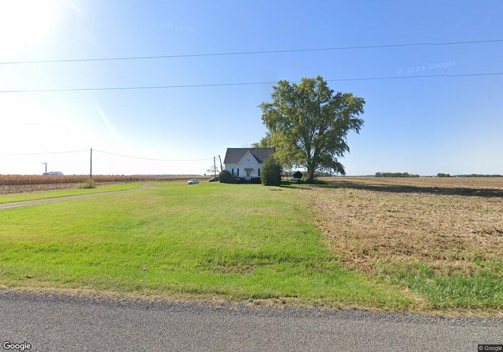
11750 Coal Mine Rd Lenzburg, IL 62255
Estimated Value: $169,000 - $447,870
--
Bed
--
Bath
1,080
Sq Ft
$254/Sq Ft
Est. Value
About This Home
This home is located at 11750 Coal Mine Rd, Lenzburg, IL 62255 and is currently estimated at $273,968, approximately $253 per square foot. 11750 Coal Mine Rd is a home located in St. Clair County with nearby schools including Marissa Elementary School and Marissa Jr & Sr High School.
Ownership History
Date
Name
Owned For
Owner Type
Purchase Details
Closed on
Aug 8, 2017
Sold by
Hundelt Steven J and Hundelt Cynthia R
Bought by
Hundelt Steven J and Steven J Hundelt Declaration Of Trust
Current Estimated Value
Purchase Details
Closed on
Sep 10, 2002
Sold by
Kirchhoefer Meta F
Bought by
Hundelt Steven J and Hundelt Cynthia R
Home Financials for this Owner
Home Financials are based on the most recent Mortgage that was taken out on this home.
Original Mortgage
$112,500
Interest Rate
6.54%
Mortgage Type
Purchase Money Mortgage
Create a Home Valuation Report for This Property
The Home Valuation Report is an in-depth analysis detailing your home's value as well as a comparison with similar homes in the area
Home Values in the Area
Average Home Value in this Area
Purchase History
| Date | Buyer | Sale Price | Title Company |
|---|---|---|---|
| Hundelt Steven J | -- | Attorney | |
| Hundelt Steven J | $151,000 | Chicago Title |
Source: Public Records
Mortgage History
| Date | Status | Borrower | Loan Amount |
|---|---|---|---|
| Closed | Hundelt Steven J | $112,500 |
Source: Public Records
Tax History Compared to Growth
Tax History
| Year | Tax Paid | Tax Assessment Tax Assessment Total Assessment is a certain percentage of the fair market value that is determined by local assessors to be the total taxable value of land and additions on the property. | Land | Improvement |
|---|---|---|---|---|
| 2024 | $4,355 | $58,066 | $17,689 | $40,377 |
| 2023 | $3,854 | $50,043 | $16,145 | $33,898 |
| 2022 | $3,896 | $46,218 | $14,465 | $31,753 |
| 2021 | $3,852 | $43,090 | $12,918 | $30,172 |
| 2020 | $3,717 | $42,710 | $11,574 | $31,136 |
| 2019 | $3,674 | $41,113 | $10,277 | $30,836 |
| 2018 | $3,932 | $40,933 | $9,167 | $31,766 |
| 2017 | $3,796 | $39,295 | $8,123 | $31,172 |
| 2016 | $3,736 | $38,824 | $7,197 | $31,627 |
| 2014 | $3,414 | $37,993 | $5,770 | $32,223 |
| 2013 | $2,440 | $38,883 | $5,346 | $33,537 |
Source: Public Records
Map
Nearby Homes
- 2770 Washington County Line Rd
- 000 Darmstadt Rd
- 2430 Beckmann Rd
- 735 Buss St
- 882 Edward St
- 964 Kleefeld Ln
- 632 Wiese Ln
- 644 Hailie St
- 624 Hailie St
- 620 Kate Ct
- 616 Kate Ct
- 1019 Saint Peter Ave
- 612 Kate Ct
- 639 Hailie St
- 1008 Jean Marie St
- 631 Hailie St
- 627 Hailie St
- 1007 Jean Marie St
- 652 Hailie St
- 608 Kate Ct
- 11813 Coal Mine Rd
- 11703 Coal Mine Rd
- 11609 Coal Mine Rd
- 11601 Coal Mine Rd
- 2901 Washington County Line Rd
- 11542 New Athens Darmstadt Rd
- 11530 New Athens Darmstadt Rd
- 11522 Mill St
- 11520 Church St
- 11516 New Athens Darmstadt Rd
- 11516 New Athens Darmstadt Rd
- 11515 Mill St
- 11515 Mill St
- 11512 New Athens Darmstadt Rd
- 11518 Race St
- 11511 Mill St
- 11511 Mill St
- 11508 Mill St
- 11507 Church St
- 11503 New Athens Darmstadt Rd