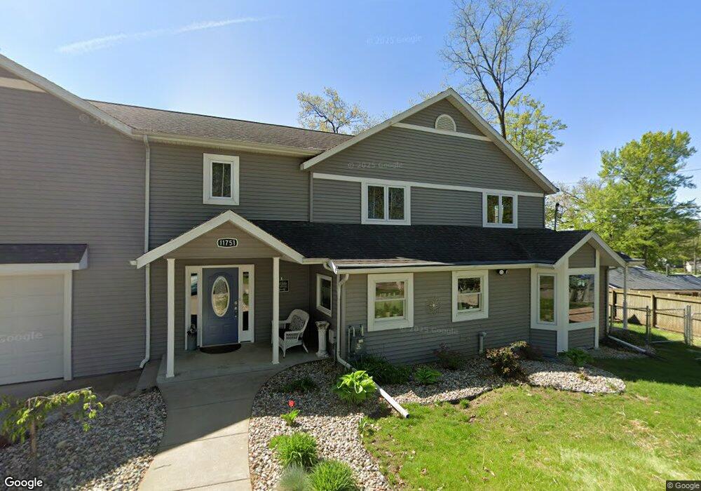
11751 Fords Point Dr Plainwell, MI 49080
Estimated Value: $832,000 - $1,048,000
4
Beds
3
Baths
4,000
Sq Ft
$231/Sq Ft
Est. Value
About This Home
This home is located at 11751 Fords Point Dr, Plainwell, MI 49080 and is currently estimated at $924,096, approximately $231 per square foot. 11751 Fords Point Dr is a home located in Barry County with nearby schools including Delton Kellogg Elementary School, Delton-Kellogg Middle School, and Delton-Kellogg High School.
Ownership History
Date
Name
Owned For
Owner Type
Purchase Details
Closed on
Apr 5, 2021
Sold by
Reynolds Todd
Bought by
Gregg-Marger Michelle and Marger Bryan
Current Estimated Value
Home Financials for this Owner
Home Financials are based on the most recent Mortgage that was taken out on this home.
Original Mortgage
$546,000
Outstanding Balance
$404,281
Interest Rate
2.3%
Mortgage Type
New Conventional
Estimated Equity
$519,815
Purchase Details
Closed on
Jan 15, 2009
Sold by
Reynolds Sandra
Bought by
Reynolds Todd
Purchase Details
Closed on
Mar 29, 2000
Bought by
Reynolds Todd J
Create a Home Valuation Report for This Property
The Home Valuation Report is an in-depth analysis detailing your home's value as well as a comparison with similar homes in the area
Home Values in the Area
Average Home Value in this Area
Purchase History
| Date | Buyer | Sale Price | Title Company |
|---|---|---|---|
| Gregg-Marger Michelle | $728,000 | None Listed On Document | |
| Reynolds Todd | -- | None Available | |
| Reynolds Todd J | $245,000 | -- |
Source: Public Records
Mortgage History
| Date | Status | Borrower | Loan Amount |
|---|---|---|---|
| Open | Gregg-Marger Michelle | $546,000 |
Source: Public Records
Tax History Compared to Growth
Tax History
| Year | Tax Paid | Tax Assessment Tax Assessment Total Assessment is a certain percentage of the fair market value that is determined by local assessors to be the total taxable value of land and additions on the property. | Land | Improvement |
|---|---|---|---|---|
| 2025 | $7,136 | $389,700 | $0 | $0 |
| 2024 | $7,136 | $344,600 | $0 | $0 |
| 2023 | $5,539 | $275,400 | $0 | $0 |
| 2022 | $5,539 | $275,400 | $0 | $0 |
| 2021 | $4,431 | $260,900 | $0 | $0 |
| 2020 | $4,427 | $268,600 | $0 | $0 |
| 2019 | $4,395 | $253,100 | $0 | $0 |
| 2018 | $0 | $234,800 | $117,900 | $116,900 |
| 2017 | $0 | $234,800 | $0 | $0 |
| 2016 | -- | $203,900 | $0 | $0 |
| 2015 | -- | $199,800 | $0 | $0 |
| 2014 | -- | $199,800 | $0 | $0 |
Source: Public Records
Map
Nearby Homes
- 11625 Spring Point Dr
- 12651 Pine Lake Rd
- 12391 Sunset Dr
- 12387 Sunset Point Dr
- 9700 Lindsey Rd
- 12167 Southgate Dr
- 1217 Marsh Rd
- 11322 3 Mile Rd
- 8897 Cory Dr
- 8494 Marsh Rd
- VL Cory Dr
- 0 Doster Rd Unit 22855337
- 11463 Snowshoe Dr
- 24 Heron Ct
- 185 Hestia Dr Unit 7
- 667 Pierce Rd
- 414 Midlakes Blvd
- 7805 Cougar Dr
- 282 Doster Rd
- 9308 W Guernsey Lake Rd
- 11759 Ford Point Dr
- 11751 Ford Point Dr
- 11759 Fords Point Dr
- 11735 Fords Point Dr
- 11735 Ford Point Dr
- 11783 Ford Point Dr
- 11783 Fords Point Dr
- 11727 Fords Point Dr
- 11794 Fords Point Dr
- 11791 Fords Point Dr
- 11721 Fords Point Dr
- 11794 Ford Point Dr
- 11802 Ford Rd
- 11713 Fords Point Dr
- 11713 Ford Point Dr
- 11790 Fords Point Dr
- 11740 Fords Point Dr
- 11786 Fords Point Dr
- 11786 Fords Point Dr
- 11800 Ford Point Dr