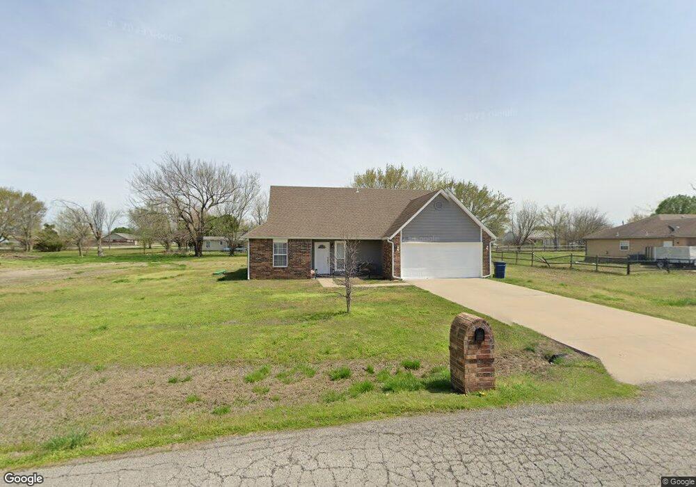
11755 Gun Smoke Dr Collinsville, OK 74021
Estimated Value: $269,528 - $298,000
3
Beds
2
Baths
1,610
Sq Ft
$175/Sq Ft
Est. Value
About This Home
This home is located at 11755 Gun Smoke Dr, Collinsville, OK 74021 and is currently estimated at $282,382, approximately $175 per square foot. 11755 Gun Smoke Dr is a home located in Rogers County with nearby schools including Northeast Elementary School, Owasso 6th Grade Center, and Owasso 8th Grade Center.
Ownership History
Date
Name
Owned For
Owner Type
Purchase Details
Closed on
Feb 17, 2012
Sold by
Foote Brandon Arthur and Foote Tamara S
Bought by
Foote Brandon A and Foote Tamara S
Current Estimated Value
Home Financials for this Owner
Home Financials are based on the most recent Mortgage that was taken out on this home.
Original Mortgage
$126,100
Outstanding Balance
$86,243
Interest Rate
3.93%
Mortgage Type
New Conventional
Estimated Equity
$196,139
Purchase Details
Closed on
Aug 30, 2005
Sold by
Homes By Betty Inc
Bought by
Foote Brandon Arthur
Home Financials for this Owner
Home Financials are based on the most recent Mortgage that was taken out on this home.
Original Mortgage
$24,000
Interest Rate
5.81%
Mortgage Type
Seller Take Back
Purchase Details
Closed on
Dec 16, 2004
Sold by
Cherub Investments Inc
Create a Home Valuation Report for This Property
The Home Valuation Report is an in-depth analysis detailing your home's value as well as a comparison with similar homes in the area
Home Values in the Area
Average Home Value in this Area
Purchase History
| Date | Buyer | Sale Price | Title Company |
|---|---|---|---|
| Foote Brandon A | -- | First Title & Abstract Servi | |
| Foote Brandon Arthur | $120,000 | Firstitle And Abstract Servi | |
| -- | $18,000 | -- |
Source: Public Records
Mortgage History
| Date | Status | Borrower | Loan Amount |
|---|---|---|---|
| Open | Foote Brandon A | $126,100 | |
| Closed | Foote Brandon Arthur | $24,000 |
Source: Public Records
Tax History Compared to Growth
Tax History
| Year | Tax Paid | Tax Assessment Tax Assessment Total Assessment is a certain percentage of the fair market value that is determined by local assessors to be the total taxable value of land and additions on the property. | Land | Improvement |
|---|---|---|---|---|
| 2025 | $2,439 | $22,470 | $3,796 | $18,674 |
| 2024 | $2,362 | $21,401 | $3,616 | $17,785 |
| 2023 | $2,362 | $20,382 | $3,297 | $17,085 |
| 2022 | $2,179 | $19,411 | $3,287 | $16,124 |
| 2021 | $2,052 | $18,595 | $3,300 | $15,295 |
| 2020 | $1,952 | $18,015 | $3,300 | $14,715 |
| 2019 | $1,860 | $16,768 | $2,750 | $14,018 |
| 2018 | $1,848 | $17,216 | $2,750 | $14,466 |
| 2017 | $1,850 | $17,078 | $2,750 | $14,328 |
| 2016 | $1,805 | $16,642 | $2,750 | $13,892 |
| 2015 | $1,784 | $16,221 | $2,750 | $13,471 |
| 2014 | $1,778 | $16,163 | $2,750 | $13,413 |
Source: Public Records
Map
Nearby Homes
- 11610 N 190th East Ave
- 12047 N 193rd East Ave
- 12225 N 194th East Ave
- 12192 N 179th East Ave
- 17542 E 112th St N
- 4608 E 472 Rd
- 0 Hobbs Creek Dr Unit 2541616
- 12875 N 193rd East Ave
- 16893 E 116th St N
- 0 E 106th St N Unit 2543814
- 0 E 106th St N Unit 2546711
- 11381 N 209th E
- 11417 N 168th East Ave
- 4728 E Hwy 20
- 13247 Hobbs Creek Dr
- 16550 E 120th St N
- 20624 S Brentwood Ave
- 5 Hobbs Creek Trail
- 20823 S Concord Ave
- 20603 S Concord Ave
- 11755 Gunsmoke Dr
- 11735 Gunsmoke Dr
- 11735 Gun Smoke Dr
- 11720 N 190th East Ave
- 11795 Gunsmoke Dr
- 11710 N 190th East Ave
- 11715 Gunsmoke Dr
- 11750 Gunsmoke Dr
- 11750 Gun Smoke Dr
- 11825 Gun Smoke Dr
- 11715 Gun Smoke Dr
- 11730 Gunsmoke Dr
- 11790 Gun Smoke Dr
- 11730 Gun Smoke Dr
- 11825 Gunsmoke Dr
- 11624 N 190th East Ave
- 11710 Gunsmoke Dr
- 11695 Gunsmoke Dr
- 11695 Gun Smoke Dr
- 11715 N 190th East Ave