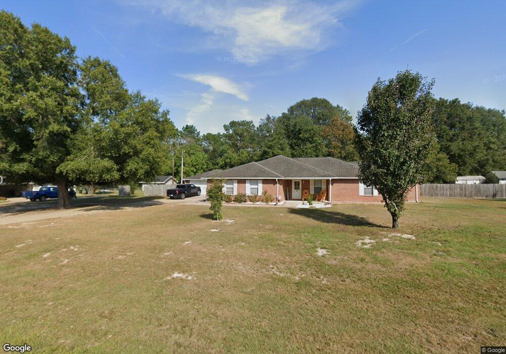
1176 Allison Dr Deridder, LA 70634
Estimated Value: $288,000 - $299,000
3
Beds
2
Baths
3,500
Sq Ft
$84/Sq Ft
Est. Value
About This Home
This home is located at 1176 Allison Dr, Deridder, LA 70634 and is currently estimated at $292,639, approximately $83 per square foot. 1176 Allison Dr is a home located in Beauregard Parish with nearby schools including K.R. Hanchey Elementary School, Pine Wood Elementary School, and DeRidder Junior High School.
Ownership History
Date
Name
Owned For
Owner Type
Purchase Details
Closed on
Oct 28, 2020
Sold by
Clemons Randy Tyler and Clemons Stephanie Hollis
Bought by
Smith Ronald Allen and Smith Suzanne Jean
Current Estimated Value
Home Financials for this Owner
Home Financials are based on the most recent Mortgage that was taken out on this home.
Original Mortgage
$219,500
Outstanding Balance
$193,533
Interest Rate
2.8%
Mortgage Type
VA
Estimated Equity
$99,106
Purchase Details
Closed on
May 27, 2009
Sold by
Hudson Ella Louise Renfro
Bought by
Clemons Randy Tyler and Clemons Stephanie Hollis Nardo
Create a Home Valuation Report for This Property
The Home Valuation Report is an in-depth analysis detailing your home's value as well as a comparison with similar homes in the area
Purchase History
| Date | Buyer | Sale Price | Title Company |
|---|---|---|---|
| Smith Ronald Allen | $219,500 | None Available | |
| Clemons Randy Tyler | $220,000 | -- |
Source: Public Records
Mortgage History
| Date | Status | Borrower | Loan Amount |
|---|---|---|---|
| Open | Smith Ronald Allen | $219,500 |
Source: Public Records
Tax History
| Year | Tax Paid | Tax Assessment Tax Assessment Total Assessment is a certain percentage of the fair market value that is determined by local assessors to be the total taxable value of land and additions on the property. | Land | Improvement |
|---|---|---|---|---|
| 2025 | $2,244 | $21,714 | $1,200 | $20,514 |
| 2024 | $2,229 | $21,714 | $1,200 | $20,514 |
| 2023 | $2,311 | $22,000 | $1,700 | $20,300 |
| 2022 | $2,310 | $22,000 | $1,700 | $20,300 |
| 2021 | $2,310 | $22,000 | $1,700 | $20,300 |
| 2020 | $2,309 | $22,000 | $1,700 | $20,300 |
| 2019 | $2,313 | $22,000 | $1,700 | $20,300 |
| 2018 | $2,313 | $22,000 | $1,700 | $20,300 |
| 2017 | $2,313 | $22,000 | $1,700 | $20,300 |
| 2016 | $2,313 | $22,000 | $1,700 | $20,300 |
| 2015 | $778 | $22,000 | $1,700 | $20,300 |
| 2014 | $2,228 | $22,000 | $1,700 | $20,300 |
Source: Public Records
Map
Nearby Homes
- 1615 Ernest Dr
- 1460 Ernest Dr
- 704 Auburn Dr
- 1598 Glendale Rd
- 1007 Nichols St
- 1128 N Texas St
- 1526 Peggy Ln
- 0 N Texas St
- 1123 Walnut St
- 905 N Texas St
- 1105 Mc Arthur St
- 0 N Frusha Dr
- 737 Roberts St Unit A and B
- 0 Bilbo Street (Tract 1)
- 0 Bilbo Street (Tract 2)
- 0 Planer Mill Rd
- 1110 W Port St Unit West Port
- 1109 W Port St
- 1406 Camelia Dr
- 122 Azalea Ave
- 1208 Allison Dr
- 1156 Allison Dr
- 1175 Allison Dr
- 0 Allison Dr 1157 Unit 1157
- 1213 Allison Dr
- 1140 Allison Dr
- 1141 Allison Dr
- 1136 Christina Dr
- 1236 Allison Dr
- 1235 Allison Dr
- 1206 Christina Dr
- 1234 Christina Dr
- 1102 Christina Dr
- 1116 Allison Dr
- 1245 Allison Dr
- 1252 Christina Dr
- 1510 Ashley Dr
- 1235 Christina Dr
- 1252 Allison Dr
- 1311 Melissa Dr
Your Personal Tour Guide
Ask me questions while you tour the home.