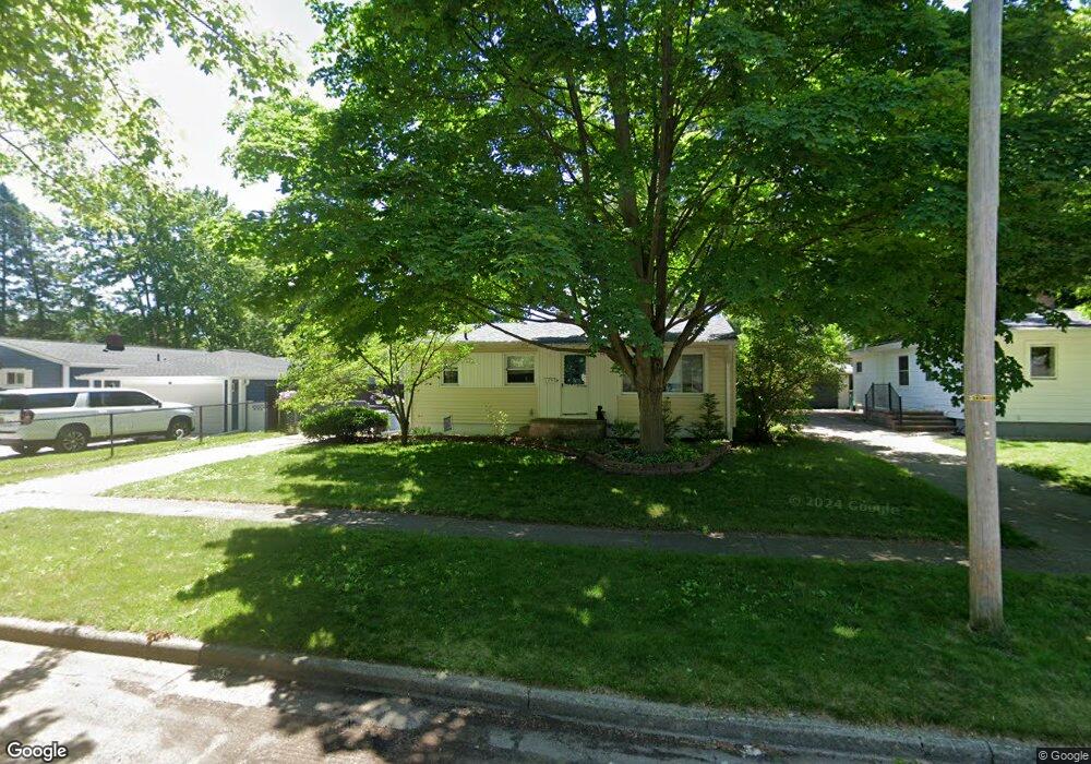
1176 Maple St Ypsilanti, MI 48198
Estimated Value: $222,000 - $263,000
3
Beds
1
Bath
983
Sq Ft
$246/Sq Ft
Est. Value
About This Home
This home is located at 1176 Maple St, Ypsilanti, MI 48198 and is currently estimated at $242,149, approximately $246 per square foot. 1176 Maple St is a home located in Washtenaw County with nearby schools including Holmes Elementary School, Erickson Elementary School, and Estabrook Elementary School.
Ownership History
Date
Name
Owned For
Owner Type
Purchase Details
Closed on
Jul 24, 2018
Sold by
Strom Andrea
Bought by
Moser Andrea and Moser Jamie
Current Estimated Value
Purchase Details
Closed on
Oct 27, 1995
Sold by
Marshall Randy P
Bought by
Strom Alex C Perdue and Strom Arthur P
Home Financials for this Owner
Home Financials are based on the most recent Mortgage that was taken out on this home.
Original Mortgage
$62,400
Interest Rate
7.61%
Mortgage Type
New Conventional
Create a Home Valuation Report for This Property
The Home Valuation Report is an in-depth analysis detailing your home's value as well as a comparison with similar homes in the area
Home Values in the Area
Average Home Value in this Area
Purchase History
| Date | Buyer | Sale Price | Title Company |
|---|---|---|---|
| Moser Andrea | -- | None Available | |
| Strom Alex C Perdue | $78,000 | -- |
Source: Public Records
Mortgage History
| Date | Status | Borrower | Loan Amount |
|---|---|---|---|
| Previous Owner | Strom Alex C Perdue | $62,400 |
Source: Public Records
Tax History Compared to Growth
Tax History
| Year | Tax Paid | Tax Assessment Tax Assessment Total Assessment is a certain percentage of the fair market value that is determined by local assessors to be the total taxable value of land and additions on the property. | Land | Improvement |
|---|---|---|---|---|
| 2025 | -- | $100,300 | $0 | $0 |
| 2024 | $1,514 | $92,300 | $0 | $0 |
| 2023 | $1,389 | $86,600 | $0 | $0 |
| 2022 | $1,437 | $81,400 | $0 | $0 |
| 2021 | $2,329 | $68,600 | $0 | $0 |
| 2020 | $2,299 | $66,900 | $0 | $0 |
| 2019 | $2,015 | $58,800 | $58,800 | $0 |
| 2018 | $2,020 | $47,300 | $0 | $0 |
| 2017 | $2,020 | $45,500 | $0 | $0 |
| 2016 | $1,239 | $41,780 | $0 | $0 |
| 2015 | $1,876 | $41,656 | $0 | $0 |
| 2014 | $1,876 | $43,200 | $0 | $0 |
| 2013 | -- | $43,200 | $0 | $0 |
Source: Public Records
Map
Nearby Homes
- 142 Glenwood Ave
- 819 N Harris Rd
- 1066 Holmes Rd
- 708 Virginia Place
- 712 E Forest Ave
- 1027 Parkwood Ave
- 823 Hawthorne Ave
- 366 S Harris Rd
- 1060 Commonwealth Ave
- 1320 Parkwood Ave
- 204 Ecorse Rd
- 1043 Rue Deauville Blvd
- 238 N Prospect Rd
- 909 Maplewood Ave
- 1161 Rambling Rd
- 211 Devonshire St
- 808 Lamay Ave
- 414 Oak St
- 409 Maple St
- 207 Oregon St
- 1166 Maple St
- 445 Browning St
- 431 Browning St
- 1156 Maple St
- 419 Browning St
- 1185 E Cross St
- 1177 E Cross St
- 1171 E Cross St
- 405 Browning St
- 1694 Maple Leaf Ln
- 1688 Maple Leaf Ln
- 1723 Maple Leaf Ln
- 1165 Maple St
- 1185 Maple St
- 1155 Maple St
- 507 Browning St
- 1175 Maple St
- 1175 Maple St Unit Lower Level
- 1175 Maple St Unit Upstairs
- 1165 E Cross St