Estimated Value: $44,000 - $180,000
--
Bed
--
Bath
1,336
Sq Ft
$68/Sq Ft
Est. Value
About This Home
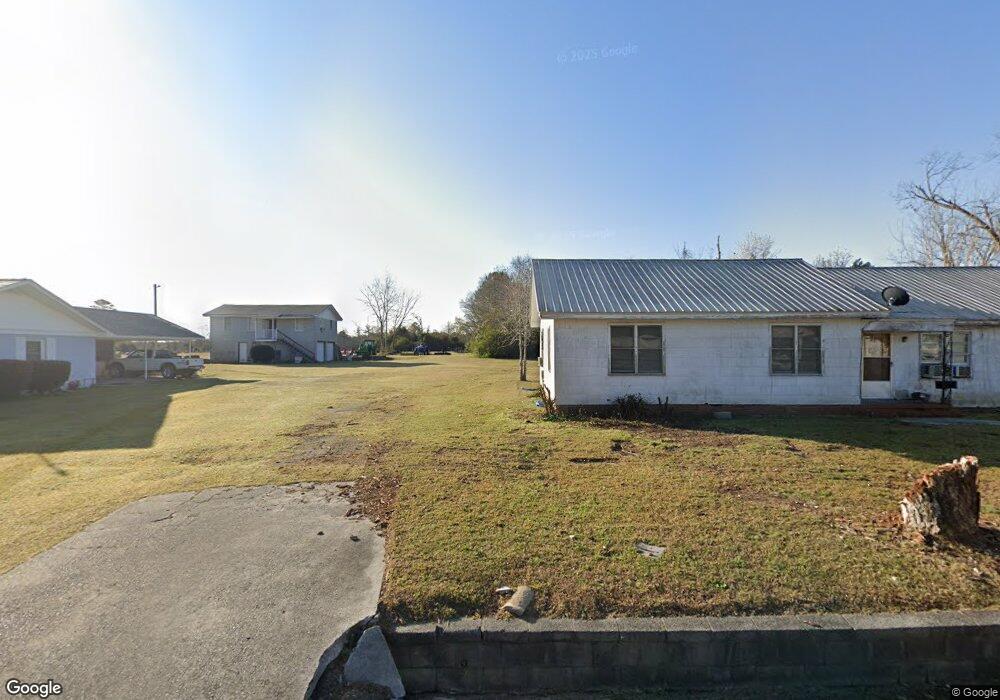
This home is located at 1176 Railroad St, Kite, GA 31049 and is currently estimated at $90,507, approximately $67 per square foot. 1176 Railroad St is a home with nearby schools including Johnson County Elementary School, Johnson County Middle School, and Johnson County High School.
Ownership History
Date
Name
Owned For
Owner Type
Purchase Details
Closed on
May 6, 2022
Sold by
Mcalister Evy Irene
Bought by
Mcalister Evy Irene and Mcalister Peggy
Current Estimated Value
Purchase Details
Closed on
Feb 3, 2000
Sold by
Williams Arthur C
Bought by
Mcalister Evy Irene
Purchase Details
Closed on
Jun 1, 1999
Sold by
Myers Carl S
Bought by
Williams Arthur C
Purchase Details
Closed on
Aug 7, 1998
Sold by
Ruby Riner
Bought by
Myers Carl S
Create a Home Valuation Report for This Property
The Home Valuation Report is an in-depth analysis detailing your home's value as well as a comparison with similar homes in the area
Home Values in the Area
Average Home Value in this Area
Purchase History
| Date | Buyer | Sale Price | Title Company |
|---|---|---|---|
| Mcalister Evy Irene | -- | -- | |
| Mcalister Evy Irene | $20,000 | -- | |
| Williams Arthur C | $22,000 | -- | |
| Myers Carl S | $24,000 | -- |
Source: Public Records
Tax History Compared to Growth
Tax History
| Year | Tax Paid | Tax Assessment Tax Assessment Total Assessment is a certain percentage of the fair market value that is determined by local assessors to be the total taxable value of land and additions on the property. | Land | Improvement |
|---|---|---|---|---|
| 2024 | $297 | $13,032 | $1,208 | $11,824 |
| 2023 | $275 | $13,032 | $1,208 | $11,824 |
| 2022 | $179 | $13,032 | $1,208 | $11,824 |
| 2021 | $394 | $10,638 | $1,208 | $9,430 |
| 2020 | $111 | $10,638 | $1,208 | $9,430 |
| 2019 | $129 | $10,878 | $1,208 | $9,670 |
| 2018 | $403 | $10,878 | $1,208 | $9,670 |
| 2017 | $119 | $10,878 | $1,208 | $9,670 |
| 2016 | $403 | $10,878 | $1,208 | $9,670 |
| 2015 | -- | $12,918 | $1,208 | $11,710 |
| 2014 | -- | $12,918 | $1,208 | $11,710 |
| 2013 | -- | $12,918 | $1,207 | $11,710 |
Source: Public Records
Map
Nearby Homes
- 55 Hatcher St
- 2195 Montgomery St
- 53 Averett St
- 22 Jl Price Rd
- 728 Martin Rd
- 0 Asa Lindsey Rd Unit 10595336
- 0 Asa Lindsey Rd Unit 25496504
- 0 Sardis Church Rd Unit 10601519
- 546 Alton Lawson Rd
- 600 Alton Lawson Rd
- 400 Alton Lawson Rd
- 503 Alton Lawson Rd
- 0 Alton Lawson Rd
- 0 Trinity Church Rd
- 87 Georgia Ave
- 0 Smith Rd
- 223 Kersey Rd
- 92 Paul Lord Rd
- 3004 Pollett Rd
- 0 Walden Way Unit 10601502
- 417 Claxton Blvd
- 1173 Railroad St
- 1188 Railroad St
- 1164 Railroad St
- 1185 Railroad St
- 57 Ga Highway 57 Ave E
- 14 Claxton Blvd
- 106 Church St
- 39 Cemetary St
- 12 Claxton Blvd
- 47 Cemetary St
- 517 College St
- 513 Kight St
- 24 Cemetary St
- 2034 Montgomery St
- 92 College St
- 312 Railroad St
- 511 Montgomery St
- 533 Kight St
- 2042 Montgomery St