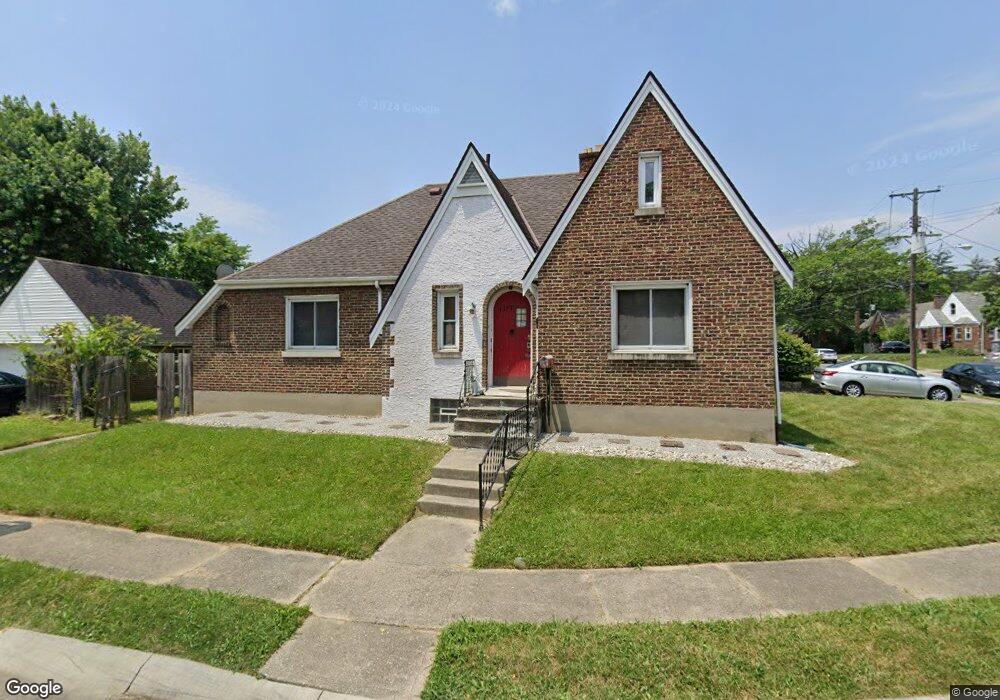
1177 West Way Cincinnati, OH 45224
College Hill NeighborhoodEstimated Value: $173,000 - $241,000
3
Beds
2
Baths
1,784
Sq Ft
$114/Sq Ft
Est. Value
About This Home
This home is located at 1177 West Way, Cincinnati, OH 45224 and is currently estimated at $204,257, approximately $114 per square foot. 1177 West Way is a home located in Hamilton County with nearby schools including Pleasant Hill Elementary School, Robert A. Taft Information Technology High School, and Western Hills High School.
Ownership History
Date
Name
Owned For
Owner Type
Purchase Details
Closed on
Aug 15, 2000
Sold by
Wilkerson Roger and Wilkerson Kim
Bought by
Ingram David and Ingram Minnie
Current Estimated Value
Home Financials for this Owner
Home Financials are based on the most recent Mortgage that was taken out on this home.
Original Mortgage
$88,250
Outstanding Balance
$29,088
Interest Rate
8.12%
Mortgage Type
FHA
Estimated Equity
$175,169
Purchase Details
Closed on
Feb 24, 2000
Sold by
Bankers Trust Company Of Ca Na
Bought by
Wilkerson Roger and Wilkerson Kim
Home Financials for this Owner
Home Financials are based on the most recent Mortgage that was taken out on this home.
Original Mortgage
$77,100
Interest Rate
8.21%
Purchase Details
Closed on
Dec 3, 1999
Sold by
Jeane Mathis Marva and Jeane John
Bought by
Bankers Trust Company Of California Na and Delta Funding Home Equity Loan Trust
Create a Home Valuation Report for This Property
The Home Valuation Report is an in-depth analysis detailing your home's value as well as a comparison with similar homes in the area
Home Values in the Area
Average Home Value in this Area
Purchase History
| Date | Buyer | Sale Price | Title Company |
|---|---|---|---|
| Ingram David | $88,300 | Title Masters Agency Inc | |
| Wilkerson Roger | $63,000 | -- | |
| Bankers Trust Company Of California Na | $58,000 | -- |
Source: Public Records
Mortgage History
| Date | Status | Borrower | Loan Amount |
|---|---|---|---|
| Open | Ingram David | $88,250 | |
| Previous Owner | Wilkerson Roger | $77,100 |
Source: Public Records
Tax History
| Year | Tax Paid | Tax Assessment Tax Assessment Total Assessment is a certain percentage of the fair market value that is determined by local assessors to be the total taxable value of land and additions on the property. | Land | Improvement |
|---|---|---|---|---|
| 2025 | $3,460 | $53,939 | $8,526 | $45,413 |
| 2024 | $3,456 | $53,939 | $8,526 | $45,413 |
| 2023 | $3,462 | $53,939 | $8,526 | $45,413 |
| 2022 | $1,251 | $26,527 | $6,944 | $19,583 |
| 2021 | $1,181 | $26,527 | $6,944 | $19,583 |
| 2020 | $1,228 | $26,527 | $6,944 | $19,583 |
| 2019 | $1,097 | $23,268 | $6,090 | $17,178 |
| 2018 | $1,099 | $23,268 | $6,090 | $17,178 |
| 2017 | $1,036 | $23,268 | $6,090 | $17,178 |
| 2016 | $1,434 | $28,788 | $6,500 | $22,288 |
| 2015 | $1,302 | $28,788 | $6,500 | $22,288 |
| 2014 | $1,312 | $28,788 | $6,500 | $22,288 |
| 2013 | $1,392 | $29,677 | $6,699 | $22,978 |
Source: Public Records
Map
Nearby Homes
- 1190 West Way
- 1166 Groesbeck Rd
- 1217 Groesbeck Rd
- 5679 Folchi Dr
- 5945 Leffingwell Ave
- 5940 Kenneth Ave
- 1197 Toluca Ct
- 1620 Linden Dr
- 6071 Lantana Ave
- 6045 Tahiti Dr
- 6085 Capri Dr
- 5510 Hamilton Ave
- 6101 Capri Dr
- 6000 Capri Dr
- 5441 Lanius Ln
- 5974 Sunridge Dr
- 1734 Llanfair Ave
- 6024 Sunridge Dr
- 875 Venetian Terrace
- 939 Venetian Terrace
Your Personal Tour Guide
Ask me questions while you tour the home.