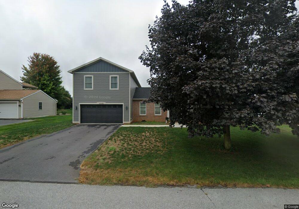
11775 Waxwing Dr Greencastle, PA 17225
Estimated Value: $105,017 - $355,000
--
Bed
--
Bath
1,772
Sq Ft
$157/Sq Ft
Est. Value
About This Home
This home is located at 11775 Waxwing Dr, Greencastle, PA 17225 and is currently estimated at $278,754, approximately $157 per square foot. 11775 Waxwing Dr is a home located in Franklin County with nearby schools including Greencastle-Antrim Primary School, Greencastle-Antrim Elementary School, and Greencastle-Antrim Middle School.
Ownership History
Date
Name
Owned For
Owner Type
Purchase Details
Closed on
Oct 5, 2005
Sold by
Bradley Michael R and Bradley Stephanie A
Bought by
Pittman Cory A
Current Estimated Value
Home Financials for this Owner
Home Financials are based on the most recent Mortgage that was taken out on this home.
Original Mortgage
$220,000
Outstanding Balance
$118,125
Interest Rate
5.81%
Mortgage Type
New Conventional
Estimated Equity
$160,629
Create a Home Valuation Report for This Property
The Home Valuation Report is an in-depth analysis detailing your home's value as well as a comparison with similar homes in the area
Home Values in the Area
Average Home Value in this Area
Purchase History
| Date | Buyer | Sale Price | Title Company |
|---|---|---|---|
| Pittman Cory A | $220,000 | None Available |
Source: Public Records
Mortgage History
| Date | Status | Borrower | Loan Amount |
|---|---|---|---|
| Open | Pittman Cory A | $220,000 | |
| Closed | Pittman Cory A | $220,000 |
Source: Public Records
Tax History Compared to Growth
Tax History
| Year | Tax Paid | Tax Assessment Tax Assessment Total Assessment is a certain percentage of the fair market value that is determined by local assessors to be the total taxable value of land and additions on the property. | Land | Improvement |
|---|---|---|---|---|
| 2025 | $5,030 | $30,070 | $2,430 | $27,640 |
| 2024 | $4,564 | $30,070 | $2,430 | $27,640 |
| 2023 | $3,151 | $21,010 | $2,430 | $18,580 |
| 2022 | $3,151 | $21,010 | $2,430 | $18,580 |
| 2021 | $3,090 | $21,010 | $2,430 | $18,580 |
| 2020 | $3,009 | $21,010 | $2,430 | $18,580 |
| 2019 | $2,941 | $21,010 | $2,430 | $18,580 |
| 2018 | $2,910 | $21,010 | $2,430 | $18,580 |
| 2017 | $2,836 | $21,010 | $2,430 | $18,580 |
| 2016 | $602 | $21,010 | $2,430 | $18,580 |
| 2015 | $553 | $20,730 | $2,430 | $18,300 |
| 2014 | $553 | $20,730 | $2,430 | $18,300 |
Source: Public Records
Map
Nearby Homes
- 823 Buchanan Trail E
- 431 Leitersburg St
- 674 Lohman Ave
- 775 Lohman Ave
- 34.77 Acres Red Oak Estate S
- 271 E Baltimore St
- 0 Molly Pitcher Hwy Unit PAFL178468
- 0 Molly Pitcher Hwy Unit PAFL2030380
- 0 Molly Pitcher Hwy Unit PAFL178444
- 602 Brookview Dr
- 480 S Carlisle St
- 45 W Dahlgren St
- 231 N Allison St Unit 1
- 11498 Nicole Dr
- 101 N Carlisle St
- 148 N Carlisle St
- 763 Joy Dr
- 560 Meadowview Cir
- 375 Carolle St
- 341 W Baltimore St
- 11769 Waxwing Dr
- 11787 Waxwing Dr
- 541 Tall Cedar Ln
- 11795 Waxwing Dr
- 509 Tall Cedar Ln
- 521 Tall Cedar Ln
- 555 Tall Cedar Ln
- 11772 Waxwing Dr
- 11784 Waxwing Dr
- 11764 Waxwing Dr
- 567 Tall Cedar Ln
- 11792 Waxwing Dr
- 11817 Waxwing Dr
- 11756 Waxwing Dr
- 0 Tall Cedar Ln
- 504 Tall Cedar Ln
- 502 Tall Cedar Ln
- 512 Tall Cedar Ln
- 516 Tall Cedar Ln
- 433 Tall Cedar Ln